Radoboj - Sušec (Strahinjščica)
Starting point: Radoboj (255 m)
Time of walking: 2 h 15 min
Difficulty: easy marked way
Altitude difference: 591 m
Altitude difference po putu: 600 m
Map:
Recommended equipment (summer): crampons
Recommended equipment (winter):
Views: 387
 | 1 person likes this post |
Access to the starting point:
Leave the Macelj-Zagreb motorway at the Krapina exit and continue in the route Varaždin-Radoboj. When you reach the next crossroads, the left direction is Krapina, the right direction is Krapinske Toplice, and we go straight for Radoboj (direction not marked).
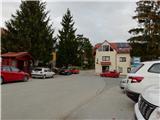
The road then leads us through Veliko Vas and Jazvine, and then starts to climb and leads us to Radoboj. Leave the car in the centre of the village, or if it is busy, a little lower down by the NK Radoboj playground.
Path description:
From the centre of Radoboj, head north. Orientation is easy because this is the only road going up. Soon you will come to a small roundabout, where signs and tourist boards help you. Continue along the road, which begins to descend slightly, and the path also leads you past a hunting lodge, which was still under construction at the time of writing. The first part of the trail is not marked, but it is almost impossible to miss if you stick to the asphalt road.
When you reach the village of Kamenečki, the path turns to the right, but a little further on the asphalt ends and you continue into the forest on the cart track.
The path then climbs steeply through the forest cart track, where the path leads us past some waterworks. The steepness then gradually eases, and the path leads us through an area where it is usually quite muddy. Following this path, we arrive at the Plat saddle, where there is a crossroads.
At the crossroads, turn right and cross a meadow with a hunting observation post. The path quickly returns to the forest and becomes quite steep and the ground increasingly rocky. Continue past a shelter where you can rest, and just a minute higher you will reach the pass between the Sekolje peak and the Strahinjščice ridge, where the next crossroads is.
Straight down the path leads to Gornje Jesenje, to the right the path climbs to the top of Sekolje, and we go left.
From here on the path becomes very steep and leads us along the ridge, where it also becomes more rocky and especially in the wet also dangerous to slip, so in this part would also come in handy some steel cable, which is not. Higher up, the ridge lays down and leads us to a place where there used to be a beautiful lookout point, but today it is increasingly overgrown by forest.
We continue along the northern ridge of Strahinjščice, where we go over another part where a rope would have been helpful. The path continues from the ridge to the southern slope, where we soon reach the forest cart track.
Walk along cart track for only a few 10 metres and then turn left onto a footpath. There is some easy walking through less dense forest, and after crossing another cart track, the path climbs steeply again. When the path is laid, only about a minute's walk separates us from the summit. Since the summit is in the forest, the view requires a further 20 minutes in the direction of the mountain home, to the Dedek wall.
I advise against the route after rain.

Pictures:
 1
1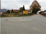 2
2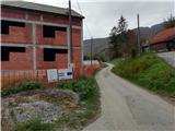 3
3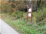 4
4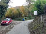 5
5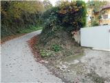 6
6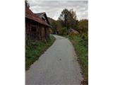 7
7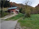 8
8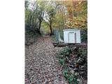 9
9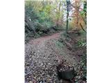 10
10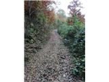 11
11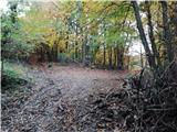 12
12 13
13 14
14 15
15 16
16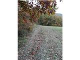 17
17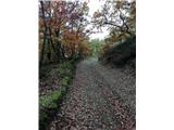 18
18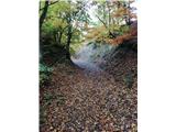 19
19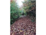 20
20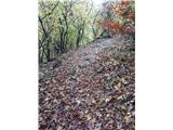 21
21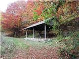 22
22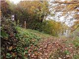 23
23 24
24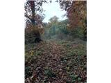 25
25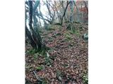 26
26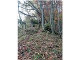 27
27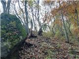 28
28 29
29 30
30 31
31 32
32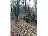 33
33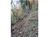 34
34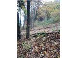 35
35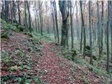 36
36 37
37 38
38 39
39 40
40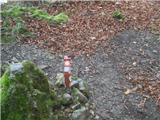 41
41
Discussion about the trail Radoboj - Sušec (Strahinjščica)
|
| Marx25. 12. 2023 20:41:06 |
Planinski dom (slika 3) je dokončan, asfalt je zdaj na slikah 8,9 i 10, ob sliki 35 je zdaj razpotje kjer nam pride nova varianta poti od planinskeg doma Radoboj z slike 3... in je pot zdaj bistveno bolj markirana.
|
|
|