Starting point: Trkulji (610 m)
| Lat/Lon: | 44,4344°N 15,6168°E |
| |
Time of walking: 45 min
Difficulty: difficult marked way
Altitude difference: 240 m
Altitude difference po putu: 260 m
Map:
Recommended equipment (summer):
Recommended equipment (winter):
Views: 1.220
 | 4 people like this post |
Access to the starting point:
Leave the Zagreb-Split motorway at the Gornja Ploča exit. Go in the direction of Udbina, but only about a hundred metres from the toll station, where you turn right in the direction of Lovinac and then right again at the next junction (there is a small bridge with a blue fence after the junction). At the next junction, turn left onto the macadam and then go through the underpass under the motorway. From here on, each intersection is marked with tourist signs, and otherwise orientation is easy because Zir is exactly ahead. Park in a convenient place at the bus turnoff just before the village of Trkulji.
Path description:
From the starting point, we quickly reach the village of Trkulji, where a red signpost directs us into the forest, where we initially climb gently westwards. Once out of the forest, the path turns south and then climbs back into the forest across the meadow. Here you pass the entrance to a cave that continues under most of the hill and ends with a large underground lake. Above the cave entrance, you leave the forest again and the path turns eastwards, becoming slightly more technical and the ground more rocky. A steep climb follows and soon we reach the summit, which offers an exceptional view of the Ličko polje.
From the summit there is a slight descent to a small saddle between the two peaks, where there is a greater risk of slipping, especially in wet conditions. The way forward takes us to the northern slopes, where the path becomes technically demanding, and leads us through low forest and lane of bushes. There are a few ropes to help us on this part, but they are in poor condition (data from 2020), and the most challenging part is the rock before we leave the forest on the top slope of the mountain. Here, the summit is first bypassed on the right hand side, and then a path is followed up to the summit, which is very scenic.
The summit is not particularly spacious, with room for up to about 10 people. Despite its relatively low altitude, the summit offers a very nice view on all sides.
I do not recommend this trail in wet weather.

Pictures:
 1
1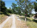 2
2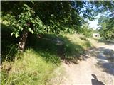 3
3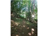 4
4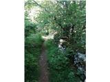 5
5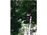 6
6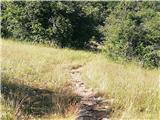 7
7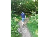 8
8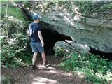 9
9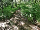 10
10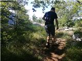 11
11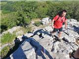 12
12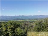 13
13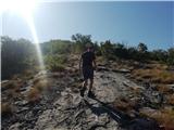 14
14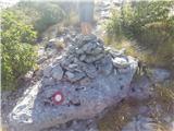 15
15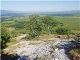 16
16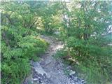 17
17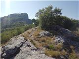 18
18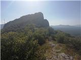 19
19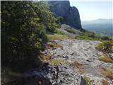 20
20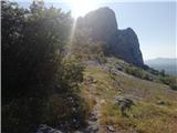 21
21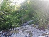 22
22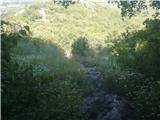 23
23 24
24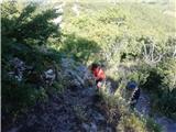 25
25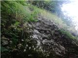 26
26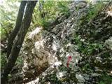 27
27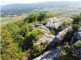 28
28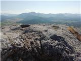 29
29
Discussion about the trail Trkulji - Zir
|
| Marx7. 07. 2021 09:56:03 |
Po novem je ob koncu pot rahlo zmenjena. Zdaj je nekjer na sliki 28 narejena krajša mikroferata z jeklenicom in skobami in ta se konča natančno na vrhu. Ostale jeklenice su tudi nanovo narejene. Markacije so pak nekaj obledele ampak pot je tako uhojena da ni mogoče zgrešiti.
|
|
|