Baška - Diviška (via Sveti Ivan)
Starting point: Baška (30 m)
| Lat/Lon: | 44,9721°N 14,756°E |
| |
Name of path: via Sveti Ivan
Time of walking: 2 h 15 min
Difficulty: easy marked way
Altitude difference: 441 m
Altitude difference po putu: 490 m
Map:
Recommended equipment (summer):
Recommended equipment (winter):
Views: 4.217
 | 2 people like this post |
Access to the starting point:
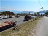
From the motorway Rupa - Rijeka / Rijeka or Zagreb - Rijeka / Rijeka, drive towards Rijeka, and from there follow the signs for Krk Island. When the motorway or expressway in the last part ends, we descend to the Krk Bridge (toll 35 kuna - March 2014) and then continue driving to Omisalj, Njivice, Malinska, Krk, Punat and Baška. After Punat, which you pass on the left, the road starts to climb steeply towards the Treskavac pass (Treskavac is a good starting point for some mountain tours, including the climb to the highest peak of Krka - Obzova (569 m)). After the pass, the road starts to descend and is quite winding, flattening out a bit only when you reach the valley. Continue on through Draga Bašćanska and Jurandvor, and then arrive in Baška. When you see the signs for the bus parking area, turn right and park in the large parking area (the parking area is for both buses and cars). During the summer season, there is a charge for parking.
Path description:
From the parking lot, return to the main road, cross it carefully, and then continue towards St Ivan's Church along a slightly narrower asphalt road, which gradually begins to climb. After a few minutes of climbing, you reach a marked crossroads from which you continue on the asphalt road (left Planina Mjesec / mountain pasture Mjesec via the Zakam crossroads). There is a cross-country climb and 2 serpentines, and you reach the parking area under the Church of St Ivan, with beautiful views of Baška, Prvić Island and the Krka hills.
At the end of the parking lot, the road turns sharp left (straight over the fence to reach the cemetery and St Ivan's Church, from where there is a fine view of Baška and the sea) and after a few 10 metres leads to a place where you cross a pasture fence.
Beyond the fence, a minor road continues to the right, leading to the upper part of the cemetery, while we continue straight on along the mulatier, which climbs gently through a pleasant pine forest, which provides shade on hot days. Along the path, which climbs gently to moderately, there are several benches where we can rest, and during the climb we often get a nice view of Baška, Senjski vrata, Prvić island, the mountain ridge west of Baška, ending with Cape Škuljica, Velebit and more. There are a few marked serpentines, and then the slopes gradually change to a more flatter world, where the path to Stražić branches off to the right, which is about a 500 metre walk, and we continue along a wider and well-maintained path. Further on, the path is quite sloping, but within a few minutes of further walking we reach the shelter and information boards at Planina Mjesec / mountain pasture Mjesec.
From Planina Mjesec we continue in the direction of Kalić - Lokva, Hlam and Lokva Diviška, following the path that immediately crosses the stone fence and leads us out of the forest into the rocky expanse. We continue straight for a short time, then the path splits into two parts, and we take the right path (Hlam on the left).
From the crossroads, first descend slightly and then follow the path to the nearby dirt track or stone road, which you follow to the left. Follow the road around the top of Hlam on the right and follow the waymarked trail at the crossroads or junctions. The route continues for some time along a winding road, which has some ascents and descents, and alongside it there are a few watering places for animals, especially sheep grazing here, and a number of stone fences, mostly marking property boundaries. As the road gets a little worse, look out for a marked path branching off the road and turning slightly to the left. Once off the road, the path becomes rather monotonous terrain, where you have to follow carefully, in parts, the sparse markings. The trail, which is quite difficult in terms of orientation, slowly begins to climb moderately and turns slightly to the left. Later, the path is completely laid and leads us to a larger watering point, behind which it climbs more steeply along a stone fence, which we cross at a higher level, and then in a few steps we climb to the scenic peak of Diviška. The uniformity of the terrain makes orientation difficult and, in fog, virtually impossible without a compass or navigation device.

Pictures:
 1
1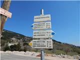 2
2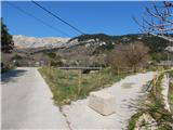 3
3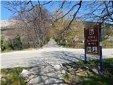 4
4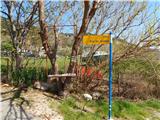 5
5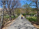 6
6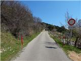 7
7 8
8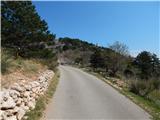 9
9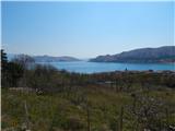 10
10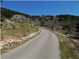 11
11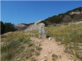 12
12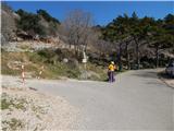 13
13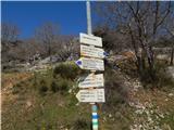 14
14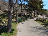 15
15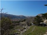 16
16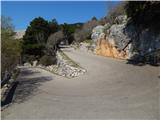 17
17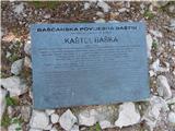 18
18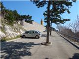 19
19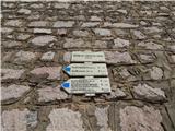 20
20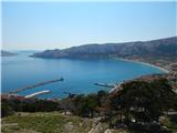 21
21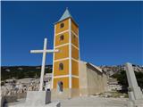 22
22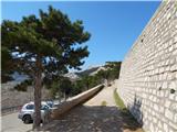 23
23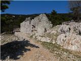 24
24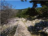 25
25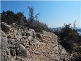 26
26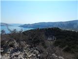 27
27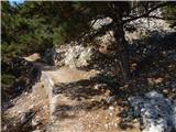 28
28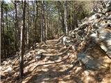 29
29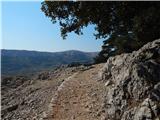 30
30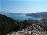 31
31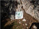 32
32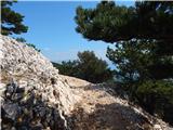 33
33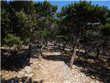 34
34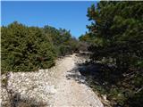 35
35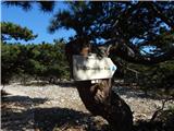 36
36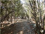 37
37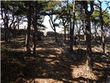 38
38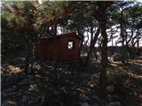 39
39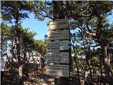 40
40 41
41 42
42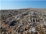 43
43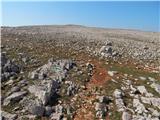 44
44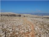 45
45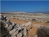 46
46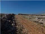 47
47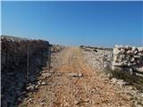 48
48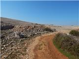 49
49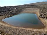 50
50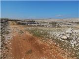 51
51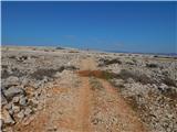 52
52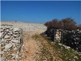 53
53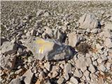 54
54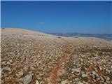 55
55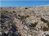 56
56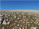 57
57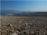 58
58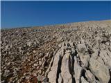 59
59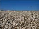 60
60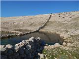 61
61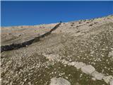 62
62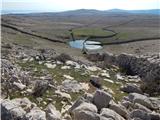 63
63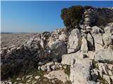 64
64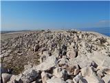 65
65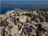 66
66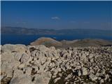 67
67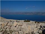 68
68
Discussion about the trail Baška - Diviška (via Sveti Ivan)
|
| robi210712. 05. 2017 |
Na Mesečev plato se lahko povzpnemo tudi, če na razpotju na sliki 13 zavijemo levo. Nekaj časa hodimo po zložni poti do ograje, ki jo prečkamo, še nekaj časa nadaljujemo po tej poti in kmalu zatem pridemo do označenega razpotja. Tu zavijemo desno in se kmalu začnemo precej strmo vzpenjati. Orientacija ni zahtevna, ker tako ali tako ni nobene druge poti navzgor, v pomoč pa so nam tudi zelene oznake (črte) ob poti. Konec te "zelene" poti označuje razpotje na sliki 44. Od tu naprej nas proti Diviški usmerjajo rumene oznake (črte), ob katerih pa se nekaj časa pojavljajo tudi modre oznake (črte), ki označujejo pot proti Hlamu, saj sta oba cilja v isti smeri in je del poti skupen. Pot proti Hlamu se odcepi kar kmalu za ograjo na sliki 48. Modra oznaka, ki označuje odcep, je precej neopazna, zato je treba dobro napeti oči. Opazili jo boste na kamnu levo ob poti, kjer s kolovoza zavijemo levo in pot nadaljujemo ob suhozidu, nič pa ne bo narobe, če boste po kolovozu nadaljevali do napajališča na sliki 50 in tam zavili levo navzgor v hrib. Zelo kmalu boste prišli na markirano pot, ki vas bo pripeljala do vrha Hlama.
Proti Diviški pa še nekaj nadaljujemo po kolovozu in sledimo rumenim oznakam. Izbira rumenih markacij ni najbolj posrečena, saj je rumena barva na svetlih kamnih precej slabo opazna. Sprva sicer ni večjih težav z orientacijo, saj je pot dobro vidna, kasneje pa je treba res dobro napeti oči, da ne zgrešimo, saj pot skoraj povsem izgine. Orientacijo nam sicer delno olajšajo možici, vendar pa za nadaljevanje poti vseeno poiščite TUDI markacijo. Nazaj grede je pot še slabše označena, in če boste sledili samo možicem, boste pot zagotovo zgrešili. To se je namreč zgodilo tudi meni.
Še to: na pot proti Hlamu in Diviški se podajte opremljeni z dovolj vode (zlasti v poletnih mesecih) in obuti v čevlje s trdimi podplati, saj vas bodo v nasprotnem primeru zaradi hoje po ostrem nalomljenem kamenju zagotovo boleli podplati.
|
|
|