Klammbrückl - Kerschbaumeralm Schutzhaus
Starting point: Klammbrückl (1092 m)
| Lat/Lon: | 46,79024°N 12,76478°E |
| |
Time of walking: 2 h
Difficulty: easy marked way
Altitude difference: 810 m
Altitude difference po putu: 810 m
Map:
Recommended equipment (summer):
Recommended equipment (winter): ice axe, crampons
Views: 2.034
 | 1 person likes this post |
Access to the starting point:
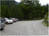
Drive through the Karavanke Tunnel into Austria, then continue to Spittal and on to Lienz (the motorway ends a little after Spittal). We continue along a relatively nice and wide road through the Drava Valley. In the centre of Lienz, at the main roundabout, turn left and continue towards Itali (exit from the roundabout in the direction of Leisach, Anras and Silian). Shortly after Leisach, you will see direction signs on the left-hand side of the road directing you to a narrow wooden bridge over the River Drava (direction Kerschbaumer Alm, ÖTK - Schutzhaus 1902 m). The road narrows just after the bridge and starts to climb steeply. Follow this road to the parking lot at Klammbrückl.
Path description:
From the parking lot, continue along the road, which is closed to traffic. After a few dozen metres, you reach a crossroads where you continue to the right, following the signs "ÖTK Schutzhaus". You can either follow the mountain road all the way or take the footpath through the forest and then join the mountain road a few more times for a short distance.
When the road ends, continue on the footpath, which begins to climb up the right side of the valley. The path leads through sparse wodland to a slightly steeper slope and then to a viewpoint with a good view of Klapffall Waterfall. The path then turns slightly to the left and approaches a mountain stream. The path climbs along the stream and then leads to the mountain pasture Kerschbaumer alm. The path here follows the left-hand side of the mountain pasture and there is only a short climb up a grassy slope past sparse trees to the Schutzhaus hut.
Pictures:
 1
1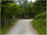 2
2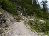 3
3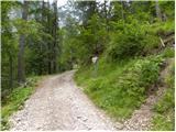 4
4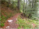 5
5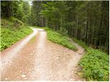 6
6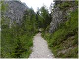 7
7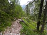 8
8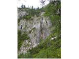 9
9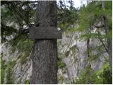 10
10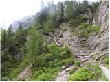 11
11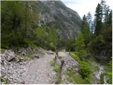 12
12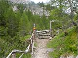 13
13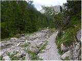 14
14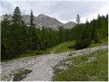 15
15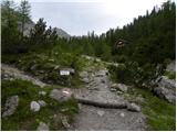 16
16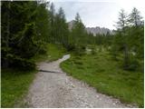 17
17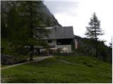 18
18
Discussion about the trail Klammbrückl - Kerschbaumeralm Schutzhaus