Aljažev dom v Vratih - Triglav (Gamsja pot okoli Triglava)
Starting point: Aljažev dom v Vratih (1015 m)
| Lat/Lon: | 46,4128°N 13,8466°E |
| |
Name of path: Gamsja pot okoli Triglava
Time of walking: 25 h 30 min
Difficulty: very difficult marked way
Altitude difference: 1849 m
Altitude difference po putu: 3400 m
Map: TNP, 1:50 000
Recommended equipment (summer): helmet, self belay set
Recommended equipment (winter): helmet, self belay set, ice axe, crampons
Views: 37.239
 | 6 people like this post |
Access to the starting point:
Leave the Gorenjska motorway at the Hrušica exit and follow the road towards Kranjska Gora. Just before the village of Dovje, the road branches off to the left and leads to Mojstrana (Vrata, Kot and Krma). Follow the road in the direction of the Vrata valley and follow it to the large parking lot near the Aljaž's home.
Path description:
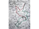
Day 1: Aljažev dom - Bovški Gamsovec (via Sovatno) - Luknja - Triglav (via Plemenice) - Dom Planika (via Mali Triglav)
Aljažev dom - Bovški Gamsovec:
From the parking lot, continue along the dirt road, which after a 3-minute walk leads to the crossroads at Aljažev dom. Continue straight ahead in the direction of Triglava, Luknja and Pogačnik's home (right Škrlatica) along the wide path that goes behind the chapel (on the right) and Aljaž's home (on the left) into the lane of the forest. A wide tourist-walking path leads us past the winter bivouac out of the forest, where we see the famous wedge in front of us (a monument dedicated to the fallen partisan mountaineers). Continue straight ahead (Tominškova cesta on the left) along the path which returns to the forest and leads us to the next crossroads (Tominškova cesta on the left). Continue right in the direction of Pogačnik's home (straight on the path over Prag and Luknja) along the path which begins to climb steeply through the forest. A moderately steep path leads us at 1300m to a pleasant little spring where we can freshen up. The steepness then gradually eases and the path leads us out of the forest onto the bush-covered slopes, where a path branches off to the left to the bivouac under Luknja. The way forward turns slightly to the right and initially climbs gently up the grassy slopes below Sovatna. The steepness of the path, however, increases rapidly and the path soon becomes very steep. The path over Sovatna is slightly exposed in a few places, but in dry conditions there is no major danger. Once over the steep grassy jump, the path leads us to the rubble. There follows a strenuous climb on the rubble to the gentler slopes below Bovec Gamsovec. Here, on the meadows and cliffs of the above-mentioned peak, you can often observe a flock of ibex, which come quite close to the visitors. The trail continues to climb slowly and leads to Dovška vrata, where there is a crossroads. Continue left in the direction of Bovec Gamsovec, straight ahead towards Pogačnik's home, and right towards Križ and Stenar. From the crossroads, the path first climbs moderately on rocky terrain and then turns slightly to the right and becomes slightly more difficult. A few times cross quite steep slopes along the steel cable, then turn slightly to the left and climb steeply with the help of pegs and steel cables. Just below the summit, the Luknja trail joins from the left and there are only a few metres of climbing to the summit lookout. Bovški Gamsovec - Luknja:
From the top, descend a few steps back along the same path, where there is a fork to the right towards Luknja. The initial part of the trail is a bit more difficult, but it is protected by a rope and rungs. The path continues along the ridge, which is partly covered with grass, and descends quite steeply across the meadows below the Bovec Gamsovec and Pihavec walls. Ibex and Alpine marmots are usually abundant here. On the way to Luknja, we have a beautiful view of the mountains above the Soča valley.
Luknja - Triglav (via Plemenice):
Continue straight ahead in the direction of Triglava over Plemenice (right down Zadnjica, left Vrata). After a few steps the path climbs up the wall almost vertically. Before entering the climbing part of the route, put on your helmet and self-protection kit. In the initial part of the climb, the fixed safety gear are helpful, but they are sparsely metered in the upper part. Once the initial wall is climbed, the route is laid, which does not mean that the problems are over. From here on there are almost no belays and occasionally we walk along a path over a deep chasm. In the wet there is a high risk of slipping! The problems then slowly ease and the path leads us to the famous Sphinx (the steepest pillar in the Triglav region), but to see it you have to step a little way off the marked path. The way forward leads us to the Western Triglav plateau, where there is a crossroads. Continue left up towards Triglava (right Dolič) over the scree to enter the next climbing section of the route. This part is much easier than the one over Plemenice, so it will not cause us any major problems (only the crowds can be quite heavi). The route continues with the help of numerous belays and climbs crosswise to lead us under the Triglav notch. Continue up to the notch, where you will reach a crossroads. Continue left up (straight down Planika) on a steep but well protected path. After a few minutes the steepness eases and we have only a few minutes of climbing to the top of the Triglav slope.
Triglav - Dom Planika:
Shortly from the summit towards Mali Triglav, the path descends more steeply, where it leads to Stanič's shelter, which is 30 m from the path. The exposed but perfectly protected path along the ridge follows. Further on, a more scenic route with the help of guardrails leads us to the undistinguished summit of Maly Triglav. Shortly afterwards, turn right towards Dom Planika along the ravine, where a view opens up on the other side into the abyss. The descent down the ravine is not difficult and is protected. From the ravine onwards we descend along the path, which is in places strewn with gravel (quicksand on the path) to the plain below Triglav, where Dom Planika stands. We spend the night here. Day 2: Triglav (via Mali Triglav) - Koča na Doliču - Kanjavec - Dolič (via Hribarice) - Dom Planika - Kredarica - Aljažev dom
Dom Planika - Triglav:
If we want to admire the sunrise the next morning from the top of Triglav, we need to get there early enough, well equipped with flashlights and trained to walk in the dark, and take our time, not to rush. Walking at night increases the difficulty of the trail, so make sure you have a good look at it the day before and remember how it goes in the exposed parts. Climb again via Maly Triglav to Triglav.
Triglav - Tržaška koča na Doliču:
From the top we first have a few minutes descent down the top slope of Triglav. Then comes a steep but well protected path. Descend to the Triglav notch, where you reach a crossroads. Continue down to the right (Planika on the left). The path ahead descends with the help of numerous guardrails and leads us under the wall. Continue left down the scree to a crossroads where the path to Koča na Doliču joins the path from Plemenice on the right. Continue walking in the direction of Doliča along the flor, where care is needed to avoid stepping in a hole and twisting your legs. The world flattens out and the path no longer loses height. Half an hour before the hut, descend to it on a mulatier.
Tržaška hut na Doliču - Kanjavec:
From the hut, continue west to the right, past the winter bivouac (direction Kanjavec). The path descends for a few metres and then starts to rise again. The path is well laid out and climbs moderately on a rocky slope. After an hour's walk from the hut at Dolič, the path climbs more steeply, and there are a few guard rails to help us. Once you have overcome this steep slope, you have only a few steps to the top.
Kanjavec - Planika:
Head towards the western summit of Kanjavac. The trail descends quite steeply and follows an undistinguished valley between the eastern and western peaks of Kanjavac. After a few minutes' walk, you will reach the crossroads at Hribarice, where you join the path to Dolič via Hribarice. The path continues downhill on scree towards the Dolič saddle. After a half-hour descent, there is a slight climb up to the saddle, where the next crossroads are. Turn right here towards Dom Planika. The trail ascends and descends with beautiful views, in between there is some sheltered path with rungs. A steeper climb awaits just before we reach the scree below Planika, where the path is protected by a cable. In the keys, we follow the scree to the hut. Planika - Kredarica:
At the cottage, we turn onto the path towards Kredarica. First, the path climbs gently to an exposed ledge, which is protected by a jeklenico. Descend slightly and continue along the scree below Mali Triglav. The path used to go under the wall of Maly Triglav, but now it descends down towards the path coming from Vodnikov dom to Kredarica, where it turns left.
Kredarica - Aljaž's home:
From Kredarica we start to descend gently. The steepness of the trail gradually increases and in places we are helped by a rope ladder. The way down is through the Triglav fothills, where we may have some problems with orientation (especially in fog). The way forward soon leads us to the next crossroads, where we continue left in the direction of the Aljažev home (right Staničev dom). A little later, along the way, we see a nice little well at which we can rest. Continue along the scree slope and turn left at the crossroads for the Tominškovo trail along the path over the Prag. The easy part of the trail soon becomes more difficult again, and we are helped by the rocks, which make walking safer. The most difficult part of the path on the way over the Prag follows. With the help of crampons and a rope, we descend the 15 m high, almost vertical chimney. Further down, you can enjoy beautiful views along the path, which is occasionally surrounded by dwarf pines. Before leaving the last rocky part, there is a steep part of the path where the rungs are helpful. With the help of the guardrails, the path quickly leads to a meadow where you cross a torrent. Continue right along the path through the forest, past the famous wedge. A wide tourist-walking trail leads to the Aljaž's House in Vrata.

Pictures:
 1
1 2
2 3
3 4
4 5
5 6
6 7
7 8
8 9
9 10
10 11
11 12
12 13
13 14
14 15
15 16
16 17
17 18
18 19
19 20
20 21
21 22
22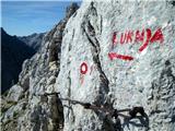 23
23 24
24 25
25 26
26 27
27 28
28 29
29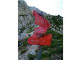 30
30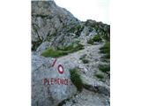 31
31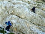 32
32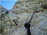 33
33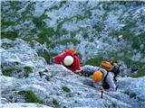 34
34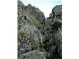 35
35 36
36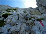 37
37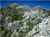 38
38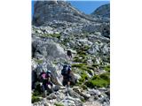 39
39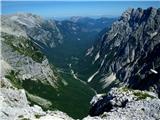 40
40 41
41 42
42 43
43 44
44 45
45 46
46 47
47 48
48 49
49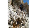 50
50 51
51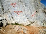 52
52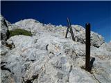 53
53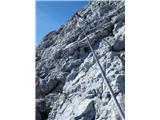 54
54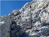 55
55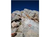 56
56 57
57 58
58 59
59 60
60 61
61 62
62 63
63 64
64 65
65 66
66 67
67 68
68 69
69 70
70 71
71 72
72 73
73 74
74 75
75 76
76 77
77 78
78 79
79 80
80 81
81 82
82 83
83 84
84 85
85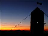 86
86 87
87 88
88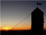 89
89 90
90 91
91 92
92 93
93 94
94 95
95 96
96 97
97 98
98 99
99 100
100 101
101 102
102 103
103 104
104 105
105 106
106 107
107 108
108 109
109 110
110 111
111 112
112 113
113 114
114 115
115 116
116 117
117 118
118 119
119 120
120 121
121 122
122 123
123 124
124 125
125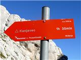 126
126 127
127 128
128 129
129 130
130 131
131 132
132 133
133 134
134 135
135 136
136 137
137 138
138 139
139 140
140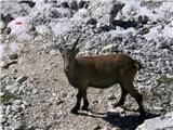 141
141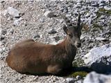 142
142 143
143 144
144 145
145 146
146 147
147 148
148 149
149 150
150 151
151 152
152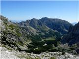 153
153 154
154 155
155 156
156 157
1575151110.th.jpg) 158
1585151110.th.jpg) 159
1595151111.th.jpg) 160
1605151111.th.jpg) 161
1615151111.th.jpg) 162
1625151112.th.jpg) 163
1635151112.th.jpg) 164
1645151114.th.jpg) 165
1655151114.th.jpg) 166
1665151114.th.jpg) 167
167 168
168 169
169 170
170 171
171 172
172 173
173 174
174 175
175 176
176 177
177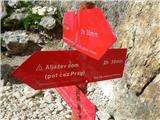 178
178 179
179 180
180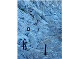 181
181 182
182 183
183 184
184 185
185 186
186 187
187 188
188 189
189 190
190 191
191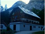 192
192
Discussion about the trail Aljažev dom v Vratih - Triglav (Gamsja pot okoli Triglava)
|
| medo*4. 09. 2009 |
Ker je opis precej nepregleden, naj na kratko opišem potek ture, ki je potekala 31.8. in 1.9.2009: 1.dan: Aljažev dom (05.15) - Bovški Gamsovec čez Sovatno - Luknja (10.30) - Triglav čez Plemenice (16.00) - Dom Planika čez Mali Triglav (18.00) 2.dan: Dom Planika (04.15) - Triglav čez Mali Triglav - Koča na Doliču - Kanjavec (10.00) - Dolič čez Hribarice - Dom Planika (13.00) - Kredarica - Aljažev dom (18.00) Morda so kakšne ure malo out, vendar je to zato, ker sem si po potrebi vzel čas za malico in za razgledno sončenje  Pripisal bi (bom) tudi komentarje k slikam, a mi meni »Uredi slike« zaenkrat ne deluje. Sonce je vzšlo približno ob 06.10. Oba dneva sta bila izredno lepa, brez oblačka na nebu, zato razgledi čudoviti… 
|
|
|
|
| medo*26. 12. 2009 |
Turo se lahko v dobri družbi  lepo prehodi tudi v štirih dneh: 1.dan: Aljažev dom – Pogačnikov dom na Kriških podih 2.dan: Pogačnikov dom – Triglav čez Plemenice – Dom Planika 3.dan: Dom Planika – Kanjavec – Dom Planika 4.dan: Dom planika – Aljažev dom
|
|
|
|
| ljud852. 08. 2010 |
super izlet sem ga dal skozi, jasno vreme vse lepo, kozorogi, moceradi, gamsi, skratka ni da ni  spal sem pa ko top, dones bom pa se bolj:I) no zdaj bo vsaj malo vec ur. Hvala za lep opis!
|
|
|
|
| Jože.3. 08. 2010 |
Zelo lepo. (samo majhen popravek: slika 153 prikazuje Velsko dolino)
|
|
|
|
| stropci2. 08. 2013 |
Pozdravljeni, Tura mi je zelo zanimiva in mislim, da jo bom opravil v kratkem .Zanima me če je še kje v sredini avgusta možen sneg ? Glede na zahtevnost pa če priporočate za nekoga ki je srednje pripravljen plezalec, glede kondicije mislim da ni panike, izpostavljenost in zahtevnosti plezanja?
Hvala za odgovore
l.p.
|
|
|
|
| skočnik123. 08. 2013 |
Pot čez plemenice je najtežji pristop na triglav  (pp4), ter eden izmet najtežjih v sloveniji. po poti čez plemenice boš moral plezati tudi I-II plezalno stopnjo. 
|
|
|
|
| bošte3. 08. 2013 |
O drugi plezalni stopnji čez plemenice ni niti sledu, edino če se izgubiš iz markirane poti 
|
|
|
|
| skočnik123. 08. 2013 |
tako piše v knjigi:"55 zavarovanih poti" 
|
|
|
|
| bošte3. 08. 2013 |
OP označena pot
ZOP zahtevna označena pot
ZZOP zelo zahtevna označena pot (zavarovana, izpostavljena)
NP neoznačena pot
B brezpotje, tehnično in orientacijsko razmeroma nezahtevno
I prva težavnostna stopnja plezanja: vzpon poteka po zelo razčlenjenem skalnatem svetu, kjer je obilo stopov in oprimkov. Roke uporabljamo predvsem za vzdrževanje ravnotežja. Nekateri predeli so lahko tudi izpostavljeni, zato ti vzponi niso za vrtoglave
II druga stopnja: tu se pravzaprav začne pravo plezanje. Stena je že precej strma, oprimki in stopi so manjši, vendar jih je veliko. Pri plezanju moramo upoštevati pravilo treh točk, varovanje z vrvjo je za neplezalca že skoraj nujno, posebej če so odseki II. stopnje daljši in bolj izpostavljeni
III tretja stopnja: plezanje poteka po zelo strmi ali celo navpični steni. Pri vzponu rabimo tudi moč v okončinah, varovanje z vrvjo je obvezno
|
|
|