Baumgartnerhof - Mallestiger Mittagskogel (climbing way)
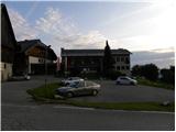
Starting point: Baumgartnerhof (950 m)
| Lat/Lon: | 46,5385°N 13,9049°E |
| |
Name of path: climbing way
Time of walking: 3 h 15 min
Difficulty: very difficult marked way
Ferata: B/C
Altitude difference: 851 m
Altitude difference po putu: 900 m
Map:
Recommended equipment (summer): helmet, self belay set
Recommended equipment (winter): helmet, self belay set, ice axe, crampons
Views: 8.554
 | 2 people like this post |
Access to the starting point:
a) Cross the Korensko sedlo border crossing into Austria and then turn right towards Bialjak / Villach. Before crossing the river Zilja / Gail, leave the road leading to Bialjak and continue driving to the right in the direction of Lake Bäck / Faaker See. Continue towards the lake, and at Bekštanj / Finkenstein we turn right towards Škocjan / Kanzianiberg and Old Castle / Altfinkenstein. Continue along local roads, following the crossroads in the direction of the Baumgartnerhof Hotel. Park in the parking lot near the hotel.
b) Drive through the Karavanke tunnel into Austria and leave the motorway at the first exit. Turn right at Kot / Winkl and continue driving towards Lake Baska / Faaker See. At the end of Loče / Latschach, turn left in the direction of Hotel Baumgartnerhof. Park in the parking lot near the hotel.
Path description:
From the parking lot, continue up the stairs past the signs "Mallestiger Mittagskogel", "zum Wasserfall". After a few metres, you reach a crossroads where you turn left after the Rotschitza Klettersteig signs. The path first crosses meadows, descends for a few metres, then turns right and leads into the forest. The path then joins the cart track, which takes some time to climb. Follow the signs for the Rotschitz Klettersteig all the way up the cart track. At the hunting observation post, the cart track ends and we continue along the footpath, which soon leads us by the stream to the waterfall where the climbing part of the route begins.
Before entering the climbing part of the route, equip yourself with a helmet and a self-protection kit.
Cross the stream below the waterfall and start climbing up along the waterfall with the help of pegs and a rope. Above the waterfall, continue along the left side of the stream and then follow the most difficult part of the route (difficulty B/C), where you will use wedges to climb up to a bridge (a rope bridge over the stream). Cross the stream to the other side using the rope bridge and then continue climbing along the stream. Cross the stream twice more using the rope. In the last part, the climbing route leads to another small waterfall above which the route becomes less difficult. Walk along the stream for a while, then continue to the right and the path through the forest soon leads to a crossroads where you join an easier path.
At the crossroads, continue left and climb up the right side of the valley. The path then leads to a lookout point where there are also benches and a cross. From the viewpoint where there is a nice view of some small waterfalls, continue right and climb through the forest. Then climb in the keys along a small stream at the edge of the forest. Because of the forest, we rarely have views of the surrounding peaks. Higher up, the path becomes a shade less steep and leads to the Mitzl Moitzl Hütte.
At the hut, continue slightly to the left and start climbing through the larch forest. Higher up, the path turns slightly to the right and there is a short climb to a crossroads on the border ridge.
When you reach the ridge, continue right (left Kresišče) and start climbing moderately. Follow the path, from which, through the sometimes rather sparse larch forest, we can see beautiful views towards Austria and partly towards Julian Alps, all the way to the summit called Maloško poldne.
From the summit, where we are joined by an unmarked path from the Slovenian direction, we continue down to the right. The path descends steeply at first, then lays down and passes onto a ridge, where we find some fixed safety gear to help us. There is a short climb, then the path turns to the right and leads to the top of Mallestiger Mittagskogel, where the cross stands.

Pictures:
 1
1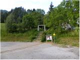 2
2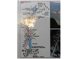 3
3 4
4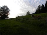 5
5 6
6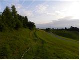 7
7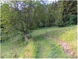 8
8 9
9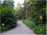 10
10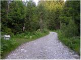 11
11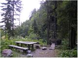 12
12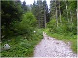 13
13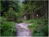 14
14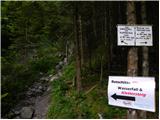 15
15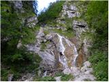 16
16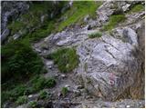 17
17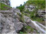 18
18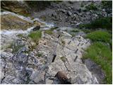 19
19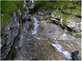 20
20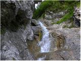 21
21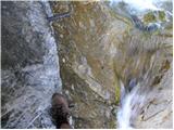 22
22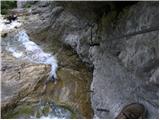 23
23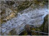 24
24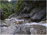 25
25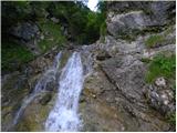 26
26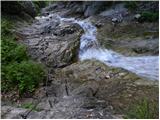 27
27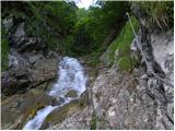 28
28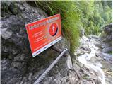 29
29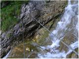 30
30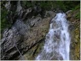 31
31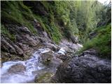 32
32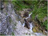 33
33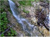 34
34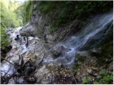 35
35 36
36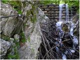 37
37 38
38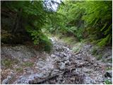 39
39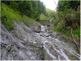 40
40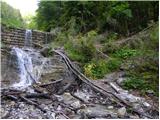 41
41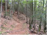 42
42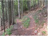 43
43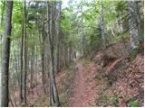 44
44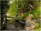 45
45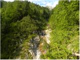 46
46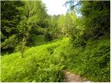 47
47 48
48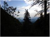 49
49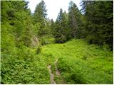 50
50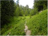 51
51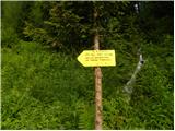 52
52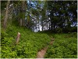 53
53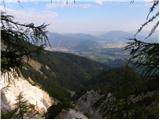 54
54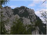 55
55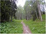 56
56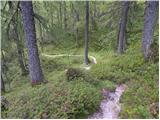 57
57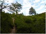 58
58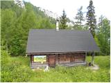 59
59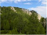 60
60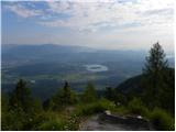 61
61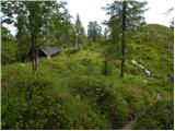 62
62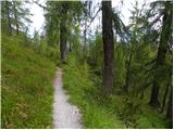 63
63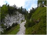 64
64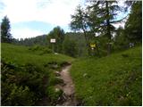 65
65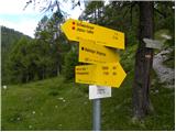 66
66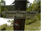 67
67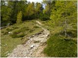 68
68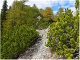 69
69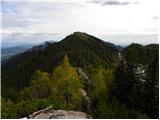 70
70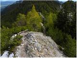 71
71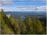 72
72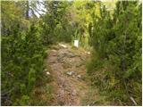 73
73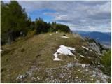 74
74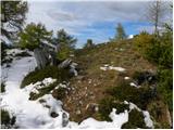 75
75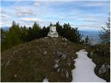 76
76 77
77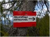 78
78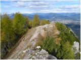 79
79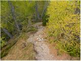 80
80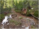 81
81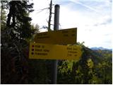 82
82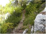 83
83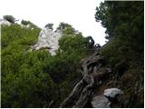 84
84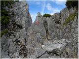 85
85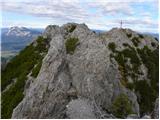 86
86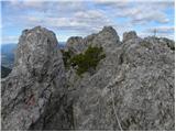 87
87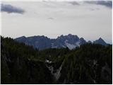 88
88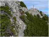 89
89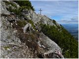 90
90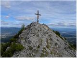 91
91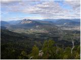 92
92 93
93
Discussion about the trail Baumgartnerhof - Mallestiger Mittagskogel (climbing way)
|
| krevs3318. 11. 2012 |
Takoj, ko sem zagledal slike, sem vedel, da na to pot moramo iti!!! 
|
|
|
|
| katja8728. 10. 2013 |
V nedeljo, 27.10.2013, smo se po tej poti odpravili na vrh. Dan je bil sončen in razgledi prečudoviti  Naredili smo krožno turo: Hotel Baumgartnerhof - Wasserfall Klettersteig - koča Mitzl Moitzl Hütte - Ostra peč/Mallestiger Mittagskogel - Hotel Baumgartnerhof (po novadni poti). Plezalni del poti je zelo lepo izpeljan in naravnost čudovit, saj te ves čas spremlja potok  Najboljši del pa je bila jeklenica, ki je speljana čez potok, saj ko ga prečiš po njej, je občutek izredno adrenalinski. Na koncu pa se počutiš prav fantastično Po koncu te ture smo se ustavili še v bližnjem Škocjanu, kjer smo preplezali še nekaj kratkih in lepo izpeljanih ferrat Slike iz pohoda si lahko ogledate na spletni strani Planinskega društva Matica Murska Sobota: http://www.mojalbum.com/pdmaticams/20131027-ostra-pec-plezalna-pot/se-zadnji-razgled-na-ostro-pec-mallestiger-mittagskogel/21213340
|
|
|
|
| Roman0523. 10. 2014 |
Po dveh letih ogledovanja te poti sem jo končno obiskal skupaj s prijatelji. Plezalni del ni preveč zahteven. Prav tako smo naredili krožno pot, kot je opisala Katja in res fantastična pot, lepi razgledi, prav tako pa zanimiv plezalni del, čeprav kratek.
|
|
|