Bogojina - Bukovniško jezero
Starting point: Bogojina (185 m)
| Lat/Lon: | 46,678°N 16,2755°E |
| |
Time of walking: 2 h 30 min
Difficulty: easy marked way
Altitude difference: 4 m
Altitude difference po putu: 250 m
Map: Pomurje 1:40.000
Recommended equipment (summer):
Recommended equipment (winter):
Views: 490
 | 2 people like this post |
Access to the starting point:
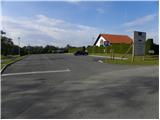
From the Pomurje motorway, take the exit Gančani and follow the road towards Moravske Toplice. After a few kilometres of further driving, the road leads to a slightly larger junction in Bogojina. Here you continue straight on (left Moravske Toplice, right Lendava) and a slightly narrower road quickly leads you to the centre of the village of Bogojina. Continue driving through the village, following the signs for Plečnik's Church. Just before the church, you will come to a small triangular crossroads, where you turn left towards the cemetery (straight ahead Plečnikova cerkev). After a short further drive, you will reach the cemetery, in front of which you will park in a nicely landscaped parking lot.
Path description:
From the parking lot, walk to Plečnik's church, then turn onto the road between the church and the Alenka restaurant. At several crossroads through the village, continue straight ahead, and when the village ends, go left. Continue walking along the road leading towards the village Bukovnica, and at the marked crossroads go right for Trnavski breg, and only a few 10 steps further on, the markings direct you left onto a slightly narrower road, which leads up to a lonely homestead, which you pass by on the right, and above it you pass into the forest. Follow the signs through the woods at several crossroads, and walk for a short distance along a field, from where you will get some views of the surrounding countryside. When you leave the forest, you will reach a carriage road, which you follow to the right and which leads you through Filovski Breg. In the middle of the village, signs point us left to a path that leads us between vineyards, and quickly, by another house, we reach another road, which descends a little. From the road, soon take a sharp left onto cart track, and a little lower down, when you reach the slightly wider cart track, take another left.
The signs for the Pomurska mountain trail point us right just past the hunting observation post, where we descend easily along the fields to the forest, through which we then continue. Through the forest you mostly climb, and when you reach cart track, go left.
At a nearby fork in the tracks, go straight ahead, and then signs point you right onto a track that continues through the forest. When you leave the forest, you will come out on an asphalt road, and we follow it to the right, where we walk between the houses of the village of Gaj. When you reach the chapel, go left, a little further down go right, and then go down past the last houses in the settlement. When the settlement ends, go left on the track that leads us along the fields, and when we get closer to the forest, the signs lead us right into the forest, where we cross the small bridge over the Janderdol stream. On the other side of the brook there is a short climb through the forest, and then the path is laid and leads us out of the forest, where we pass a hunting observation post to reach the village of Strehovski Breg, where we go left by the sign. Continue straight through the settlement at the crossroads, and when the settlement ends, the road begins to descend through the forest. The road continues past the lock and leads to the Chapel of St. Vid.
At the chapel, continue slightly to the left (if you continue straight ahead, you will descend to the parking lot slightly below Bukovniško jezero) and first walk to the spring at St. Vid, and from there descend through the forest to Bukovnik Lake.
Bogojina - St. Vid 2:25, St. Vid - Bukovniško jezero 0:05.
Description and pictures (except the first one) refer to the situation in November 2021.

Pictures:
 1
1 2
2 3
3 4
4 5
5 6
6 7
7 8
8 9
9 10
10 11
11 12
12 13
13 14
14 15
15 16
16 17
17 18
18 19
19 20
20 21
21 22
22 23
23 24
24 25
25 26
26 27
27 28
28 29
29 30
30 31
31 32
32 33
33 34
34 35
35 36
36 37
37 38
38 39
39 40
40 41
41 42
42 43
43 44
44 45
45 46
46 47
47 48
48 49
49 50
50 51
51 52
52 53
53 54
54 55
55 56
56 57
57
Discussion about the trail Bogojina - Bukovniško jezero