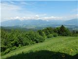
Brezovica - Sveti Primož in Felicijan (Jamnik)
Starting point: Brezovica (440 m)
| Lat/Lon: | 46,305°N 14,2079°E |
| |
Time of walking: 1 h 20 min
Difficulty: easy unmarked way
Altitude difference: 391 m
Altitude difference po putu: 405 m
Map: Škofjeloško in Cerkljansko hribovje 1:50.000
Recommended equipment (summer):
Recommended equipment (winter): crampons
Views: 2.410
 | 1 person likes this post |
Access to the starting point:
a) Leave the Ljubljana - Jesenice motorway at the Naklo exit, or alternatively at the Podtabor fork, then follow the signs for Podbrezje, Podnart and Kropa. After crossing the railway line at Podnart, turn left and head towards Kropa. When you see the Iskra Mehanizmi d. o. o. factory on the left, you are already close to the starting point. After the company, the road to the village of Brezovica branches off to the left, and we park a little further on in the parking lot on the right side of the road.
b) From the motorway Jesenice - Ljubljana, take the exit Lesce or Radovljica, then continue in the direction of Radovljica and later the villages Lancovo, Lipnica, Kamna Gorica and Kropa, which we do not take. Continue towards Podnart, then park just a little further from the junction in the parking lot on the left hand side of the road, opposite the Iskra Mehanizmi company.
c) Take Železniki, then continue towards Kropa. After Kropa, opposite Iskra Mehanizmi, park in the parking lot on the left-hand side of the road.
Path description:
From where you parked, walk to the crossroads where the road for Kropa and Kamna Gorica splits. At the crossroads, at the 0. 0 km marker, you will see a path climbing through the forest. Follow the track quickly up to cart track, which is followed to the left, and before leaving the forest and entering a larger meadow, continue slightly right on a well-worn track, which initially ascends cross-country, but turns right when it reaches a small ridge. Continue climbing moderately through the forest for some time, and higher up, the path leading from the centre of the village of Brezovica joins from the left.
Continue along the ascending path, which passes Kugla (the summit with the converters) on the left, and then descends gently to a marked crossroads, where the unmarked path from Češnjica pri Kropi joins from the left, and the marked path from Kropa joins from the right.
Continue towards Jamnik, following the path along a wooded ridge, and after a short climb reach the undistinguished summit of Berigle. Higher up, the path gradually moves from the ridge to the slope and splits.
Continue to the left (straight ahead and to the left after a few steps Vodiška mountain pasture) and climb quickly up to the hunting lodge, which you pass on the right. From the hut, in a few steps, you reach an asphalt road, which you follow to the left (right down Kropa), and a few metres after the road sign marking the beginning of Jamnik, continue slightly to the left, on a side road in the direction of the footpath to Jamnik (right Vodiška mountain pasture). After the nearby farmhouse, the road changes to cart track, and with occasional fine views reaching Karawanks and Kamnik Savinja Alps, we reach the ridge of St. Primož and Felicijan in a few minutes of further walking, after which, in a few minutes of easy walking, we walk to the church of the same name.
Description and pictures refer to the situation in 2018 (May).

Pictures:
 1
1 2
2 3
3 4
4 5
5 6
6 7
7 8
8 9
9 10
10 11
11 12
12 13
13 14
14 15
15 16
16 17
17 18
18 19
19 20
20 21
21 22
22 23
23 24
24 25
25 26
26 27
27 28
28 29
29 30
30 31
31 32
32 33
33 34
34
Discussion about the trail Brezovica - Sveti Primož in Felicijan (Jamnik)