Črni Vrh (Grom) - Javornik above Črni vrh
Starting point: Črni Vrh (Grom) (800 m)
| Lat/Lon: | 45,9086°N 14,0698°E |
| |
Time of walking: 1 h 10 min
Difficulty: easy marked way
Altitude difference: 440 m
Altitude difference po putu: 440 m
Map: Nanos 1:50.000
Recommended equipment (summer):
Recommended equipment (winter):
Views: 27.912
 | 1 person likes this post |
Access to the starting point:
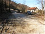
From Logatec, drive to Idrija or vice versa. In the village Godovič turn left (from the Logatec side, from the Idrija side turn right) in the direction of Črni vrh and Cola. Follow this road to the beginning of the village of Črni vrh, where you turn left towards the ski resort in the village. Continue past the ski slope to the Grom farm near which you will see a parking area and mountain signs for Javornik.
From the Primorska side, drive to Ajdovščina from where you continue towards Colo and Črnji vrh. At the end of the village of Črni vrh, turn right towards the ski resort in the village. Continue as described above.
Path description:
Near the parking lot we see the mountain signs for Javornik, which direct us to the path, which initially climbs gently through the forest. The trail initially leads along cart track, which has a number of switchbacks. Soon, however, we are walking along a fairly steep track which crosses or climbs for some time on one of the tracks. As the path is well marked, there are no problems with orientation. A little higher up, the path leads us to a forest road, which we just cross. The ascent continues along the wide and relatively steep cart track in the direction of Javornik. Follow this cart track, which ascends crosswise, all the way to Pirnatova hut na Javorniku.
From the hut, continue right up the meadow towards the tower on Javornik. After a few tens of metres, the path goes into the forest, where it climbs moderately. When you come out of the forest, cross a short scenic slope and then, just below the summit, the path goes back into the forest. There is a slight climb through the forest to the top where you can see a lookout tower. If you want a view, climb to the top of the tower at your own risk and you will get a nice view.

Pictures:
 1
1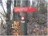 2
2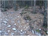 3
3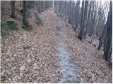 4
4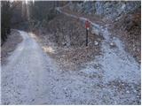 5
5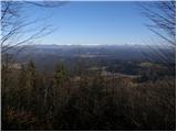 6
6 7
7 8
8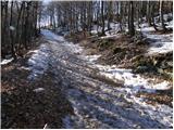 9
9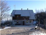 10
10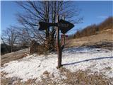 11
11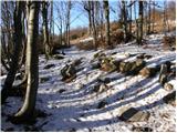 12
12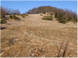 13
13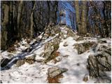 14
14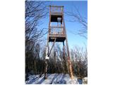 15
15
Discussion about the trail Črni Vrh (Grom) - Javornik above Črni vrh
|
| Darxta22. 07. 2012 |
Po prečkanju gozdne ceste markacije kar malce izginejo, še posebej zdaj ko so posekali nekaj dreves, ampak je skoraj nemogoče zaiti. Bil sem na vrhu stolpa pri burji s hitrostjo vsaj 100 km/h, in čeprav se je zibal vsaj kakih 20cm vstran, je zadeva zdržala! 
|
|
|
|
| Kigeot5. 10. 2014 |
Pred časom sem želela gor po tej poti in, žal, nisem našla izhodišča. Mimo smučišča nikjer ni bilo kmetije Grom, niti oznak za izhodišče. Parkirišče je sicer tik pod smučiščem, a nisem vedela, če je pravo. Domačin v zadnji hiši tudi ni vedel, kje je začetek poti, niti kje je kmetija... Tako na pot sem se podala iz bljižnjih Lom...
|
|
|
|
| D0men13. 09. 2022 12:31:52 |
Stolp na vrhu ni več izpraven in je zaprt. Je potrebna nova konstrukcija. 
|
|
|
|
| bjka7. 02. 2023 12:33:22 |
Vidim da imajo planinci, ki so prvič tu kar nekaj težav kako najti to izhodišče Grom. Mogoče bi bilo pametno namestiti kakšno oznako desno gor po poti od ekološkega otoka, da se ve, da je to smer Javornik mimo Groma. Kolikor vem je oznaka šele pri zadnji hiši (slika št.1) gor na eni bukvi (slika št.2) Obvezno pa v koči pojest ocvirkovco 
|
|
|
|
| erikas9. 10. 2023 18:14:24 |
Od ceste v Črnem vrhu, pa do smerokaza za Javornik je kar dolga makadamska pot (cca 2 km), tako, da misliš, da si že zašel. Ko prideš do bele hiše, katere fotografija je objavljena je samo nekaj metelrov naprej, iz desne strani ceste smerokaz za Javornik. Ko si enkrat na poti za vrh, ni več dilem. Srečno 
|
|
|