Dom na Gospincu - Vrh Korena (via Zvoh)
Starting point: Dom na Gospincu (1492 m)
| Lat/Lon: | 46,2957°N 14,5214°E |
| |
Name of path: via Zvoh
Time of walking: 2 h 40 min
Difficulty: difficult marked way
Altitude difference: 507 m
Altitude difference po putu: 650 m
Map: Kamniške in Savinjske Alpe 1:50.000
Recommended equipment (summer): helmet
Recommended equipment (winter): helmet, ice axe, crampons
Views: 12.791
 | 4 people like this post |
Access to the starting point:
a) From the motorway Ljubljana - Jesenice take the exit Vodice, then continue to the first semaphore crossing in Vodice, where you turn left towards Cerkelj na Gorenjskem and Brnik. When you reach the main roundabout at Spodnji Brnik, continue driving in the direction of Cerkeliai and the ski resort Krvavec. At the end of Cerklje na Gorenjskem, leave the main road, which continues towards Velesovo and Visoke, and turn slightly right onto the road towards the ski resort Krvavec. Park in the large parking lot at the lower station of the round-cabin cable car to Krvavec, buy a ticket and take the cable car to the upper station, which is next to the Mountain House at Gospinec.
b) From the motorway Jesenice - Ljubljana, take the exit Kranj - East, then continue to Brnik, Komenda and Mengeš. When you reach the main roundabout at Spodnji Brnik, continue driving towards Cerkeliai and the ski resort Krvavec. At the end of Cerklje na Gorenjskem, leave the main road, which continues towards Velesovo and Visoke, and turn slightly right onto the road towards the ski resort Krvavec. Park in the large parking lot at the lower station of the round-cabin cable car to Krvavec, buy a ticket and take the cable car to the upper station, which is located next to the Mountain House at Gospinec.
c) From the motorway Ljubljana - Jesenice, take the exit Vodice, then continue driving to the first semaphorised crossroads in Vodice, where you turn left in the direction of Cerkelj na Gorenjskem and Brnik. When you reach the main roundabout at Spodnji Brnik, continue driving in the direction of Cerkeliai and the ski resort Krvavec. At the end of Cerklje na Gorenjskem, leave the main road, which continues towards Velesovo and Visoke, and turn slightly right onto the road towards the ski resort Krvavec. Continue to the village of Grad, where the signs for Ambrož pod Krvavcem direct you to the right on a steep asphalt road (straight ahead to the lower station of the round-cabin cable car to Krvavec and Štefanja Gora). When the steepness of the steep road eases slightly, you will come to a junction, where you will continue to the left in the direction of Ambrož pod Krvavcem (straight ahead to the settlements of Ravne, Apno and Šenturška Gora). A little further on, the road descends a little and then climbs over slopes that are sometimes quite scenic. Higher up, you reach Ambrož pod Krvavcem, where you pass the church of St Ambrose and the tourist farm Pr Ambružarju on the left. From the tourist farm the road passes into the forest and climbs through it to mountain pasture Jezerec, where there is a large parking lot. The road here is laid and turns left, and about 500 m further on it leads to a crossroads, where you continue slightly left (to the right Kriška mountain pasture). You then drive along a dirt road for some time or to the upper station of the round-cabin cable car. The road from mountain pasture Jezerec to Dom na Gospincu is now closed to public traffic, which will extend the journey by about 30 minutes.
d) From the motorway Jesenice - Ljubljana take the exit Kranj - East, then continue to Brnik, Komenda and Mengeš. Once you reach the main roundabout at Spodnji Brnik, continue driving towards Cerkeliai and the ski resort Krvavec. At the end of Cerklje na Gorenjskem, leave the main road, which continues towards Velesovo and Visoke, and turn slightly right onto the road towards the ski resort Krvavec. Continue to the village of Grad, where the signs for Ambrož pod Krvavcem direct you to the right on a steep asphalt road (straight ahead to the lower station of the circular cable car to Krvavec and Štefanja Gora). When the steepness of the steep road eases slightly, you will come to a crossroads, where you will continue to the left in the direction of Ambrož pod Krvavcem (straight ahead to the settlements of Ravne, Apno and Šenturška Gora). A little further on, the road descends a little and then climbs over slopes that are sometimes quite scenic. Higher up, you reach Ambrož pod Krvavcem, where you pass the church of St Ambrose and the tourist farm Pr Ambružarju on the left. From the tourist farm the road passes into the forest and climbs through it to mountain pasture Jezerec, where there is a large parking lot. The road here is laid and turns left, and about 500 m further on it leads to a crossroads, where you continue slightly left (to the right Kriška mountain pasture). You then drive along a dirt road for some time or to the upper station of the round-cabin cable car.
The road from mountain pasture Jezerec to Dom na Gospincu is now closed to public traffic, which extends the journey by about 30 minutes.
Path description:
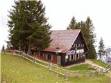
At the top station of the circular cable car to Krvavec you will see a number of mountain signs. We head in the direction of the Krvavec home and Marija Snežna on a poorly visible path that climbs up the grassy slope almost straight up. The faintly visible path leads us higher up over a pasture fence, beyond which it becomes slightly more traceable. The relatively steep path then leads to the Krvavec home, which is visible from the upper cable car station (you can also get here by a less good dirt road).
From home, continue in the direction of Zvoh along the road, which leads us past the chapel and transmitters on Krvavec to the Razor saddle (the saddle between the top of Krvavec and Velika Zvoh), where there is a crossroads of roads. Continue straight along the ridge (right Krvavec peak 5 minutes) and follow the increasingly steep transport-rescue road, which is occasionally paved, along the edge of the ski slope to the reservoir lake at Velika Zvoh. From the lake, climb to the nearby summit, then walk over the wire fence to the registration box, located a few steps below the summit.
From Veliki Zvoh we continue along the marked path along the ridge called Jež-a. The relatively easy ridge trail, however, starts to descend after a few minutes of walking and leads us to a technically challenging place. With the help of a rope ladder, we climb up a steep and crumbly gully, which is exposed to falling rocks. The gully is short, but still long enough to cause a lot of problems for inexperienced mountaineers. The difficulties then disappear and the pleasant path, which mostly follows the ridge, is followed to two successive switchbacks. At the first one the path branches off to the right down to Mokrica and mountain pasture Koren, and at the second one the path branches off to the right up to Vrh Korena, which is reached after a minute's further walking.
Dom na Gospincu - Veliki Zvoh 1:25, Veliki Zvoh - Vrh Korena 1:15

Pictures:
 1
1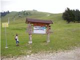 2
2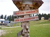 3
3 4
4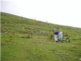 5
5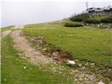 6
6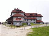 7
7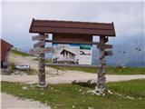 8
8 9
9 10
10 11
11 12
12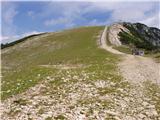 13
13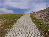 14
14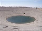 15
15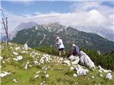 16
16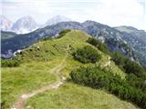 17
17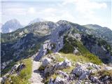 18
18 19
19 20
20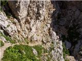 21
21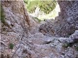 22
22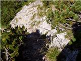 23
23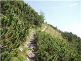 24
24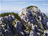 25
25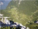 26
26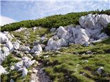 27
27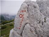 28
28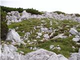 29
29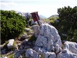 30
30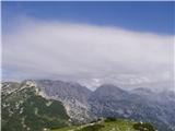 31
31
Discussion about the trail Dom na Gospincu - Vrh Korena (via Zvoh)
|
| Damijan13. 05. 2007 |
Strm vzpon na Zvoh, potem kmalu sledi zanimiv prehod čez žleb, na vrhu pa čudovit razgled na Kamniško-Savinjske Alpe.
|
|
|
|
| andrej jerina17. 08. 2008 |
Tudi midva s sinom Joštom sva danes opravila zgoraj omenjeno turo, ter jo nadaljevala na Kompotelo, povratek pa sva opravila čez planino Koren in zatem prečno v desno na sedlo Razor, ter povratek do Doma na Gospincu. Tura je enkratna, občasno je bila malce orientacijsko težavna zaradi megle. Dobro bi bilo pot ponovno markirati, saj so markacije od vrha Korena na Kompotelo in proti planini Koren slabo vidne. Priporočava. LP Andrej
|
|
|
|
| Lj28. 09. 2008 |
Prehodile danes, nadaljevale na Kompotelo in Mokrico in sestop na Kriško planino ter nazaj do Gospinca. S sestopom čez Kriško planino naredimo lepo krožno turo.
Andrej, zgoraj navajaš povratek s planine Koren na sedlo Razor - je to kakšna bližnjica t.j. se nista spustila do Kriške planine, ampak že s planine Koren prečila desno? Kje pa je odcep? LpLj
|
|
|
|
| andrej jerina29. 09. 2008 |
S planine Koren se sprva malce vzdigneš, nato pa začneš sestopati. V daljavi že vidiš greben, kateri se spušča proti Kriški planini, na desno pa se odpira pogled na greben proti vrhu Krvavca. Po cca 20 minutah hoje, se na desno odcepi neoznačena pot (mislim, da je edina pot, katero sem opazil), katera se zložno vzpenja po melišču pod grebenom v smeri sedla Razor. Pot je lepo vidna in sledljiva. Po tej poti sva krenila, ker sva imela avto pri Domu na Gospincu in ne na Kriški planini. LP Andrej
|
|
|
|
| Lj29. 09. 2008 |
Hvala! Pa spet vemo nekaj novega, morda nam kdaj prav pride. 
|
|
|
|
| petruša3. 05. 2010 |
Še je na tej poti kaj snega, ali je že sneg skopnel.lp
|
|
|