Dom pod Reško planino - Črni vrh (Čemšeniška planina)
Starting point: Dom pod Reško planino (644 m)
| Lat/Lon: | 46,20648°N 15,06421°E |
| |
Time of walking: 3 h
Difficulty: easy marked way
Altitude difference: 560 m
Altitude difference po putu: 720 m
Map:
Recommended equipment (summer):
Recommended equipment (winter): ice axe, crampons
Views: 1.530
 | 1 person likes this post |
Access to the starting point:
From the Prebold - Trbovlje road, in the Marija Reka settlement, turn right (left from the route of Trbovlje) onto the side road in the direction of the Mountain Home under Reška planina (at the crossroads there is a brown road sign with the inscription "Under Reška planina"). Follow the ascending and winding road to the Mountain Home, or continue on another serpentine road to the parish church, where you can park.
Path description:
From the parking lot near the mountain lodge, take the marked footpath in the direction of Reška planina, Zajčeva koča and Svete Mountain pasture (Partizanski vrh). At first you climb steeply and after 5 minutes you reach the Church of the Assumption of the Virgin Mary, where you return to the tarmac road.
A little further on from the church, where there is another parking area, from the marked crossroads continue left up the asphalt road (straight into the Reška planina bank), which starts to climb crosswise. At a higher level you reach an information board on the geological composition of the soil, where the road is laid. After a few minutes of crossing, you reach a marked crossroads on the south-west side of Reška mountain pasture.
Continue left down (right Reška planina along the ridge, Šmiglova zidanica, Grajska vas and Prebold.
There is some occasional downhill, first passing Jamškov vrh (811 m) on the left, then Nacetov vrh (828 m) on the right, and then passing individual farmsteads to reach a crossroads where we join the Pod s Podmeje.
Continue right up the hill and walk along the slightly wider asphalt road, which leads us across the north-western slopes of Šterbenkel Hill, higher up past the ski slope, and then we reach the slopes of Javor Peak. At a few crossroads follow the main road, and when you reach a slightly larger crossroads by the NOB memorial, go right (left Sveta Mountain pasture) and quickly reach the Church of St. Lenart on Vrheh.
A few 10 metres further on is the former mountain lodge Vrhe, which has been closed for several years and is privately owned.
From the former Mountain Home Vrhe, take the worse road in the direction of Čemšeniška mountain pasture. Walk along the road for a short distance and then turn right onto the steeper cart track, which gradually turns into a forest. Higher up, we also leave the wide cart track, as the signs for Čemšeniška mountain pasture direct us slightly right on a path that almost completely lays down. There is a few minutes of crossing, and then the path turns slightly right and leads us out of the forest onto a scenic slope. Here the path turns left and begins to descend over a moderately steep grassy slope. At a lower level you reach the Gunet homestead, where you also get on the road.
When you get on the road, turn right and after a few steps you will arrive at the next crossroads.
Continue straight ahead and follow the road, passing Gunet's Head (926 m) on the left. On the other side of the summit we reach a lookout saddle, and the road turns to the left here, and we walk along it for only 100 m, then the signs for Čemšeniška mountain pasture direct us sharp right to cart track, which first crosses the lane of a forest, and then leads us to an overlook slope from which we have a beautiful view towards Krvavica. Here, the cart track, which continues to climb for some time, turns to the left and then gradually turns into a slightly steeper footpath. Higher up, the footpath splits into two parts, and we have the choice of continuing along the rather steep and less well maintained marked mountain path, or along the slightly less steep parallel 'Lojzova cesta', which is newly surfaced and marked with light blue dots. Higher up, the two paths merge, and the path gradually flattens out and leads us to the edge of a steep ridge. The path continues along the right-hand side of the ridge, which then flattens out and descends to a crossroads at a registration box.
Continue straight on here (right down Vransko) and then at the next crossroads, which is located a few steps further to the right (straight down Hut na Čemšeniška mountain pasture). The way ahead takes you past the site of the old hut and past the hut of the radio amateurs. The summit, which can be reached easily, is located just a few steps above the above-mentioned amateur radio hut.
Starting point - Vrhe 1:30, Vrhe - Črni vrh 1:30.

Pictures:
 1
1 2
2 3
3 4
4 5
5 6
6 7
7 8
8 9
9 10
10 11
11 12
12 13
13 14
14 15
15 16
16 17
17 18
18 19
19 20
20 21
21 22
22 23
23 24
24 25
25 26
26 27
27 28
28 29
29 30
30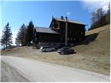 31
31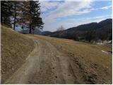 32
32 33
33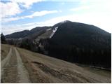 34
34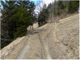 35
35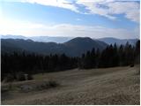 36
36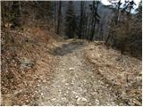 37
37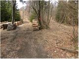 38
38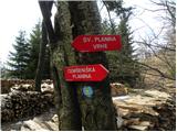 39
39 40
40 41
41 42
42 43
43 44
44 45
45 46
46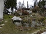 47
47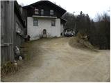 48
48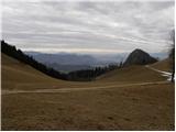 49
49 50
50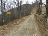 51
51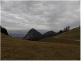 52
52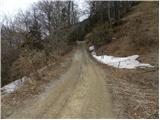 53
53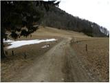 54
54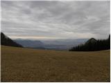 55
55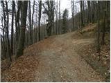 56
56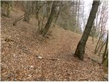 57
57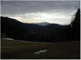 58
58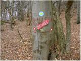 59
59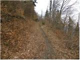 60
60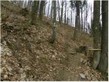 61
61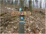 62
62 63
63 64
64 65
65 66
66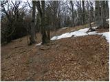 67
67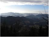 68
68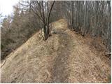 69
69 70
70 71
71 72
72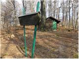 73
73 74
74
Discussion about the trail Dom pod Reško planino - Črni vrh (Čemšeniška planina)
|
| Roberto-MMLM30. 12. 2023 09:28:07 |
Najprej včeraj 29.12.23 sem bil pri tem Adijev bivak ok za to je izhodišče v redu, ampak kje za vraga ste vi našli izhodišče za ta Črni vrh, se hecate? Ko se spustiš iz strmega grebena dol do ceste do teh tabel, vse na enem drogu in nepregledno. Seveda o Črnem vrhu nikjer niti besede, niti ničesar od tega kar je na teh tablah naprej niti ene markacije, tavaš v temi v večini primerov. Tega tu nikakor ne priporočam, ne moreš brati opisa na interneru preko telefona in hoditi po poti, še to je nepopolno. Važno, da je gosenica na sliki in 1 smajli markacija in tabla za prepovedano odlaganje smeti in 1 panoramska tabla hribov v ozadju. Katastrofa. Bivak se pa splaca it pogledat. Da ne govorim o prostoru kjer se lahko parkira avto polno mehanizacije in drv, tako da res ne veš ali je to privat ali kako? Je sploh varno pustiti tam avto? Na srečo ke bilo vse ok, samo vseeno. Ta del me ne vidi več, katastrofa.
|
|
|
|
| jprim4. 01. 2024 20:27:32 |
Sama pa ne mislim, da je to katastrofa ...  , morda nova izkušnja, da je potrebno tudi takšno pot na tako nizek kucelj vzeti resno. Ko boš večkrat prehodil različne poti na Čemšeniško planino, katere najvišji vrh je Črni vrh, ti bo vse bolj jasno.  Škoda, da še spotoma nisi skočil na Krvavico.  LP!
|
|
|
|
| Roberto-MMLM10. 01. 2024 12:12:47 |
Pojdi "kot prvič" sem, pa probaj. Nič ni označeno, samo tu je nek opis.
To izhodišče me ne vidi več. Tako je. Sem prehodil večje razdalje in težje, tako da. To ni to. Še posebej zdaj ko je hitro tema...
|
|
|
|
| Kafetarca10. 01. 2024 14:27:20 |
A kdo ve, katera kamera na hribi.net je najboljša za preverit vreme na Čemšeniški?
|
|
|
|
| turbo10. 01. 2024 16:09:06 |
Za vreme pokličeš v dom oziroma kočo, preden se od doma odpraviš 
|
|
|