Dom v Dragi - Tolsti vrh (at Poljška planina)
Starting point: Dom v Dragi (689 m)
| Lat/Lon: | 46,395°N 14,2183°E |
| |
Time of walking: 1 h 40 min
Difficulty: easy marked way, easy unmarked way
Altitude difference: 536 m
Altitude difference po putu: 540 m
Map: Karavanke - osrednji del 1:50.000
Recommended equipment (summer):
Recommended equipment (winter): crampons
Views: 2.161
 | 1 person likes this post |
Access to the starting point:
a) Take the Begunje na Gorenjskem exit (to get here from the Gorenjska motorway, take the Radovljica exit, from Žirovnica or from the semaphorised junction at Podvin), then follow the signs for Tržič. Towards the end of the settlement, leave the road towards Tržič and continue driving to the left towards Kamen Castle and Draga. Follow the slightly narrower road to the marked parking area, which is located a few 10 m in front of the Dom v Draga.
b) Drive to Bistrica pri Tržiču, then follow the signs for Begunje na Gorenjskem. When you reach the above-mentioned place, continue to the right in the direction of Kamen Castle and the Draga valley. Follow the slightly narrower road to the marked parking area, which is located some 10 m in front of the Dom v Draga.
Path description:
From the marked parking lot continue along the road crossing the stream Begunjščica over a bridge, then continue right in the direction of Roblek's home, Begunjščica, Poljška mountain pasture and Prevala (on the left Dom v Draga). Continue walking along the road leading past the bee farm, and when you reach the confluence, the path splits. To the right, the marked path continues towards Prevala, and we continue to the left and continue walking on the macadam road. There is a slightly steeper climb, and then the signs direct us to the left onto a forest path, which ascends quite steeply. Cross the dirt road a few more times, or get closer to it, and then leave the forest to reach mountain pasture Planinca.
At the mountain pasture we return to the road, and we continue straight on (right mountain pasture Prevala) and after about 15 minutes of further walking we reach Tomčeva koča na Poljški planini, where the next crossroads is.
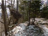
Continue left (right Roblekov dom na Begunjščici), initially still walking on the dirt road, and leave the path towards St Peter's at a fork in the track, from where you continue straight ahead on an unmarked ridge, following an unmarked track. During the ascent, a beautiful view opens up to the right towards Stol, and then the path returns to the forest and leads to the highest point of Tolstego vrh.
Draga - mountain pasture Planinca 1:15, mountain pasture Planinca - Poljška mountain pasture 0:15, Poljška mountain pasture - Tolsti vrh 0:10.
Description and figures refer to the situation in 2019 (January).

Pictures:
 1
1 2
2 3
3 4
4 5
5 6
6 7
7 8
8 9
9 10
10 11
11 12
12 13
13 14
14 15
15 16
16 17
17 18
18 19
19 20
20 21
21 22
22 23
23 24
24 25
25 26
26 27
27 28
28 29
29 30
30 31
31 32
32 33
33
Discussion about the trail Dom v Dragi - Tolsti vrh (at Poljška planina)