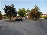
Dragomer - Liparjev grič (on cart track)
Starting point: Dragomer (297 m)
| Lat/Lon: | 46,0181°N 14,3868°E |
| |
Name of path: on cart track
Time of walking: 20 min
Difficulty: easy unmarked way
Altitude difference: 77 m
Altitude difference po putu: 77 m
Map: Ljubljana - okolica 1:50.000
Recommended equipment (summer):
Recommended equipment (winter):
Views: 252
 | 2 people like this post |
Access to the starting point:
From the motorway Ljubljana - Koper, take the exit Brezovica, then continue along the parallel old road towards Vrhnika. After 4. 5 km of driving, from the point where we left the old road, turn right at the traffic lights towards the centre of Dragomera. As soon as we leave the main road, there is a marked path to the right, initially the road to Debele hill. Park somewhere in Dragomer, preferably near the sports ground.
Path description:
The route initially leads us along an asphalt road, which opens up a beautiful view of Dragomer. The asphalt soon ends and the road turns into a forest. We continue past a bench, where a marked path branches off, and we continue straight on past a few houses, the road becomes asphalt. Soon we come to a fork where we turn right and immediately come to another fork, continue straight or right, both ways lead to the destination. Cart track goes into the woods, makes a sharp turn and climbs some more to the next crossroads, where the other route variant joins. Continue slightly right on the path, which turns into a meadow. Follow it to the forest and then turn left onto a trackless path and in a few steps you are on the grassy top of Liparjev hill.
Description and pictures (except the first one) refer to the situation in September 2022.
Pictures:
 1
1 2
2 3
3 4
4 5
5 6
6 7
7 8
8 9
9 10
10 11
11 12
12 13
13 14
14 15
15 16
16 17
17
Discussion about the trail Dragomer - Liparjev grič (on cart track)