Gate (Belca) - Mallestiger Mittagskogel (by road)
Starting point: Gate (Belca) (1007 m)
| Lat/Lon: | 46,5041°N 13,9179°E |
| |
Name of path: by road
Time of walking: 3 h 25 min
Difficulty: easy unmarked way
Altitude difference: 794 m
Altitude difference po putu: 950 m
Map: Kranjska Gora 1:30.000
Recommended equipment (summer):
Recommended equipment (winter): ice axe, crampons
Views: 4.958
 | 3 people like this post |
Access to the starting point:
Due to the collapse, access to the described starting point is not possible until further notice (May 2018).
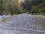
From the motorway Ljubljana - Jesenice take the exit Jesenice - West and then continue along the regional road towards Kranjska Gora. Follow the road to Belca and continue for a few 100 m, then you will see the beginning of a forest road on your right, leading into the Belka valley. Continue along the initially still wide, then narrower and sometimes quite precipitous forest road. Follow the picturesque road through the tunnel to a marked parking area by a small bridge at the confluence of the Suhego graben and Beli potok.
If you continue over the bridge, which has a green ramp behind it, you may find that it is locked when you leave.
Path description:
From the parking lot, continue along the road, which immediately crosses a bridge, followed by a green ramp. The road soon starts to climb steeply along the picturesque stream Suhi graben. Higher up, we climb over a beautiful waterfall, and the road leads us a little further to a crossroads, where we continue along the road on the left (Kepa on the right).
The road continues to climb moderately, and we follow the "main" road at all junctions. A little higher up, the road leads past a forestry hut and a little higher still, past a water trough. The road, which has a few more small crossroads, continues to follow the 'main' road, which leads us around the last sharp right turn to a small crossroads at which there is usually a small cairn. Here, the path to Mojstrovica over the Bashinov Breg branches off to the left, and we continue straight on and follow the road to its end.
From the end of the road, climb over the fence to the above-mentioned saddle, where there is a crossroads of unmarked paths. Continue slightly right on the west side of the ridge (left Mojstrovica and Visoki vrh) along the path, which quickly leads to a small clearing, where we encounter the first orientation lop. Continue straight ahead on the initially poorly visible path (not to the left), which climbs steeply and leads us higher up to a small pass. The path ahead turns right and starts descending a slope covered with larch forest. The path then passes Tišlerica (1757m) in a semicircle and descends to a slightly larger meadow on the other side. In the upper part of this meadow there is a small crossroads where you continue north along a slightly steeper path. The path then climbs in a few switchbacks and then leads to an undistinguished saddle between Kresišče and Laskovec.
Continue along the path, which crosses the slopes of Kresišča to the west and in a slight downhill. After a short descent, a pleasant path (there are several of them) leads us to mountain pasture Grajšca, where the path from Srednji vrh joins us from the left.
From Grajšca, from which there is a fine view of the Martuljska group of mountains, we continue along the gently sloping meadow, which is interspersed with numerous holes made by marmots. The path through the narrower and narrower meadow leads us higher into a rare forest, which ends with a small but very distinct torrent. The path continues along and alongside the torrent and leads us higher up to the border ridge, where the next crossroads are. Continue right along the ridge path (straight Techantinger Mittagskogel), which starts to descend. After a short descent, the path starts climbing again, this time between dwarf pines and the gully. The steepness soon eases and the path leads to the top of "Maloško poldna", where there is a crossroads.
Continue left downhill (right Kresišče along the ridge) on a relatively steep and entirely Austrian ridge. After a few minutes of descending, the path climbs again and leads to the ridge again. The way ahead becomes a bit more difficult, but the fixed safety gear are helpful to climb safely to the nearby summit (the more difficult part is very short).
Starting point - end of the road 1:45, end of the road - Mallestiger Mittagskogel 1:40.

Pictures:
 1
1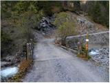 2
2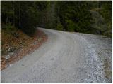 3
3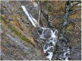 4
4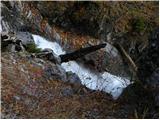 5
5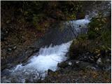 6
6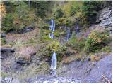 7
7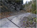 8
8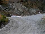 9
9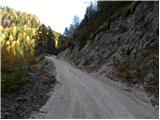 10
10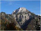 11
11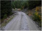 12
12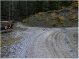 13
13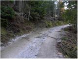 14
14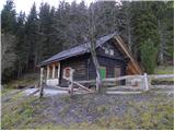 15
15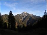 16
16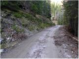 17
17 18
18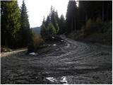 19
19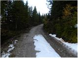 20
20 21
21 22
22 23
23 24
24115500.th.jpg) 25
25 26
26 27
27 28
28 29
29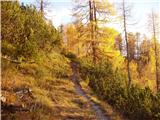 30
30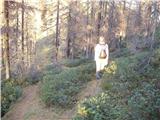 31
31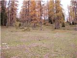 32
32 33
33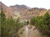 34
34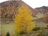 35
35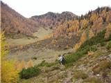 36
36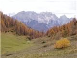 37
37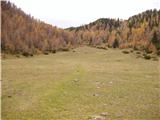 38
38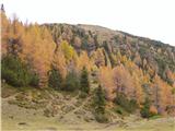 39
39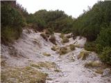 40
40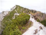 41
41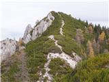 42
42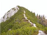 43
43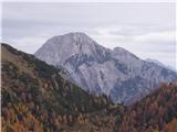 44
44 45
45 46
46 47
47 48
48 49
49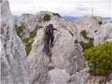 50
50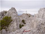 51
51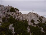 52
52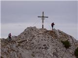 53
53
Discussion about the trail Gate (Belca) - Mallestiger Mittagskogel (by road)