Gozd Martuljek - The Lower Martuljek waterfall
Starting point: Gozd Martuljek (750 m)
| Lat/Lon: | 46,4821°N 13,8378°E |
| |
Time of walking: 30 min
Difficulty: easy marked way
Altitude difference: 100 m
Altitude difference po putu: 100 m
Map: Kranjska Gora 1:30.000
Recommended equipment (summer): helmet
Recommended equipment (winter): helmet, ice axe, crampons
Views: 67.886
 | 4 people like this post |
Access to the starting point:
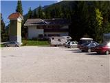
From Mojstrana drive to Kranjska Gora or vice versa, but only as far as the village of Gozd-Martuljek, where you park in the parking lot near the bridge over the Sava Dolinka river (the parking lot is located behind the bridge, or in front if you are coming from Kranjska Gora).
Path description:
From the parking lot, continue along the main road towards Kranjska Gora, but only to the point where the cycle path branches off to the left (there are also mountain signs at the start of the cycle path, which also direct you to the road). Follow the cycle path to the first crossroads, where you continue straight onto the dirt road (the cycle path turns right), which quickly leads you to the next crossroads.
Continue to the right and follow the road closed to traffic until you reach the TNP signpost. Further on, the path splits into two parts. Take the path to the left, which leads to a small bridge crossing the river. Immediately after the little bridge, turn right into the gorge of Martuljških falls. The path ahead is exposed to falling rocks, so it is best to wear helmets. The path ahead climbs up along the river, initially gently, and then begins to climb steeply with the help of steps. The path then crosses a large bridge over the river and on the other side climbs up steps below the cliff. Just a few steps further on, the path leads to another bridge with a beautiful view of the Lower Martuljkov waterfall.

Pictures:
 1
1 2
2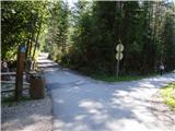 3
3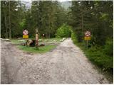 4
4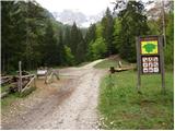 5
5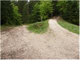 6
6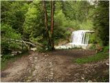 7
7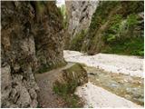 8
8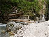 9
9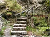 10
10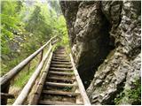 11
11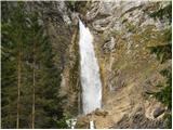 12
12
Discussion about the trail Gozd Martuljek - The Lower Martuljek waterfall
|
| Guest5. 06. 2006 |
Super izlet, če nimate preveliko časa, pa bi vseeno radi občudovali lepote TNP. Seveda, če že greste na na spodnji Martuljkov Slap, greste tudi do zgornjega, ki je za mene osebno še lepši ko spodnji. Pri zgornjem ne rinite vse do slapa, če niste prepričani v "skalo".
|
|
|
|
| Guest5. 05. 2007 |
A se v teh dneh splača obisk slapov? Koliko je kaj vode? Hvala
|
|
|
|
| Guest5. 05. 2007 |
Mislim, da je kar primerno saj se nad slapovi tali sneg.
|
|
|
|
| Guest23. 12. 2007 |
Ali ta slap pozimi zamrzne? Zanima me, ker sva šla s kolegom stavit. Peter 
|
|
|
|
| 5ko29. 09. 2011 |
Pot do spodnjega slapa je zaprta, tako da te pri tabli TNP pošlje po poti za zgornji slap in se nato spustiš po urejeni označeni poti do slapa (po tabli sodeč bi spust naj bil zelo zahteven -pa ni- urejen je z lesenimi ograjami, stopnicami in vmes z vrvjo namesto ograje). Ta pot vsaj ni izpostavljena padajočemu kamenju. Opravili pot z dvomesečnim otrokom (v pestunji) in z kužatom.
|
|
|
|
| damjanindamjana16. 07. 2013 |
Ali ima kdo informacijo če je spodnji slap že odprt in pot popravljena?
|
|
|
|
| Guest16. 07. 2013 |
Pot je popravljena,nameščene so mreže za padajoče kamenje,mostovi so novi in širši. Vseeno pa na informacijskih tablah piše da je prehod na lastno odgovornost.
|
|
|
|
| serajko16. 07. 2013 |
lp 12.7.13 je bila spodnja pot uradno zaprta . Je pa varno prehodna na lastno odgovornost . Za prehod potoka so postavljeni zasilni mostički
|
|
|
|
| orel98115. 05. 2014 |
Ali je kdo hodil zadnje case do spodnjega slapu, ali je pot prehodna?
|
|
|
|
| slavi090215. 05. 2014 |
@orel981.....mi smo bili 12.4.takrat je bilo normalno prehodno,kljub temu da že kar nekaj časa visi napis,da je pot uradno zaprta,vsi pa vemo da hodimo na lastno odgovornost....se pa splača obiskati tudi zgornjega,ker letos imata oba ogromno vode in sta veličastna
|
|
|
|
| plaNinaPirsMajcen10. 05. 2025 10:05:15 |
https://youtu.be/1_R0daPDEeE?si=l69tp1bnnJJPQbEw Lepa ideja za družinski izlet. Posneto 2.5. 2025 Spodnji, zgornji Martuljkov slap in soteska s potokom, brzice vmes, ljubki kamniti možici ob rečni strugi, prijeten piš vodnih kapljic po poti, fantastični razgledi na okoliške gore...vse to planinoljubca ne pusti ravnodušnega 🤩 Pri vzponu smo se odločili za pot ob reki do spodnjega slapu in mimo Ingotove koče na planini Jesenje še do zgornjega. Nazaj smo šli po kolovozu in obšli planino Jesenje ter spodnji Martuljkov slap. Lp, Nina
|
|
|