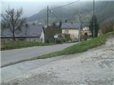
Krapina - Sušec (Strahinjščica) (via Jelenje pečine)
Starting point: Krapina (220 m)
Name of path: via Jelenje pečine
Time of walking: 1 h 45 min
Difficulty: partly demanding marked way
Altitude difference: 626 m
Altitude difference po putu: 626 m
Map:
Recommended equipment (summer):
Recommended equipment (winter): crampons
Views: 2.050
 | 2 people like this post |
Access to the starting point:
Croatia is reached via Border crossing Gruškovlje / Macelj. We drive in the direction of Zagreb, but only until the exit Đurmanec, where we leave the motorway. In the village, at the roundabout, go in the direction of Krapina. When you get to the railway crossing, turn left in the direction of Podgora. Now we are in Krapina and we go through the underpass of the Zagorje motorway and turn left again. Now follow this road (you will also see signs along the way) all the way to the large parking lot next to the Ekovent factory, where you can park.
Path description:
From the parking lot, head north downhill to the village of Strahinje and then Podgora. In Podgora, a tourist sign helps us, pointing us right up the worse road. Leave the road quickly and climb through the orchard and meadow to the forest.
Walk through the forest along the net fence and then arrive at a crossroads where the path from Žutnica village joins from the left. After the crossroads, we climb steeply in many switchbacks towards the Deer Cliffs. Here, a short steep section will help us, and behind it, a view of Krapina opens up below us.
The way forward climbs steeply in a few serpentines and passes another lookout point under the ridge, where it also lays down.
The path takes a few minutes, and then we reach the second jeklenice, which is laid due to the rather slippery terrain. There is another short steep section and two serpentines, and then the path is laid again. After 15 minutes of easy walking, you reach a crossroads where you join the path that goes via the Elephant lookout point.
From the crossroads continue eastwards, cross a short clearing and you are at the mountain hut.
In the hut you can have a snack or spend the night.
From the hut, go in the direction of Gornje Jesenje, but only for 20 metres, because then you quickly turn right back into the forest. The path initially follows the wider logging trail, then turns onto a narrower path and becomes quite steep. On the steep part, which is quite slippery during and after rain, a wooden fence helps us. The steep path then leads to the Dedek lookout point.
From Dedek, which is also a suitable take-off point for paragliders, we have a beautiful view to the south and west. For many mountaineers, this is also the final destination, and we will continue eastwards. The trail here is laid out and follows the narrow ridge of the Strahinjščice River. There is also a wooden fence at a few exposed points.
The trail leaves the ridge and runs along the southern slope, but when the ridge widens, it returns to it. A little more walking follows and the path leads to the summit.
At the very top of Sušec is a huge willow tree. There is no sign-in book (it is in the hut), only a stamp. As the summit is covered with forest, there is no view.

Pictures:
 1
1 2
2 3
3 4
4 5
5 6
6 7
7 8
8 9
9 10
10 11
11 12
12 13
13 14
14 15
15 16
16 17
17 18
18 19
19 20
20 21
21 22
22 23
23 24
24 25
25 26
26 27
27 28
28 29
29 30
30 31
31 32
32 33
33 34
34 35
35 36
36 37
37 38
38 39
39 40
40 41
41 42
42 43
43 44
44 45
45 46
46 47
47 48
48 49
49 50
50 51
51 52
52
Discussion about the trail Krapina - Sušec (Strahinjščica) (via Jelenje pečine)