Križovec - Barentaler Kotschna/Struška (by road)
Starting point: Križovec (1222 m)
| Lat/Lon: | 46,4699°N 14,0838°E |
| |
Name of path: by road
Time of walking: 2 h 15 min
Difficulty: easy unmarked way
Altitude difference: 722 m
Altitude difference po putu: 722 m
Map: Karavanke - osrednji del 1:50.000
Recommended equipment (summer):
Recommended equipment (winter): ice axe, crampons
Views: 17.580
 | 1 person likes this post |
Access to the starting point:
From the motorway Ljubljana - Jesenice take the exit Lipce and follow the road towards Jesenice. When you reach the semaphoreised junction where you join the old road, turn right in the direction of Žirovnice. Follow this road for only a short distance, as at the next slightly larger junction (traffic lights), turn left in the direction of Javorniški Rovto. The road then passes through an underpass (railway) and then turns left (Koroška Bela on the right). Follow the road, which starts to climb steeply higher up, in the direction of Javorníško Rovto. The road leads us past the Pristava home (the home is just above the road) and after the home we come to the next (smaller) crossroads, where we go right. Next, we drive along the macadam road all the way to Križovec, which we recognise by the crossroads of several roads (there are a few small car parks and a cross at the crossroads).
Path description:
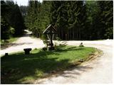
From the parking lot, take a sharp right (direction of arrival) onto the road with the cross. The road then leads past a ramp and then climbs gently through the forest. After about 15 minutes of walking, the marked path from the Pristava home joins us from the right. Continue to the left and the path leads to the pastures of Pustega rovta, where you will see two bytes on your left.
Continue past these bytes to the other side of mountain pasture, where the road turns right and then leads us in a few minutes to a crossroads by a torrent. Take the road to the right, which crosses cart track towards the saddle Kočna (Golica on the left). Further on, you will again come across a barrier which you go around on the left. Just a few tens of metres further on, another barrier stops our route. The road continues to climb in a cross-climb to the east, mostly through the forest. A few minutes before mountain pasture the road passes out of the forest into the Barentaler Kotschna grazing areas and makes a sharp left turn from which we have only a few steps to the hut at mountain pasture.
From the hut continue eastwards, initially only slightly uphill. After a five-minute walk from the hut, the path leads to a less steep ravine, where you continue left on a less visible unmarked path (straight mountain pasture Seča).
Continue up the grass-covered ravine, which is surrounded by dwarf pines. At the top of this gully, the path, which is still difficult to follow, turns right into the vast world of Barentaler Kotschna. The path continues in a moderate ascent crossing the south-western slopes of Barentaler Kotschna, which are partly covered with dwarf pines (as the path is more difficult to follow, it is possible to quickly get lost among the dwarf pines). A little below the summit, the "path" leads to a ridge which is followed to the summit.
Orientation from mountain pasture to the summit is a little more difficult, and very difficult in fog.
Križovec - Svečica 1:30, Svečica - Barentaler Kotschna 45 minutes.

Pictures:
 1
1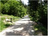 2
2 3
3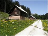 4
4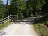 5
5 6
6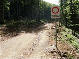 7
7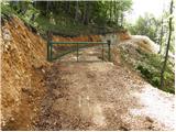 8
8 9
9 10
10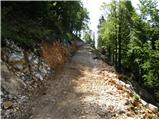 11
11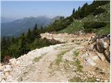 12
12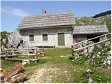 13
13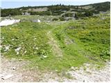 14
14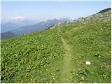 15
15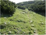 16
16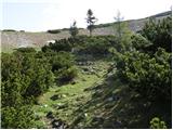 17
17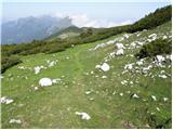 18
18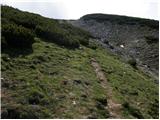 19
19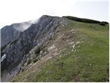 20
20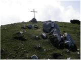 21
21
Discussion about the trail Križovec - Barentaler Kotschna/Struška (by road)
|
| Planinček21. 02. 2008 |
Ko so začeli z gradnjo ceste do planine Svečica sem bil kar precej razočaran. Če pa se sedaj pozimi odpravim na Struško je ta veliko lažje dostopna kot prej. Seveda ne odobravam uničevanja narave, a vzpon je sedaj res lažji. 
|
|
|
|
| Biser gora22. 02. 2008 |
Kar se ceste tiče mi ni prav nič všeč. Tista planinska pot, ki poteka nad cesto je veliko lepša kot ta cesta, ki jo uporabljajo za dirkanje z motorji in štirikolesniki. Ko se te peljejo ropota do vrha Struške in motijo planince in živali. Če je cesta zaprta naj to upoštevajo tudi motoristi!
|
|
|
|
| Parkeljc16. 09. 2009 |
Ja ja ja, motoristi, štirikolesniki in ostala podobna GOLAZEN. Ja, dobesedno, kot sem napisal. Pred kakimi tremi leti sem šel s hčerjo iz vasi Potoki na Ajdno. Ne moreš verjet, če se ne bi umaknila (za vsak slučaj), bi nas ta golazen z motorji povozila. Ne morete si predstavljat s kakšno brutalnostjo so pridrveli izza ovinka po POTI !!! Halo ?! In celo nekaj višje so se hoteli kregat z lastnikom gozda, ki je spravljal les z mini buldožerjem, češ, naj se mu umaknejo s poti. Pa še vsi se vozijo z neregistriranimi motorji, policija pa NIČ. Pa tudi, če bi katerega zalotili, je kazen borih 20.- EUR!! SRAMOTA. In temu rečejo "kazen". Lansko leto je policija pozimi na Krvavcu izvajala kontrolo "vožnje v naravnem okolju..." Kršitelji so bili v glavnem sami zdravniki, kirurgi,.., skratka samo premožnejši in namesto, da bi bili kaznovani..., če se pa kuža bognedaj pokaka na zelenico, je pa kazen 300.- EUR ???!!! ADIJO DRŽAVA, ADIJO PAMET !!!
|
|
|
|
| viharnica4. 03. 2015 |
Je bil morda kdo v teh dneh na Struški in bi mi lahko iz prve roke povedal, kakšne so razmere? Do Svečice najbrž ni nobenih posebnosti.
|
|
|
|
| zlatica22. 11. 2017 |
Majda, prekrasno, na vseh slikah sem najbolj občudovala čudovito nebo s takimi in drugačnimi oblaki in obširne zimske panorame kot razširjena obzorja.... Zelo sem uživala. lp  
|
|
|
|
| Majdag22. 11. 2017 |
Hvala, res so tam nad Struško oblaki prav posebno zanimivi. Tudi meni so v veselje. 
|
|
|
|
| Jusk11. 09. 2019 |
Včeraj prehodil pot od Križovca do Seče,po mejni poti na vrh Struške,dol do Belske planine in naprej do sedla Suha in po cesti nazaj do Križovca. Pot je brez posebnosti,na vrhu je kar močno pihalo.. je pa zanimiva mejna pot do vrha,ves čas med ruševjem  razgledi vse naokoli prelepi  pa samotno,celo pot sem srecal samo 2 planinca 
|
|
|