Kropa (Slovenska peč) - Razpok (upper part on the road)
Starting point: Kropa (Slovenska peč) (576 m)
| Lat/Lon: | 46,2869°N 14,1969°E |
| |
Name of path: upper part on the road
Time of walking: 2 h 45 min
Difficulty: easy marked way, easy unmarked way
Altitude difference: 426 m
Altitude difference po putu: 550 m
Map: Karavanke - osrednji del 1:50.000
Recommended equipment (summer):
Recommended equipment (winter): ice axe, crampons
Views: 478
 | 1 person likes this post |
Access to the starting point:
a) Drive to Kropa, then continue driving to Železniki and Dražgoše. When Kropa ends, continue along the Kroparica stream, and before the left serpentine and the Slovensko Poča, you will see a larger gravel area on the right where you can park.
b) From Besnice (near Kranj), drive towards Dražgoše, and continue towards Kropa higher above the village of Podblica. The trail continues past the village of Jamnik, and then starts to descend steeply towards Kropa. After Slovenska Peja, you will soon notice a larger gravel area on the left, where you park.
c) Take the road to Železniki, then follow the signs for Dražgoše and Kropa. The road ahead takes you past the village of Jamnik, then starts to descend steeply towards Kropa. After the Slovenska Poča, you will soon see a larger gravel area on your left, where you park.
Path description:
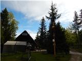
From the starting point, follow the road that runs along the Kroparica River up to the Slovenian Furnace (the Slovenian Furnace is the oldest preserved smelting furnace in Slovenia, built in the 14th century), opposite which is the National Liberation Monument, and after the smelting furnace, the signs for Vodice direct you to the right onto a worse road, which turns into a marked footpath a little further on, at the bridge over the Kroparica River.
On the other side of the bridge, the path enters the forest and starts to climb steeply. After about 25 minutes of steep ascent, you reach a ridge (on the Vreteno sign) where another path from Kropa joins from the right.
Continue in the direction of Vodice, where you pass a small cross, and the path continues to be quite steep. Higher up, the path leads us past a small spring, and above it we get some transient views. There is a short fenced part of the path, and then the path is laid and leads us to the edge of Jelovica, and a few steps further on to the lower part of the Vodiška mountain pasture. A short walk along mountain pasture and we arrive at the Partisan Home on Vodiška mountain pasture.
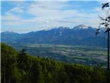
Go around the house on the left, immediately after it go right and continue walking on the dirt road. The road quickly turns into a forest, through which it initially continues without any major changes in elevation, then begins to descend gently, and at the crossroads continue straight ahead, the larger crossroads are marked, and there keep to the direction for the Goška Ravan Mountain Lodge. Follow this road through the forest all the way to Razpoko, all the way to the huts at Razpoko, where a beautiful view of the Karavanke Mountains opens up from the edge of the plateau.
Slovenska peč - Vodiška mountain pasture 1:30, Vodiška mountain pasture - Razpok 1:15.
Description and figures refer to the situation in 2019 (May).

Pictures:
 1
1 2
2 3
3 4
4 5
5 6
6 7
7 8
8 9
9 10
10 11
11 12
12 13
13 14
14 15
15 16
16 17
17 18
18 19
19 20
20 21
21 22
22 23
23 24
24 25
25 26
26 27
27 28
28 29
29 30
30 31
31 32
32 33
33 34
34 35
35 36
36 37
37 38
38 39
39 40
40 41
41 42
42 43
43
Discussion about the trail Kropa (Slovenska peč) - Razpok (upper part on the road)