Starting point: Lesično (311 m)
| Lat/Lon: | 46,1016°N 15,5193°E |
| |
Time of walking: 1 h 45 min
Difficulty: easy marked way
Altitude difference: 549 m
Altitude difference po putu: 549 m
Map: Posavsko hribovje Boč - Bohor 1:50.000
Recommended equipment (summer):
Recommended equipment (winter):
Views: 3.212
 | 4 people like this post |
Access to the starting point:
a) Exit Dramlja on the motorway and via Šentjur to Lesicko
b) From Podčetrtek via Golobinjek, Virštanj to Lesicko.
c) From Bistrica ob Sotli, Podsreda and Kozje to Lesicevo
d) From Brestanica, Senovo, Podsreda and Kozje to Lesicevo.
Path description:
In Lesično, park at the trailhead by the bridge over the Bistrica stream. The mountain trail to Brest is also the XIVth Division trail. The trail follows forest paths and roads. It is well marked. At Brest, turn left slightly down the forest road in the route Podsreda - castle, after a good hundred metres at the first turning turn left again along the forest road and continue along cart track upwards to reach the summit of Oslica.
Pictures:
 1
1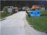 2
2 3
3 4
4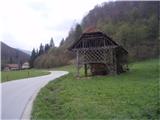 5
5 6
6 7
7 8
8 9
9 10
10 11
11 12
12 13
13 14
14 15
15 16
16 17
17 18
18 19
19 20
20 21
21 22
22 23
23 24
24 25
25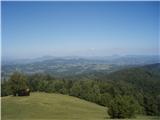 26
26
Discussion about the trail Lesično - Oslica (Bohor)
|
| šoni5. 12. 2016 |
IZ BRESTA GRE POT LEVO RAHLO NAVZGOR (IN NE NAVZDOL)
PROTI OSLICI, TOČNO V NASPROTNI SMERI OD POTI NA KOČO NA BOHORJU, PODAN OPIS TE NAPOTI LEVO PO GLAVNI CESTI NAVZDOL IZ BRESTA.
|
|
|
|
| bruny5. 12. 2016 |
Moj opis je pravilen, dobrih sto metrov je pot/cesta navzdol...se vidi že po sliki št.22...od slike št.23 je pa levo navzgor...
|
|
|