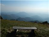
Starting point: Livek (692 m)
| Lat/Lon: | 46,203°N 13,5996°E |
| |
Time of walking: 1 h 30 min
Difficulty: easy unmarked way
Altitude difference: 551 m
Altitude difference po putu: 551 m
Map: Julijske Alpe - zahodni del 1:50.000
Recommended equipment (summer):
Recommended equipment (winter): ice axe, crampons
Views: 11.931
 | 1 person likes this post |
Access to the starting point:
a) Drive to Tolmin, then continue driving to Kobarid. When you reach Idrsko, turn left towards Livek. When you get to Livek, park at the NOB memorial and the multi-purpose building.
b) From Kobarid, drive towards Tolmin, but only as far as Idrsko, where you turn right in the direction of Livek. When you get to Livek, park at the NOB memorial and the multi-purpose building.
Path description:
From the NOB memorial, walk to the nearby crossroads, from which go left in the direction of Heaven, the home of the Kavka CŠOD, Kambreško, Kolovrat and Livški Raven (straight Itali and Avsa, right footpath to Matajur). Continue along the asphalt road, which initially leads through the settlement, passing a small fountain and the Jazbec apartment, among others, before the settlement ends and the road begins to climb. In a few serpentines we climb up to the tourist settlement of the Nebesa apartments, which we pass on the main road, and then, just after the 17. 5 km road marker, we take a sharp left onto a macadam road, which we walk along to the former ski resort of Livek (Livek ski resort).
When you reach the former ski slope, continue right and start to climb uphill on the less favourable cart track. Higher up, the path becomes passable, but it is not difficult to find the continuation of the path, as it is mown and easy to navigate. A steeper ascent follows, along a path from which we can enjoy increasingly beautiful views towards Kobarid and the surrounding mountains. The path, which initially makes some serpentines, then becomes steeper and starts to climb straight up the slope, and at the crossroads we choose the path that goes straight ahead. There are a few minutes of fairly steep climbing up the north to north-west slope, and then the path gradually moves to a ridge, where the steepness also begins to ease. Climb along the undistinguished ridge for a few more minutes, then reach the transmitters at the top of Kuka, with the registration box a few steps further on.
Description and pictures refer to 2018 (October).

Pictures:
 1
1 2
2 3
3 4
4 5
5 6
6 7
7 8
8 9
9 10
10 11
11 12
12 13
13 14
14 15
15 16
16 17
17 18
18 19
19 20
20 21
21 22
22 23
23 24
24 25
25 26
26 27
27 28
28 29
29 30
30 31
31 32
32 33
33
Discussion about the trail Livek - Kuk (Kolovrat)