Lome - Javornik above Črni vrh
Starting point: Lome (830 m)
| Lat/Lon: | 45,9001°N 14,0806°E |
| |
Time of walking: 1 h
Difficulty: easy marked way
Altitude difference: 410 m
Altitude difference po putu: 410 m
Map: Nanos 1:50.000
Recommended equipment (summer):
Recommended equipment (winter):
Views: 34.769
 | 3 people like this post |
Access to the starting point:
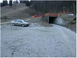
From Logatec, drive to Idrija or vice versa. In the village Godovič turn left (from the Logatec side, from the Idrija side turn right) in the direction of Črni vrh and Cola. Follow this road to the turnoff for the village Lome (ski resort Javornik), which is 500m before the village of Črni vrh. Turn left here and the road soon leads to the next crossroads, where you continue to the right in the direction of Gornji Lom (straight ahead Spodnje Lome). Continue along the road until you reach the parking lot at the Javornik ski centre.
From the Primorska side, take the road to Ajdovščina, from where you continue towards Colo and Črnji vrh. 500m after the village of Črni vrh, the road turns right towards the village of Lome. Continue as described above.
Path description:
From the parking lot, continue past the last house in the village to the marked cart track, which climbs across part of the ski slope. The cart track then goes into the wods, where it climbs moderately. During the ascent, an artificial lake is visible on the right for snowmaking on the ski slope. After this, cart track makes a sharp left turn and joins a forest road a little higher up, which is followed to the left. After a few steps, leave the road and turn right onto the steep path towards Javornik. The very steep path soon leads to cart track near the intermediate station of the double-seater. Here, continue to the right and follow cart track, which has a number of forks. All the crossroads are well marked so that orientation is easy. A little further on, join the wide cart track, which comes from Črnega vrh.
Continue to the left and after a few minutes you will reach the Pirnatova hut on Javornik.
From the hut, continue right up the meadow towards the tower on Javornik. After a walk of a few dozen metres, the path enters the forest and climbs moderately. When you come out of the forest, cross a short scenic slope, and then just below the summit, the path goes back into the forest. There is a slight climb through the forest to the top where you can see a lookout tower. If you want a view, climb to the top of the tower at your own risk and you will have a nice view.

Pictures:
 1
1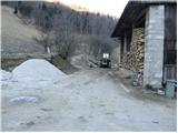 2
2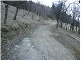 3
3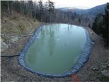 4
4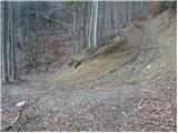 5
5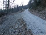 6
6 7
7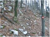 8
8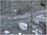 9
9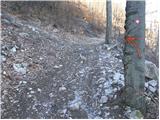 10
10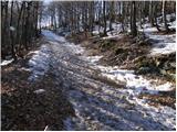 11
11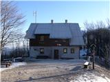 12
12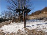 13
13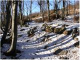 14
14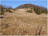 15
15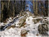 16
16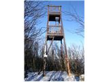 17
17
Discussion about the trail Lome - Javornik above Črni vrh
|
| Guest26. 01. 2008 |
tole smo prehodili kakšno leto nazaj,je bilo kar luštno,ampak hrib pa ne popusti menda niti enkrat,se mi zdi da smo skozi grizli kolena.
|
|
|
|
| Guest29. 01. 2008 |
Mi smo šli po tej poti v soboto. Pot se mi ni zdela nič težka, pa nisem v nevem kako dobri kondiciji. Je bil pa res lep izlet s sončkom in prelepim razgledom.
|
|
|
|
| Guest4. 02. 2008 |
ma lome so zakon.... smučišče, žuri za vse priložnosti, pes medo in prijazni domačini...kej češ lepšga  
|
|
|
|
| jerry24. 11. 2008 |
Pot je lepa in dobro označena, primerna v vseh letnih časih. Obregnil bi se samo nad "načelnost" oskrbnika Pirnatove koče. Na najino vprašanje če naju spusti notri s psom, je dejal da raje ne (kar ima seveda vso pravico), vendar le nekaj minut kasneje ni imel pripomb na psa povsem iste velikost in celo pasme! Toliko o prijaznosti! 
|
|
|
|
| možiček12. 03. 2014 |
Ali kdo ve, obstaja žig na vrhu ob stolpu? Hvala!
|
|
|
|
| MarijanB12. 03. 2014 |
Žig je nameščen na eni nogi stolpa, vsaj lani je še bil. LP
|
|
|
|
| di6. 05. 2015 |
Pot je deloma zanemarjena in ponekod slabše markirana.
|
|
|
|
| Kleemen28. 03. 2020 |
Kje točno je izhodišče? Bil sem čez cele Lome še naprej od parkirišča (tabla desno, pod smučiščem) do vrha in tam pri kmetiji obrnil. Na parkirišču tudi ni bilo nobene markacije oz. oznake za izhodišče. 
|
|
|
|
| GregorD29. 03. 2020 |
Greš čez dvorišče kmetije naravnost po kolovozu. Torej skrajno desno v gozd, ce gledas proti vrhu smučišča.
|
|
|
|
| Kleemen29. 03. 2020 |
Aja haha, potem sem se obrnil tik pred izkohiščem.  Ker sem gledal slike iz opisa in nikjer ni bilo tega parkinga, razen spodnji kjer je označena tabla - od smučišča. Hvala za info. Pridem naslednjič. 
|
|
|
|
| di29. 03. 2022 19:51:19 |
Nekajkrat sem šel po tej poti (vidim celo, da sem pisal "reklamacijo" leta 2015), ki je značilna predvsem po tem, da se "izgubiš" iz markirane poti - čeprav gre za "transverzalno" točko, celo za več planinskih obhodnic.
|
|
|
|
| D0men13. 09. 2022 12:30:36 |
Stolp na vrhu ni več izpraven in je zaprt. Je potrebna nova konstrukcija. 
|
|
|
|
| skiro12312. 01. 2025 18:32:33 |
Stolp na vrhu zgleda obnovljen, oz. se da nanj povzpeti, je pa zapisano, da je uporabo na lastno odgovornost.
|
|
|
|
| plaNinaPirsMajcen21. 12. 2025 17:58:34 |
Živjo, nekaj video utrinkov z najinega potepanja po Primorski. https://youtu.be/aiCaFR6HG20?si=X-_ryJ5Oc4N5qTsU V prvem delu videa vzpon na Mali Golak, zgoraj opisana pot na Javornik pa od 2.37 minute dalje. Pot je bila blatna. Stolp je res obnovljen, a meni plezanje nanj ni bilo prijetno. Javornik nama je postregel s panoramo, odeto v pastelne odtenke zahoda. Prelepo. Lp, Nina
|
|
|