Starting point: Lučine (634 m)
| Lat/Lon: | 46,0619°N 14,1982°E |
| |
Time of walking: 50 min
Difficulty: easy unmarked way
Altitude difference: 300 m
Altitude difference po putu: 300 m
Map: Škofjeloško in Cerkljansko hribovje 1:50.000
Recommended equipment (summer):
Recommended equipment (winter): crampons
Views: 3.551
 | 1 person likes this post |
Access to the starting point:
a) Drive to Gorenje village in the Poljanska valley, from where you take the exit from the roundabout by the Petrol station in the route Vrhnika and Horjula. Continue through Dolenjo and Gorenja Dobrava and Todraž, and then the road starts to climb steeply. As the road levels out a little higher, we reach a crossroads by the bus station Prelesje, where the road to Prelesje and Zadobje branches off to the left, and we continue slightly to the right towards Polhov Gradec, arriving at Lučine shortly after the crossroads. In Lučine, by the primary school and kindergarten Lučine, turn left towards the Matija cafeteria, and we drive between the houses to the large asphalted parking lot in front of the parish church of St. Vida in Lučine, where we park.
b) Drive to Polhov Gradec, then follow the signs for Gorenjska vas. Higher up we reach the settlement of Suhi Dol, where the road starts to descend towards Poljanska dolina, and we follow it to Lučine, where just before the primary school and kindergarten we turn right towards the Matija cafeteria, and we drive between the houses to the large asphalted parking lot in front of the parish church of St. Vida in Lučine, where we park.
c) Drive to Horjul, then follow the signs for Šentjošt nad Horjul. After Vrzdenec, the road starts to climb more visibly and soon leads to a crossroads where we continue to the right on the priority road in the direction of Suhe Dol, Butajnova and Gorenjja vas (straight on to Šentjošt and Žiri). There is some downhill, then we merge with the road from Polhovy Gradec, and we continue towards Gorenjja vas. Higher up we reach the settlement of Suhi Dol, where the road starts to descend towards the Poljanska dolina, and we follow it to Lučine, where just before the primary school and kindergarten we turn right towards the Matija cafeteria, and we drive between the houses to the large asphalted parking lot in front of the parish church of St. Vida in Lučine, where we park.
Path description:
From the parking lot, walk to the Church of St. Vid, which you pass on the left, and from the small crossroads behind the church, continue uphill on the left. There is a steep climb up a narrow asphalt road which gives a fine view of Lučine, but when the road turns left, leave it and continue right on the ascending cart track (do not continue on the cart track which crosses a grassy slope). The path then climbs through the forest, and when it reaches a small break, it turns slightly to the right and then climbs quickly to an asphalt road, which you follow uphill to a small pass by the chapel, where you leave it.
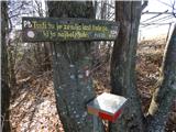
From the precipice, turn left onto the footpath in the direction of the hiking trail (Lomovec homestead to the right, Suhi Dol homestead to the right), along which you will see some signs with the inscription "Friends of Sivka" higher up. After a few minutes of ascent, the forest ends and we are only a short walk away from the summit, following the panoramic top slope of the mountain.
To the right of the summit is the mountain registration box, to the left of the summit is the registration box of the Friends of Sivka.
Description and pictures refer to the situation in 2019 (February).

Pictures:
 1
1 2
2 3
3 4
4 5
5 6
6 7
7 8
8 9
9 10
10 11
11 12
12 13
13 14
14 15
15 16
16 17
17 18
18 19
19 20
20 21
21 22
22 23
23 24
24 25
25
Discussion about the trail Lučine - Sivka