Starting point: Mačkovec (752 m)
| Lat/Lon: | 45,6148°N 14,9695°E |
| |
Time of walking: 15 min
Difficulty: easy unmarked way
Altitude difference: 78 m
Altitude difference po putu: 78 m
Map:
Recommended equipment (summer):
Recommended equipment (winter):
Views: 864
 | 1 person likes this post |
Access to the starting point:
a) Take the Kočevje exit from the semaphore crossroads in the direction of Koprivnik. Then Kočevje ends and the road leads through the settlements Cvišlerji, Zgornji Cvišlerji and Onek. When Onek ends, a road branches off to the right, leading to the centre of the village Mačkovec, and we continue along the main road towards Koprivnik, which we follow to a crossroads where a road branches off to the left, leading to Lovski vrh. Park in a suitable place near the crossroads.
b) From Črnomelj, drive towards Kočevje, and just before Nemška Loka, turn right towards Koprivnik. From Koprivnik, follow the signs for Kočevje, and a little after Laze pri Oneku you will reach a crossroads where the road to Lovski vrh turns off to the right. Park in a suitable place at the crossroads where the macadam road leading to Lovski vrh branches off.
Path description:
From the starting point, take the road in the route Lovski vrh, which after a few steps becomes a macadam road. There is a gentle to moderate climb along the macadam road, which leads us in a few minutes to a small crossroads by a nearby house.
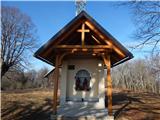
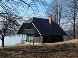
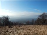
Continue along the left road, which from the crossroads onwards join the Roška cesta markings, and we follow the road to the nearby summit, where there are a few transmitters, the Chapel of St Anne and a hunting lodge from which we get a nice view.
The description and pictures refer to the situation in January 2020.
Pictures:
 1
1 2
2 3
3 4
4 5
5 6
6 7
7 8
8 9
9 10
10 11
11 12
12 13
13 14
14
Discussion about the trail Mačkovec - Lovski vrh