Starting point: Osp (57 m)
| Lat/Lon: | 45,5639°N 13,8619°E |
| |
Time of walking: 1 h 25 min
Difficulty: easy marked way
Altitude difference: 366 m
Altitude difference po putu: 385 m
Map: Primorje in Kras 1:50.000
Recommended equipment (summer):
Recommended equipment (winter):
Views: 3.420
 | 2 people like this post |
Access to the starting point:
Leave the Ljubljana - Koper motorway at the Črni Kal exit, then drive for a short distance towards Črni Kal, and turn left at the pillars of the Črni Kal viaduct in the direction of the village of Osp. The road then leads through the village of Gabrovica pri Črnem Kalu, and after about 1 km you will arrive in the village of Osp, where the route described above starts in the middle of the village. A suitable place to park is about 500 m in front of the village.
Path description:
From where we parked, we walk to the centre of the village, where we see the first markings at the NOB memorial.
Continue to the right (left down Tinjan and the tourist farm and bivouac at Vovek) and start climbing between houses, following the signs at the crossroads. The marked path soon branches off to the right towards the climbing centre, and we continue to the nearby parish church of St Peter, which we pass on the right.
The village ends here and the road turns into cart track, which quickly leads to a marked crossroads.
From the crossroads, continue right towards Kasteliec (straight ahead Socerb), and the path continues to climb mostly across to the right. Higher up, a fine view opens up towards Tinjan and the Osapska Wall, then the path turns left and passes onto a plateau. At first, the views are still beautiful, reaching all the way to the Bay of Milje and the surrounding countryside, but then the trail turns to the flat world of the Lower Karst, where the settlement of Kastelec can be seen behind. The way ahead leads us through pastures, and when we reach the macadam road, follow the signs at the crossroads.
A little further on, on the outskirts of Kastelec, we reach an asphalt road, which we follow to the left, and after a few steps we leave it and continue to the right on a marked path, which quickly leads us to the Church of the Holy Cross in Kasteliec. Go around the church on the right and then the road becomes a dirt track after the nearby children's playground. When the road forks, continue slightly right, and at the next crossroads by the cal, slightly left. The climb continues on a rather bad road, which, when laid, leads to a wider macadam road, where there is also a marked crossroads.
From the crossroads, go right in the direction of Črnokalski castle (left Socerb), and leave the road a little further on and continue slightly right on the marked footpath. From the footpath, a nice view opens up a little further on, and the path widens into cart track, after which you reach an asphalt parking lot along the old Ljubljana - Koper road.
On the south-western edge of the parking lot, find an overgrown path, which descends gently at first, and then, as the path becomes more distinct, quickly reaches a small crossroads. Continue slightly left (the right path bypasses the summit) and in a few 10 paces you will reach the relatively scenic summit of Varda.

We can extend the trip to the following destinations: Grad Socerb
Pictures:
 1
1 2
2 3
3 4
4 5
5 6
6 7
7 8
8 9
9 10
10 11
11 12
12 13
13 14
14 15
15 16
16 17
17 18
18 19
19 20
20 21
21 22
22 23
23 24
24 25
25 26
26 27
27 28
28 29
29 30
30 31
31 32
32 33
33 34
34 35
35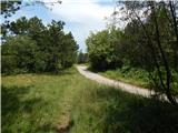 36
36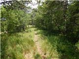 37
37 38
38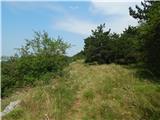 39
39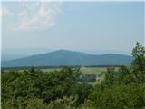 40
40 41
41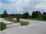 42
42 43
43 44
44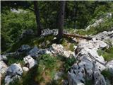 45
45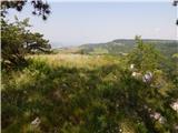 46
46 47
47
Discussion about the trail Osp - Črnokalska Varda