Planica (Planinšek) - Planina Ravne (by road)
Starting point: Planica (Planinšek) (1085 m)
| Lat/Lon: | 46,3299°N 14,6932°E |
| |
Name of path: by road
Time of walking: 1 h 15 min
Difficulty: easy marked way
Altitude difference: 415 m
Altitude difference po putu: 415 m
Map: Kamniške in Savinjske Alpe 1:50.000
Recommended equipment (summer):
Recommended equipment (winter): crampons
Views: 7.767
 | 1 person likes this post |
Access to the starting point:
a) First drive to Kamnik, then continue to Stahovica and the Črnivec Pass. A few 100 metres before the Črnivec Pass, leave the main road leading to Gornji Grad and drive sharp left in the direction of the Volovljek Pass (Kranjski Rak). From the above-mentioned pass, continue straight ahead (on the left the road leading to Velika planina, on the right the Štajerski Rak) and start descending towards Luce. Lower down, the road bends slightly and leads to the Podvolovljek valley. Continue past the road leading to the Lučka Bela valley, then past the bar at Gams. After the bar, pay attention, because just a few 100 metres further on, a road branches off to the left, leading to mountain pasture Podveža and Ravne and the Planinšek farm (at the point where you leave the main road, the road marking is approximately 11 km). Continue along the initially still asphalted road, which climbs further towards the Dleskovská plateau. Just above this, when the asphalt ends, the road continues straight ahead towards Luce, and we take a sharp left in the direction of Korošice. The road then climbs towards the Dleskovška plateau, and we follow it to a crossroads where the road to Planica or Planinšek Farm branches off to the right. Park in a suitable place at the crossroads.
b) First drive to Luce, then continue to Kamnik. When you see the road sign by the side of the road indicating 10. 5 km, pay attention to the right fork, as just a little further on the road to mountain pasture Podveža and Ravne and the Planinšek farm will fork off to the right. Continue along the initially still asphalted road, which climbs further towards the Dleskovški plateau. Just above this, when the asphalt ends, the road continues in a straight line towards Luce, and we take a sharp left in the direction of Korošice. The road then climbs towards the Dleskovška plateau, and we follow it to a crossroads where the road to Planica or Planinšek Farm branches off to the right. Park in a suitable place at the crossroads.
Path description:
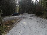
From the starting point, continue along the road on the left in the direction of Korošica, mountain pasture Podveža and mountain pasture Ravne (Planinšek on the right). The road first climbs gently through lane of a forest and then leads to grassy hay meadows above the Planinšek farm. Here a marked but less well-trodden path branches off to the left towards mountain pasture Podveža, a fine view opens up to the right towards Rogatec and Lepenatka, and we continue straight on along the road, which returns to the forest and leads us higher up to a marked crossroads, where we continue straight on again (to the left of mountain pasture Podveža).
The path continues in the direction of mountain pasture Ravne, Molička mountain pasture, Velika peak and Dleskovec and continues along the road. Just a little further on, we reach a pleasant resting place with a bench and a table, from which we have a beautiful view of the Smrekov Mountains and the surrounding area near and far. The road that immediately returns to the forest has a few small crossroads higher up, but we continue on the "main" road at all of them, which we follow all the way to mountain pasture Ravne.

Pictures:
 1
1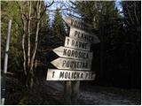 2
2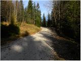 3
3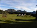 4
4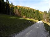 5
5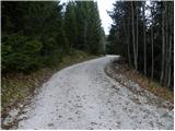 6
6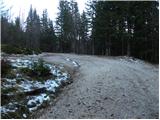 7
7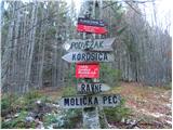 8
8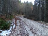 9
9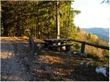 10
10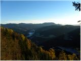 11
11 12
12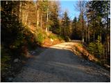 13
13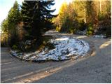 14
14 15
15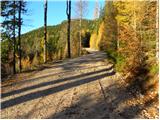 16
16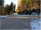 17
17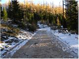 18
18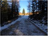 19
19 20
20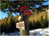 21
21 22
22
Discussion about the trail Planica (Planinšek) - Planina Ravne (by road)
|
| danicak26. 07. 2013 |
od Planinška bi jutri opravili eno krožno daljšo pot,da bi vključili tudi kakšen 2-tisočak(lažji) in se vrnili na izhodišče. ali od tu pot tudi Vodotončnikovega jezera,Korošice,še kakšno planoto,pa nazaj.
Hvala za kakšen predlog
|
|
|
|
| Daaam26. 07. 2013 |
Lahko se zapeljete tudi do planine Podvežak (opcija) od tam je pa kar nekaj možnih krožnih variant./saj so od Planinška tudi. Najlažje se boste organizirali da razgrnete zemljevid in si začrtate poljubno krožno turo.. Tudi dvatisočak se lahko vključi vmes (velika zelenica/veliki vrh ali lučki dedec(delno zahteva neoznačena pot) itd itd..
|
|
|
|
| otiv26. 07. 2013 |
@danicak od Planinška se hodi običajno samo v zimskem času,kajti do sem je splužena cesta,poleti se zapeljemo lahko še više in sicer na planino Ravne ali planino Podvežak od koder so možne ture na vrhove,ki jih je kar veliko.Niso sicer vsi dvatisočaki,je pa stati na njih prav tako prijetno in se ozirati po gorski naravi,ki je tu res lepa in zdaj je še čas cvetic,ki jih je tod vse polno. Srečno! 
|
|
|
|
| danicak26. 07. 2013 |
hvala obema za ideje, se zapeljemo vsaj na planino Ravne(dlje ne-  , pa od tam dalje,upam samo, da je cesta uredu v smislu "neizpostavljenosti", to je tudi razlog,da ne gremo do Podvežaka-  ,ker imam zeloo slabe spomine na vožnjo do tja.- 
|
|
|
|
| otiv26. 07. 2013 |
@danicak verjetno si že malce pozabila,kje si se vozila,saj že cesta do Planinška vodi po "izpostavljenem" pobočju,višje naprej ni več take "grozote" 
|
|
|
|
| Daaam26. 07. 2013 |
naj ne bo ovira tisto pobočje do Planinška  če ni ledeno( poletje?  ) ni razloga da bi imeli črne misli  ..itk je to samo par minut vžnje vmes.. korajžo v roke pa gremo 
|
|
|
|
| danicak26. 07. 2013 |
-   dopuščam možnost,da sem pozabila,hi,hi, 
|
|
|
|
| t01839621. 12. 2016 |
Pozdravljeni
Pozna kdo lovsko pot iz kmetije Palčič iz Luč do planine Ravne čez Belo peč??
Hvala za odgovore.
|
|
|