Planina Blato - Slatna (via Kreda)
Starting point: Planina Blato (1147 m)
Name of path: via Kreda
Time of walking: 3 h 20 min
Difficulty: easy pathless terrain
Altitude difference: 930 m
Altitude difference po putu: 950 m
Map: Triglav 1:25.000
Recommended equipment (summer):
Recommended equipment (winter): ice axe, crampons
Views: 8.277
 | 1 person likes this post |
Access to the starting point:
From the Ljubljana - Jesenice motorway, take the Lesce exit and follow the road towards Bled and on to Bohinjska Bistrica. Continue towards Lake Bohinj (Ribčev laz), at which you will come to a crossroads where you turn right towards Stara Fužina. In Stara Fužina, at the crossroads near the chapel, turn sharp left onto the ascending road towards mountain pasture Blato, mountain pasture Vogar and the Voja valley. The road continues to the place where the toll and parking fees are collected, and we follow it to the next crossroads, where we continue to the left (right Voje). We then follow the road to the next crossroads (we drive for some time), where we take a sharp right in the direction of mountain pasture Blato (straight ahead mountain pasture Vogar). Follow this road to the parking lot above mountain pasture Blato.
Path description:
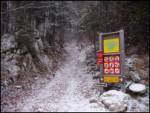
From the parking lot at mountain pasture Mud, follow the road back a little to the signs at cart track. Here we take the cart track, which climbs steeply at first and then moderately, and within ten minutes' walk leads us to a crossroads, where we turn left (straight mountain pasture in Laz). Cart track is then followed through the forest to the hut at mountain pasture at Jezero. Here you will have a view of the surrounding hills.
Go around the mountain hut on the left and the path leads us in a slight downhill to a crossroads where we continue straight along cart track (to the left mountain pasture Viševnik). The mostly rocky cart track, which follows an unmarked valley, climbs steeply a few times and, after half an hour's walk from mountain pasture at Jezero, leads to mountain pasture Dedno polje, where you reach the next crossroads.
Here, continue to the right along the faintly visible path in the direction of mountain pasture in Laz (do not continue in the direction of Zasavska hut). The path onwards in a slight downhill crosses mountain pasture and leads us on the other side to a barely visible crossroads. At the point where the marked path turns right, leave it and continue straight on the old hunting trail, which initially starts to climb gently. The path, which is occasionally overgrown due to fallen trees, starts to climb steeply higher up. The path, which passes through a sparse forest, leads to an interesting passage higher up. The narrows between the two steep slopes are easily negotiated, and the path then leads to lane of dwarf pines. Higher up, the path turns slightly to the right and passes onto the grassy slopes of the Chalk, which are overloked and lead up to the summit.
From Krede, continue slightly left, initially slightly downhill, and then the "path" leads to the foot of a small ravine. The "way" ahead climbs steeply at first, then the ravine widens and passes onto the grassy slopes of Slatna. After a few minutes of further ascent, you reach a peak with a view.
Blato - Dedno polje 1:30, Dedno polje - Kreda 1:20, Kreda - Slatna 30 minutes.

Pictures:
 1
1 2
2 3
3 4
4 5
5 6
6 7
7 8
8 9
9 10
10 11
11 12
12 13
13 14
14 15
15 16
16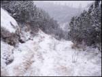 17
17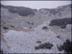 18
18 19
19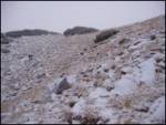 20
20 21
21 22
22 23
23 24
24 25
25
Discussion about the trail Planina Blato - Slatna (via Kreda)
|
| Okmodko18. 12. 2011 |
Kako zgleda kaj ta pot v zimskem času? Je kje kakšna nevarnost plazov? Ali je orentacija pozimi v snegu težka? In ali jo kdo uhodi in če jo mogoče že je?
|
|
|
|
| lynx27. 12. 2011 |
Glede na to, da ni izpostavljena, je najbrž brezskrbno do 2. stopnje. Orientacija ni težavna, ker ponavadi samo slediš smučinam proti Voglom, sicer pa imaš pred sabo vidno Kredo. Priporočam smučke ali krplje.
|
|
|