Planina Kuhinja - Krn (via jezero v Lužnici)
Starting point: Planina Kuhinja (991 m)
| Lat/Lon: | 46,2413°N 13,663°E |
| |
Name of path: via jezero v Lužnici
Time of walking: 4 h 45 min
Difficulty: partly demanding marked way
Altitude difference: 1253 m
Altitude difference po putu: 1400 m
Map: Julijske Alpe - zahodni del 1:50.000
Recommended equipment (summer): helmet
Recommended equipment (winter): helmet, ice axe, crampons
Views: 55.482
 | 2 people like this post |
Access to the starting point:
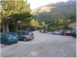
From Tolmin, drive towards Kobarid or vice versa, but only until you reach the point where the signs for Kamno direct you to the right (or left from Kobarid) across the bridge. Follow the relatively narrow and ascending road towards the village Vrsno and higher up Krn. From the village Krn, continue in the direction of the Hut at mountain pasture Kuhinja. When you reach a large parking lot, where the road continues slightly to the left towards Koča na planini Kuhinja, park in the large parking lot.
Path description:
From the parking lot at the small quarry, continue along the upper right-hand road in the direction of mountain pasture Kašina (left mountain pasture Kuhinja 3 minutes). The road, which continues to climb moderately, after a few steps of further walking leads us to the next junction, where we continue to the right again (left mountain pasture Zaslap). The relatively winding road, which gradually turns into cart track, soon leads to vast grassy slopes, where you enter the pastures of mountain pasture Kašina.
Here the road or cart track turns even more to the right, then makes a sharp left turn, and then continues crossing the slopes to the right. After about 45 minutes (from the starting point) of moderate ascent, the relatively scenic route leads to the nettle-covered mountain pasture of Leskovec.
From the above-mentioned mountain pasture, continue slightly to the left along a marked and initially rather gently sloping mountain path. The path, which turns to the western and increasingly steep grassy slopes, is joined higher up on the right by a slightly less beaten path with mountain pasture Sleme. Continue left along the already very steep path, which climbs at the foot of the steep walls of Maselnik (1906 m). A little higher up, a second path with mountain pasture Sleme joins the path, which is exposed to falling rocks due to its considerable steepness. Continue straight on along the path, which descends a little higher and then turns quite left into a small valley. There is a short, slightly steeper climb and you see the lake in Lužnice (1801 m) slightly below you on the left.
The marked trail bypasses the lake on the right and continues to climb along the foot of the Mali Peski scree ridge. Higher up, the trail turns slightly to the left and climbs over the grassy slopes of Srednji vrh (2032 m) to a small saddle called Prag (2068 m).
At Prag, where there is a marked crossroads, continue left in the direction Batognica (straight down Krnsko jezero to the right Vrh nad Peski and the hut at mountain pasture Razor) on a path that climbs moderately up the summit slope of Batognica. Follow this increasingly scenic path to the summit, which is reached after 15 minutes of further walking. From Batognica continue along the initially slightly less visible path, which continues along the left side of the summit. The path, which initially descends only gently, soon leads us into a steeper world, where we begin to descend more steeply. After a short descent, you reach a set of relatively steep steps which start to descend steeply. There is a high risk of slipping on this part of the path due to the gravel on the path. The way forward gradually becomes more steep and leads us only a little further to Krnska škrbina (the notch can also be reached by continuing on the so-called Northern Route at Prag, which bypasses the top of Batognica; the latter is slightly shorter, but also considerably less scenic).
From the stump, continue straight ahead (left mountain pasture Kuhinja, right Krnsko jezero) along the path that starts climbing up the grassy slope of the mountain. This increasingly scenic path is then followed to the summit, which is reached after about 30 minutes' walk from Krnska notch.
From the top, you can descend in 5 minutes to the Gomišček shelter and then follow the usual route down to the mountain pasture Kitchen.

Pictures:
 1
1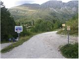 2
2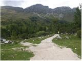 3
3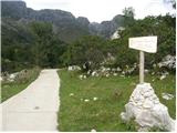 4
4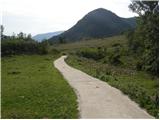 5
5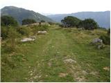 6
6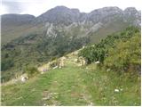 7
7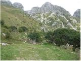 8
8 9
9 10
10 11
11 12
12 13
13 14
14 15
15 16
16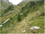 17
17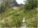 18
18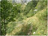 19
19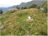 20
20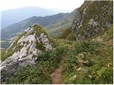 21
21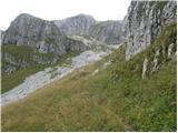 22
22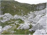 23
23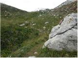 24
24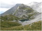 25
25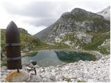 26
26 27
27 28
28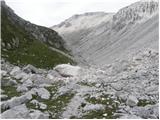 29
29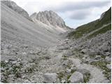 30
30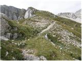 31
31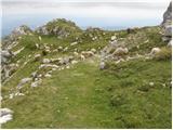 32
32 33
33 34
34 35
35 36
36 37
37 38
38 39
39 40
40 41
41 42
42 43
43 44
44 45
45 46
46 47
47 48
48 49
49 50
50 51
51 52
52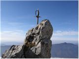 53
53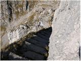 54
54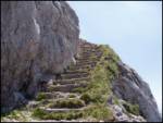 55
55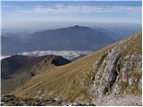 56
56 57
57 58
58 59
59 60
60 61
61 62
62 63
63 64
64 65
65 66
66 67
67 68
68 69
69 70
70 71
71
Discussion about the trail Planina Kuhinja - Krn (via jezero v Lužnici)
|
| SašaRegent22. 08. 2012 |
če opustimo nadležne muhe na štartu in pomankljivo vzdržane markacije na Batognici .... čudovito pohodniško doživetje!!
|
|
|
|
| miranm18. 06. 2013 |
Pozdravljeni,
Zanima me, če je omenjena pot iz Planine Kuhinja na Krn (mimo jezera v Lužnici) kopna in ali je potrebna zimska oprema.
Hvala in srečen korak!
Miran
|
|
|
|
| Laščan11. 07. 2013 |
Zanima me, koliko je hoje od sedelca Prag, pa do ostalin iz 1.sv.vojne pod Malimi Peski (spomenik in ostaline barak)
Hvala!
|
|
|
|
| SuzanaM12. 07. 2013 |
Do spomenika je 15-20 minut. Vidimo ga takoj, ko prečimo južna pobočja Vrha nad Peski. So pa razgledi tako lepi, da minutke do spomenika hitro minejo.
|
|
|
|
| megadave8. 09. 2014 |
Pred dvemi dnevi sem se vrnil s te čudovite ture(Pl.Kuhinja-Krn-Batognica-jezero v Lužnici-Rdeči rob-Pl.Kuhinja).Resda vse skupaj traja okrog 9 ur,ampak meni najlepša tura do sedaj.Batognica,Lužnica,svizci,orli,potem pa naravna znamenitost-Rdeči rob.Čudovito!
|
|
|
|
| miri8. 09. 2014 |
Probaj v obratni smeri! Bi šel stavit,da je še lepše.Ne vem ,zakaj.
|
|
|
|
| šnedrnca20. 11. 2015 |
.Ojla, je bil kdo na Batognici
|
|
|
|
| Smetar20. 11. 2015 |
bil sem prejšnji vikend gor...
|
|
|
|
| StyLa11. 07. 2016 |
Ta vikend smo opravili krožno turo s Planine Kuhinja - mimo koče gor na Krn in potem preko Batognice in mimo jezera nazaj. To je res lepa tura, kratkočasna in polna lepih razgledov. Toplo priporočam vsem ki bodo dostopali na Krn s tega izhodišča. Priznam pa, da verjetno ne bi našli poti v obratno smer, ki poteka po pašnikih in mimo staj, saj je dokaj slabo označena.
|
|
|
|
| darinka411. 07. 2016 |
Od parkirišča do planine Leskovca in potem naprej je pot solidno označena. Jaz običajno grem mimo Lužniškega jezera na Batognico in potem po južni dol.Mi je veliko lepše tako.
|
|
|
|
| N3bULA23. 07. 2017 |
Po zgornji poti sel na Krn vceraj. Pot je dobro oznacena, kljub soboti sem do Batognice srecal samo 5-6 planincev, zato pa ni manjkalo krav in ovc od katerih je "pognojena" cela Batognica  . Tudi stopnice na poti iz Batognice na Krnsko škrbino niso tako strasne, sploh ker je ob njihovi celotni dolžini napeljana jeklenka. Spust iz Krna sem opravil mimo zavetisca on nato po obicajni poti proti planini Kuhinja, ta običajna pot je za spust zelo primerna, za vzpon pa se mi zdi prevec monotona. LP
|
|
|
|
| haluzow23. 07. 2017 |
Včeraj sva šla s punco po tej poti. Izredno lepa tura, krasni razgledi. Sestopala sva po južni strani, ki pa se zelooo vleče. Tako da v primeru krožne ture priporočam vzpon čez Batognico.
|
|
|
|
| entrenous29. 07. 2020 |
Planinski pozdrav!
V prihodnjih dneh nameravamo s psom in manjšimi otroci na Krn preko Pl. Kuhinja in bi naredili krog preko Batognice/Lužnice. Otrokom bi pokazali ostanke Velike vojne.
Katero smer priporočate (pes, otroci) - Batognica na vzponu ali ob spustu s Krna? Rabimo za stopnice med Batognico in Krnom varovalno vrv?
Hvala!
|
|
|
|
| Enka29. 07. 2020 |
Meni se zdi boljše direktno na Krn, pa potem prek K.škrbine na Batognico (lažje za vzpon, na stopnicah je zdaj jeklenica, so pa zlizane), potem na sedlo Prag in naprej mimo jezera nazaj na Kuhinjo. Je pa pot kar dolga in v dolini Lužnice je ob sončnih dnevih hudo vroče.
|
|
|
|
| soraya200230. 07. 2020 |
V torek,28.7. sem na Planini Kuhinja na parkirišču pozabila pohodne palice Leki. Za kakršnekoli informacije - hvala.
|
|
|
|
| ljubitelj gora6. 08. 2021 21:16:11 |
Parkiranje za cel dan na tem parkirišču je 10 evrov. Velja od 6.8.2021.... 100m naprej pri koči je brezplačno parkiranje.
|
|
|
|
| 12a3bc12. 10. 2021 17:20:05 |
V vasi Vrstno je tabla za popolno zaporo ceste, ker casto višje popravljajo se je pa v nedeljo dalo it mimo. Neven pa kako je čez teden.
|
|
|