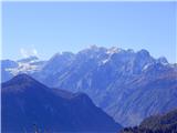
Planina pod Golico - Na pečeh pri Črnem Vrhu
Starting point: Planina pod Golico (949 m)
| Lat/Lon: | 46,4664°N 14,0517°E |
| |
Time of walking: 1 h 5 min
Difficulty: easy unmarked way
Altitude difference: 369 m
Altitude difference po putu: 369 m
Map: Karavanke - osrednji del 1:50.000
Recommended equipment (summer):
Recommended equipment (winter): ice axe, crampons
Views: 1.560
 | 5 people like this post |
Access to the starting point:
From the Ljubljana - Jesenice motorway, take the Lipce exit (Jesenice east) and drive to Jesenice, where signs for Planina pod Golico direct you to the right at the health centre, onto the ascending road. After 3 kilometres, this road leads to the village of Prihodi. Through Planina pod Golico, go straight along the main road, past the fire station, and then you will see a monument on the right and an abandoned restaurant (Belcijan or Dom pod Kahlkogel) on the left. Park nearby.
Path description:
From the starting point, follow the road back to a small crossroads with a sign, where you turn left (right church), uphill on the asphalted road. After the right-hand bend, follow the sign Črni vrh and turn left. The uphill road first leads straight on past a house and some cottages, and a little higher up, when it turns right at a crossroads and loses the tarmac surface, it turns right to the south-west. After a steeper climb on the paved surface, we find ourselves at a crossroads called Triglavček, where we turn left and continue uphill in the direction of Smučarski dom Črni Vrh, Španov Vrh. Higher up, the path leads us first to the vicinity of the ski slope, which we cross below, and a little higher up, after a sharper left turn, the macadam path is laid. After a few steps further walking, you will see logging trail on the left, which leads into the forest. To the right of the start of this logging trail is another, older logging trail, which branches off from the first and heads slightly right uphill, through the woods. Take the track that runs along the right-hand side of this logging trail and continue uphill to the east. A little higher up, where one of the trains joins from the left, continue slightly right, whereupon the path briefly dips. At this part, where logging trail splits, continue straight ahead, slightly uphill, while overlooking a small left branch logging trail. Further on the path which climbs moderately first in an arc turns left, and higher up leads us to a wide forest ridge, where there is a crossroads. Here the path is laid, and we turn left, and continue north-westwards. After a short lay-by, logging trail comes to an end, and we continue slightly right uphill towards the right-hand edge of the broad ridge we are walking on. At the edge you come across a salt pan and you also see a track, but it disappears further on. After a few steps of further walking, where we have to turn only slightly left, we descend and ascend a little more, and then continue along the increasingly sharp and partly rocky edge until we reach the goal Na pečeh. Here we have a wonderful view of Karawanks, the Julian Mountains and the Mountain pasture below Golica.

Pictures:
 1
1 2
2 3
3 4
4 5
5 6
6 7
7 8
8 9
9 10
10 11
11 12
12 13
13 14
14 15
15 16
16 17
17 18
18 19
19 20
20 21
21 22
22 23
23 24
24 25
25 26
26 27
27 28
28 29
29 30
30 31
31 32
32 33
33 34
34 35
35 36
36 37
37 38
38 39
39 40
40 41
41 42
42 43
43 44
44 45
45 46
46 47
47
Discussion about the trail Planina pod Golico - Na pečeh pri Črnem Vrhu