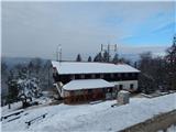
Podvin pri Polzeli - Gora Oljka (upper path)
Starting point: Podvin pri Polzeli (354 m)
| Lat/Lon: | 46,2931°N 15,0679°E |
| |
Name of path: upper path
Time of walking: 1 h 35 min
Difficulty: easy marked way
Altitude difference: 379 m
Altitude difference po putu: 430 m
Map:
Recommended equipment (summer):
Recommended equipment (winter):
Views: 6.270
 | 1 person likes this post |
Access to the starting point:
Leave the Štajerska motorway at the Šempeter exit, then follow the signs for Polzela. Cross Polzela and follow the main road, then at the pizzeria and the AS caffe restaurant turn right onto Pot na Vimperk 3-16. Continue past individual houses and then the asphalt road starts to climb more visibly. At the Cizej-Sevšek farm, you will arrive in the Podvin pri Polzeli settlement, where you will turn right at the crossroads, and a little further on, you will arrive at a parking lot, where you will park.
Path description:
From the parking lot, continue slightly left on the macadam road, which leads past the cross and along which you will see signs for Vimperk. The road quickly turns into a forest and in a few minutes of cross-climbing leads us to a small pass, where the "upper" path to Gora Oljka branches off to the right.
Continue to the right in the direction of Gora Oljka (continue on the Vinski vrh or Vimperk road) and continue walking along the marked footpath. A little further on there is a slight descent, where the forest ends, and along the way you can see the stations of the cross, which then accompany us further along the way. There is a small climb towards Vimperk (442 m), and then, following cart track, you reach an asphalt road, which you follow to the right. Follow the asphalt road up to the "last" house, which you pass on the left, and then pass the old millstone on a cross path that gradually turns to the left. There is a little more crossing, and then a path joins from the right, which leads past the birthplace of a writer, poet, journalist. . . Neže Maurer.
Continue straight ahead, at first with beautiful views, and then by an older house you reach a macadam road that turns into a forest, and follow it to a marked crossroads, where you reach the road leading to Gora Oljka.
Continue along the road towards Gora Oljka (the left road descends into the valley, the right road continues through the village of Dobrič), which quickly leads to a plague marker and a registration box. Here, the road forks off to the right to a marked parking lot and the Nasmeh Tourist Agency, and we continue straight ahead, walking along the tarmac road. Higher up, the road leads us along beautiful views, and at the former Jug guesthouse, the road from Podgora joins us on the left.
Continue along the road for another 10 metres, and then the signs for Mount Oljko direct you left to cart track, which turns into a forest. Continue through the forest, first on cart track, then on a slightly steeper marked path, which crosses cart track a few more times higher up, or occasionally continues on it. Higher up, after the sloping part, another path joins us from the right, which branches off the road higher up, and we continue to the left, arriving in a few minutes of moderate ascent at the Mountain Home on Mount Oljka, and after climbing the stairs to the Church of the Holy Cross. Description and figures refer to the situation in 2019 (January).

Pictures:
 1
1 2
2 3
3 4
4 5
5 6
6 7
7 8
8 9
9 10
10 11
11 12
12 13
13 14
14 15
15 16
16 17
17 18
18 19
19 20
20 21
21 22
22 23
23 24
24 25
25 26
26 27
27 28
28 29
29 30
30 31
31 32
32 33
33 34
34 35
35 36
36 37
37 38
38 39
39 40
40 41
41 42
42 43
43
Discussion about the trail Podvin pri Polzeli - Gora Oljka (upper path)