Starting point: Pri Rupah (1350 m)
| Lat/Lon: | 46,3659°N 13,9342°E |
| |
Time of walking: 1 h 45 min
Difficulty: easy marked way
Altitude difference: 624 m
Altitude difference po putu: 624 m
Map: TNP 1:50.000
Recommended equipment (summer):
Recommended equipment (winter): ice axe, crampons
Views: 28.444
 | 4 people like this post |
Access to the starting point:
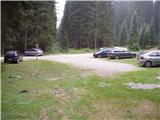
From the motorway Ljubljana - Jesenice take the exit Lesce and follow the road in the direction of Bled, where you will be directed to the right at the semaphorised junction marked for Pokljuka. Follow this road, which in the lower part takes us through a few villages and later starts to climb steeply, to Mrzle Studenec (a mountain located just 50m after the junction where the road to Bohinj branches off to the left). In the middle of the mountain pasture the main road branches off to the right, leading to Medvedova konte, Pri Rupah and mountain pasture Javornik. Turn right here and follow the road towards mountain pasture (Za)Javornik at the following junctions. The road then leads us past the above-mentioned mountain pasture and leads us a good km further to the parking area of the memorial to the fallen fighters of the National Liberation Struggle.
Path description:
From the parking lot, follow the footpath in the direction of Blejska koča na Lipanci, which leads quickly past the NOB monument into the forest. The path, which initially climbs gently, after a good 10 minutes climbs a little more and leads us to a forest road, which we just cross. Continue along the cart track towards Lipance, which leads us higher up to a place where we join the path with the mountain pasture Javornik. A fairly wide path, which is constantly surrounded by spruce forests, leads us higher up to the next crossroads, where we continue again in the direction of Lipanca (left). We continue our ascent along the very wide cart track, which leads us in a slight ascent in a few minutes to the mountain pasture grazing area of Lipanca. Here the path turns right and leads us in a moderate ascent along the right-hand lower edge of the above-mentioned mountain pasture. This is followed by crossing a grassy slope and the path which leads us back into the forest makes a sharp right turn at the NOB monument, after which we come to the shepherd's and mountaineer's hut at mountain pasture Lipanca.
From mountain pasture continue to the right along an initially poorly visible and even less well-marked path which, after a short climb, leads to the upper edge of mountain pasture, where there is also a small crossroads. Continue slightly left in the direction of Lipanski vrh, Brda and Debela peč along the path, which bypasses a larger sinkhole on the right. Just a little further on, the "main" path branches off to the left towards Lipanski vrh (Debela peč on the right). Continue towards Lipanski vrh along the path as it leaves the wods and enters the dwarf pines zone, climbing more steeply. The relatively steep and increasingly scenic path leads us higher up to a ridge where we join the path from the Krma valley. Continue left in the direction Lipanski vrh on the path which, after 5 minutes of further walking, leads us to the summit.
Starting point - Blejska koča 45 minutes, Blejska koča - Lipanski vrh 1:00.

Pictures:
 1
1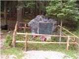 2
2 3
3 4
4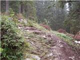 5
5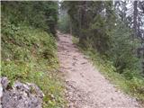 6
6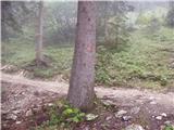 7
7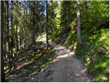 8
8 9
9 10
10 11
11 12
12 13
13 14
14 15
15 16
16 17
17 18
18 19
19 20
20 21
21 22
22 23
23 24
24 25
25 26
26 27
27 28
28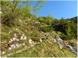 29
29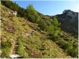 30
30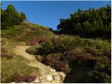 31
31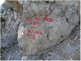 32
32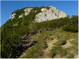 33
33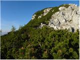 34
34 35
35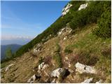 36
36 37
37 38
38 39
39
Discussion about the trail Pri Rupah - Lipanski vrh
|
| Guest3. 08. 2007 |
toplo priporočamo,le majhna pozornost na klinih pri sestopu čez mrežce 
|
|
|
|
| J.P.11. 06. 2023 16:53:23 |
Lepa, kratka tura. Cesta lepo prevozna, tu pa tam z luknjami. Pot vsekakor naredite kot krožno, preko vrha Mrežce. Lp
|
|
|
|
| lubadar11. 06. 2023 17:58:43 |
Pa je tam še dovoljeno parkirat?
|
|
|
|
| J.P.11. 06. 2023 18:45:35 |
Dobro vprašanje. Območje je označeno kot tiho, parkiramo lahko na "označenih mestih". (zimski režim je drugo) Nikjer ni bilo takega mesta in sem zgodaj avto pustila pri NOBU. Po vrnitvi je bilo tam že 10 avtov.
|
|
|