Railway station (Most na Soči) - Viewpoint Široko
Starting point: Railway station (Most na Soči) (175 m)
| Lat/Lon: | 46,14632°N 13,76013°E |
| |
Time of walking: 1 h 40 min
Difficulty: easy marked way
Altitude difference: 580 m
Altitude difference po putu: 580 m
Map:
Recommended equipment (summer):
Recommended equipment (winter):
Views: 5.870
 | 5 people like this post |
Access to the starting point:
The starting point is at the Most na Soči railway station in Postaja. Access from two directions is described, the third access is via Čepovan.
a) From Nova Gorica follow the signs for Bovec and Tolmin, go through Kanal and then look out for the turn-off for Most na Soči in the direction of Idrija and Ljubljana. Continue driving through the village of Kozaršče, in the centre of Most na Soči continue driving in the direction of Ljubljana and Idrija. After one and a half kilometres, you will see a bridge on your right and a signpost for Lokve, Čepovan and Station. Cross the bridge and find a parking place near the railway station.
b) From the direction of Idrija, follow the signs for Tolmin. 500 metres after the settlement Bača pri Modreju (before the settlement a railway viaduct crosses the road), you will see a bridge on your left and a signpost for Lokve, Čepovan and the Station. Cross the bridge and find a parking place near the railway station.
Path description:
The route is well marked and easy, but quite steep in some sections. In the first part it follows a dirt road with paved sections, in the second part it follows a cart track path through pastures, which is occasionally barred with wire.
Orientation is not difficult.
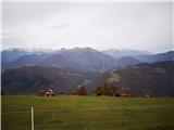
From the railway station, follow the asphalt road along the left bank of the Idrijca towards Čepovan, after 400 metres follow the road around the bend under the railway bridge. After 200 metres, a sign on the right-hand side of the road at a tap with running water directs you to a viewpoint on the macadam road. Continue along the dirt road to the next turnoff, where a sign directs you to the far left, to the right is a footpath to Most na Soči. Soon we start to climb, the road is concreted on the steepest parts, we can easily follow it to the hamlet of Klohi. At the last house, turn around the corner onto the narrower cart track, which leads across pastures and meadows, from which a view opens up towards the Tolmin hills. After two serpentines, be careful not to continue ahead in the beech enclosure, but to turn sharp right, as indicated by the sign. When you reach the hamlet of Široko, head straight towards the tourist farm and between the house and the stables, past the information board, up onto the ridge, where you can see a beautiful view on several sides.

Pictures:
 1
1 2
2 3
3 4
4 5
5 6
6 7
7 8
8 9
9 10
10 11
11 12
12 13
13 14
14 15
15 16
16 17
17 18
18 19
19 20
20 21
21 22
22 23
23 24
24 25
25 26
26
Discussion about the trail Railway station (Most na Soči) - Viewpoint Široko