Ridovc / Ridovcsäge - Cjajnik / Lärchenturm (by Mrzli potok and over Cjajnik)
Starting point: Ridovc / Ridovcsäge (808 m)
| Lat/Lon: | 46,466°N 14,3776°E |
| |
Name of path: by Mrzli potok and over Cjajnik
Time of walking: 4 h 25 min
Difficulty: extremely difficult marked way
Ferata: D
Altitude difference: 1157 m
Altitude difference po putu: 1157 m
Map: Karavanke - osrednji del 1:50.000
Recommended equipment (summer): helmet, self belay set
Recommended equipment (winter): helmet, self belay set, ice axe, crampons
Views: 4.655
 | 3 people like this post |
Access to the starting point:
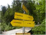
From the motorway Ljubljana - Jesenice, take the exit Ljubelj (Tržič) and then continue in the direction of Klagenfurt / Klagenfurt. After the Ljubelj tunnel, the road starts to descend and we follow it to a junction where the road to Borovlje / Ferlach branches off slightly to the right and downwards. The road continues to descend and quickly leads us to the aforementioned place, where we soon cross the railway line. Just after the railway line, we join another road, which we follow to the right, and we follow it towards Sele / Zell - Pfarre. Higher up, the road leads us through a short, picturesque gorge, and then we soon reach a sharp left turn at the Ridovc homestead, where we see yellow mountain direction signs and a bus stop. Park somewhere nearby in a suitable place along the road.
Path description:
From the Ridovc bus stop, continue along the asphalt road (right along the macadam road for 15 minutes, a longer route through the valley of the Hude Cave), which you leave after a few metres and continue to the right towards a nearby residential house, which you pass on your left. After the house the road turns into cart track, which you then follow for some time as you climb along the Mrzle potok. At a higher altitude, join the forest nature trail and follow it to the right, first crossing the stream and then, after a short climb, leaving it as the signs lead you left onto a relatively steep path. Climb up the slope quite steeply for a while, and then the path and slope lay down. There is a short walk along cart track, then cross the road leading from Sele towards Koča pod Košuto.
There is a steep climb of a few minutes, then we return to the road, and we follow it out of the forest to Mrzli log.
From here you can either continue to the right along the marked path that continues along the valley floor, or along the parallel dirt road. Wherever you continue, after about 15 minutes of walking you will reach Koschutahaus and a few steps further on to the parking lot.
From the parking lot, head south-east following the signs Lärchenturm / Cjajnik, Koschutnikturm / Koschutnikturm. At the start of the trail you will also see a large sign with a picture of Koshuta and the exact trails to Cjajnik and Koschutnikturm. The trail then passes through the forest to the east for some time and leads to a crossroads where you turn right after the Cjajnik markers. Soon you will come out of the forest to a scree slope which you then cross westwards (towards Cjajnik) in an ascending direction. When crossing the scree slope, follow the red and white markings, but do not be confused by the large yellow markings on the rocks, which lead up the scree slope towards the gully leading to Cjajnik's notch.
When entering the climbing part of the route, be sure to wear a helmet and self-protection kit, and climbing gloves are highly recommended. The route climbs steeply from the start and then crosses a steep wall to the right. The route is well protected by a rope throughout, with the occasional rock to help, but much less than one might expect. There are not many steps and a lot of the climbing has to be done by hand. The path then goes slightly to the right for quite some time and climbs almost vertically a few times. Later the path turns left and climbs a slightly easier, slightly vegetated slope. The top of Cjajnik also appears briefly, and then we re-enter the wall. Again the climb is very steep and the exposure is also increasing. The steepness subsides only slightly, then the path turns slightly to the right and leads to a crossroads below the summit tower. We have a choice of two routes leading to the summit, but whichever one we choose, we are in for some very challenging climbing. The left route is marked with difficulty level D and the right route with difficulty level C. Austrians rate the difficulty of climbing routes from A to E, with A being the easiest and E the most difficult.
The easier right-hand route first goes around the summit on the right-hand side and then ascends to the summit from the west. The left-hand path climbs vertically from the crossroads to the summit. The climbing is really very difficult here as there are not many holds in the rock. The only help is a few crampons and a vertical rope.
The route to Cjajnik is extremely difficult and is only suitable for the most skilled mountaineers with enough strength in their arms and with compulsory self-belay. The route is among the most difficult in Karawanks and harder than most of the Italian extremely difficult routes in the Julian Alps.
Alternatively, you can descend south to the Cjajnik notch from where you continue to the main ridge of Kosuta and descend to the Slovenian side, or follow the climbing route to Koschutnikturm to the starting point. The route from the Cjajnik ridge across the eastern gully is closed due to falling rocks.

Pictures:
 1
1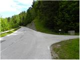 2
2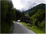 3
3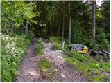 4
4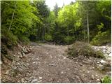 5
5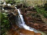 6
6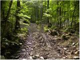 7
7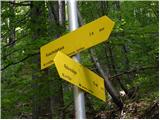 8
8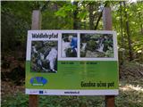 9
9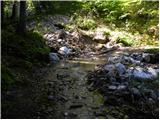 10
10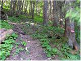 11
11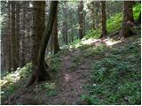 12
12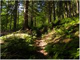 13
13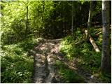 14
14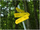 15
15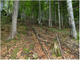 16
16 17
17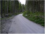 18
18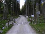 19
19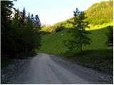 20
20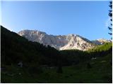 21
21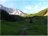 22
22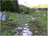 23
23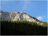 24
24 25
25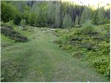 26
26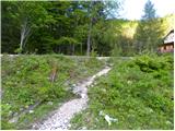 27
27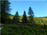 28
28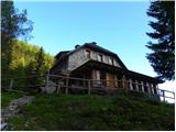 29
29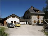 30
30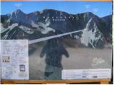 31
31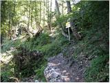 32
32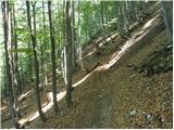 33
33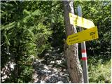 34
34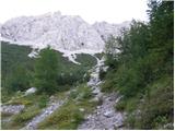 35
35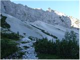 36
36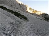 37
37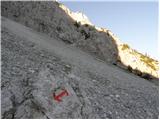 38
38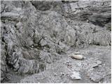 39
39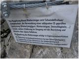 40
40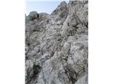 41
41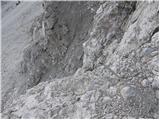 42
42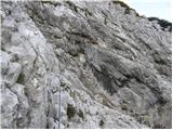 43
43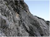 44
44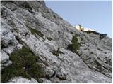 45
45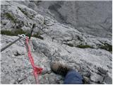 46
46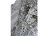 47
47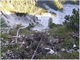 48
48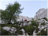 49
49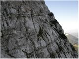 50
50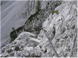 51
51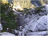 52
52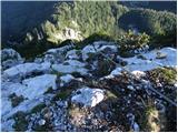 53
53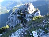 54
54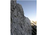 55
55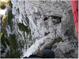 56
56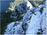 57
57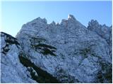 58
58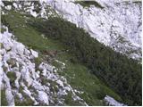 59
59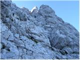 60
60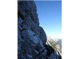 61
61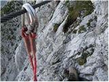 62
62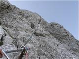 63
63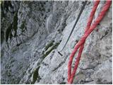 64
64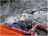 65
65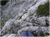 66
66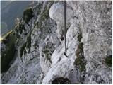 67
67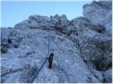 68
68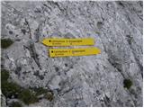 69
69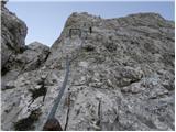 70
70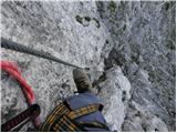 71
71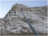 72
72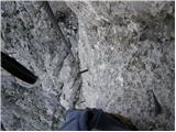 73
73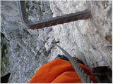 74
74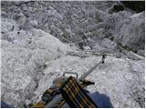 75
75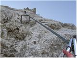 76
76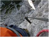 77
77 78
78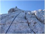 79
79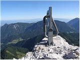 80
80
Discussion about the trail Ridovc / Ridovcsäge - Cjajnik / Lärchenturm (by Mrzli potok and over Cjajnik)