Ruski križ - Koča v Krnici (on forest path)
Starting point: Ruski križ (1000 m)
| Lat/Lon: | 46,4444°N 13,7746°E |
| |
Name of path: on forest path
Time of walking: 45 min
Difficulty: easy marked way
Altitude difference: 113 m
Altitude difference po putu: 165 m
Map: PZS, Kranjska gora z okolico, 1 : 25.000
Recommended equipment (summer):
Recommended equipment (winter):
Views: 20.643
 | 2 people like this post |
Access to the starting point:
Take the Kranjska Gora, where you continue driving to the left in the direction of Vršič or Bovec. Just before the 3rd serpentine of the Ruska or Vršiška cesta, you will notice a small parking lot along the road, where you park. On the opposite side of the road from the parking lot you can see a cross, and a few metres further on the left a forest road branch and mountain signs for the Koča v Cirque. You can also go down the worse macadam road towards Suha Pišnica where there is also a slightly larger parking area. There are also a few car parks a little further along the main road between the 4th serpentine and Mihov's home.
The starting point can also be reached from the coastal side via the Vršič Pass.
Path description:
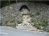
Take the worse macadam road, which immediately starts to descend moderately. After a few minutes of descending through the forest, the path is laid and leads to a parking area near the dry Pišnica riverbed. There is also drinking water at the parking lot. Before the stream, we can decide to cross the new wooden bridge on our left (the old one has been carried away by the rising water), and then, in the next few 10 metres, follow the frequent signs pointing us sharp right, away from the private hut on our left, towards the wide path leading to the mountain pasture in Klin. This option is particularly suitable when there is a lot of water and crossing by footbridge would be difficult. Alternatively, you can choose to continue straight ahead and cross the river via a narrow footbridge laid on the rocks in the riverbed. Just after crossing the stream, the path turns slightly to the left and leads out of the forest onto the vast grassy slopes of the mountain pasture in Klin, where you can see a larger, older hut on the right. As you walk down the path past the hut, you come to a small, beautifully landscaped memorial park dedicated to the fallen mountaineers in the surrounding mountains (Mali Tamar). The path leads past this memorial on the right for a further 10 metres and brings us to a junction with the road leading to Cirque from the bridge over the Velika Pišnica River below the former Hotel Erika. Join this road and follow it to the right, but only for a very short distance. When the path reaches a large dry torrent bed that reaches all the way to the opposite bank of the valley, the road crosses part of the stone deposit. Just after this crossing, look out for a marked trail that branches off the road and heads right into a sparse forest. From here on, the path leads us in an easy ascent through the wods, most of it pleasantly soft, only a little rockier here and there. Just before the finish, we can see on the right the consequences of a large rock fall that occurred in Cirque in the winter of 2007/2008 in the immediate vicinity of the hut. After about 20 minutes of walking along this path, marked with few signs, we emerge from the forest and, just 10 m before the hut, we join the road that leads to the hut on our left at Cirque.

We can extend the trip to the following destinations: Pogačnikov dom na Kriških podih (4 h 25 min),
Gubno (4 h 15 min),
Križ,
Planja (6 h 10 min),
Špik (4 h 15 min),
Stenar (5 h 30 min),
Dolkova špica (5 h),
Razor (6 h 25 min),
Velika Martuljška Ponca (6 h 15 min),
Veliki Oltar (5 h 15 min),
Škrlatica (6 h 45 min)
Pictures:
 1
1 2
2 3
3 4
4 5
5 6
6 7
7 8
8 9
9 10
10 11
11 12
12 13
13 14
14 15
15 16
16 17
17 18
18 19
19 20
20 21
21 22
22
Discussion about the trail Ruski križ - Koča v Krnici (on forest path)
|
| MašaI19. 07. 2016 |
Super za majhne otroke. - Pot je lahka in razgibana. Nasemu 3,5 letniku je bilo zelo vsec.
|
|
|