Senožeti - Sveti Miklavž above Sava (footpath)
Starting point: Senožeti (275 m)
| Lat/Lon: | 46,0905°N 14,7336°E |
| |
Name of path: footpath
Time of walking: 1 h 20 min
Difficulty: easy marked way
Altitude difference: 466 m
Altitude difference po putu: 466 m
Map: Ljubljana - okolica 1:50.000
Recommended equipment (summer):
Recommended equipment (winter):
Views: 23.752
 | 2 people like this post |
Access to the starting point:
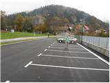
a) From the Ljubljana - Celje motorway, take the Šentjakob exit and follow the road towards Litija. A few kilometres after Dolsko, the road leads to a roundabout, where we head towards the village of Senožete. The road then leads immediately into the village, where you turn right at the junction and drive for about 100 metres to a large parking lot near the school playgrounds.
b) From Litija, drive towards Ljubljana but only as far as the roundabout where signs direct you towards the village of Senožete. The road then leads immediately into the village, where you turn right at the crossroads and drive about 100 m further to a large parking lot near the school playgrounds.
Path description:
From the parking lot, continue along the road, which leads over a small stream to a crossroads where you continue to the left. The road then leads us after a few metres to the next crossroads, where markings direct us to the left of the chapel on the footpath. The path is short, as after a few metres you rejoin the road. Walking along the road continues for only a few minutes, as the signs for Miklavža then direct us to the left, steeply uphill. Next, follow the path as it climbs through the forest and leads us a little higher to a larger clearing beyond which we join the road. The road then leads to a crossroads at Velika vas, where signs direct you to the right. The road then takes us above the village in a few minutes. Here the signs direct us left to cart track, which soon turns into a footpath. Next, follow the path as it climbs crosswise and leads us a little higher to a crossroads, where we continue straight on (left Cicelj). Just a little further on, the path leads us out of the wods and onto vast meadows. The path across the meadow turns slightly left towards the last house in the village, where you can see a registration box.
From the last house, continue up the cart track, which climbs across the meadow and leads us after a few minutes to the Church of St Nicholas, which is situated on a lookout.

Pictures:
 1
1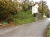 2
2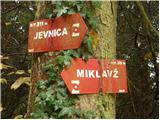 3
3 4
4 5
5 6
6 7
7 8
8 9
9 10
10 11
11 12
12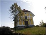 13
13
Discussion about the trail Senožeti - Sveti Miklavž above Sava (footpath)
|
| kroki29. 01. 2008 |
Mimo Vegove domačije lahko naredimo lepo turico.
|
|
|
|
| darh2. 05. 2010 |
Vzpon na Sv. Miklavž smo včeraj vpletli v našo krožno pot čez Sv. Miklavž, Cicelj in Murovico z izhodiščem v Križevski vasi.
|
|
|
|
| janezz29. 11. 2011 |
S ceste nad Senožetmi levo v hrib zavij pred vodnim zajetjem, da se izogneš strmini, na kateri še v suhem vremenu drsi. Ko boš pri zajetju se ozri nazaj in videl boš markacijo.
|
|
|
|
| navrhu14. 09. 2014 |
Bil včeraj. Lahko bi narisali kakšne markacije po gozdu. Sicer pa je slabo stanje z markacijami po večini hribih, katere sem letos prehodil (govorim o hribih, ne o gorah).
|
|
|
|
| alyas21. 04. 2020 |
Zanima me, kdo pod sv. Miklavžem ureja plezališče ?
… če ni skrivnost ali javna tajna, lahko pišete tudi na ZS, alyas.
|
|
|