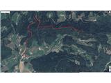
Škalske Cirkovce - Smodivnik
Starting point: Škalske Cirkovce (615 m)
| Lat/Lon: | 46,3955°N 15,1364°E |
| |
Time of walking: 45 min
Difficulty: easy unmarked way
Altitude difference: 308 m
Altitude difference po putu: 320 m
Map: Šaleška dolina z okolico 1:50000
Recommended equipment (summer):
Recommended equipment (winter):
Views: 1.320
 | 2 people like this post |
Access to the starting point:
From the Ljubljana - Maribor motorway, take the Žalec exit and then continue in the direction of Velenje. At the main roundabout (2nd roundabout) in Velenje, under the ski jump, continue straight on (2nd exit) in the direction Šoštanj - Mozirje. Then turn right at the traffic lights. Go straight ahead, over the railway line, uphill to the next roundabout. Take the 3rd exit in the direction of the city stadium. Follow the next roundabout, taking the 1st exit in the direction Škale - Graška gora.
Drive past Lake Škale to the point of Škale. Follow the crossroads and turn right towards Cirkovce. Pass through Hrastovec to Škale Cirkovce. At the Church of St. Ožbolt, turn right and park by the playground.
Path description:
From the parking lot by the playground, continue up the road. Soon you will reach the turn-off for Graška gora. Turn right. Walk along the road until you reach the turn-off for Hudo hole. Turn right again. After 200 m, leave the road and turn right onto the forest road logging trail.
Follow the path. When you pass the chapel, a wide ridge starts, leading to the top.
Pictures:
 1
1 2
2 3
3 4
4 5
5 6
6 7
7 8
8 9
9 10
10 11
11 12
12 13
13 14
14 15
15 16
16 17
17 18
18 19
19 20
20 21
21 22
22
Discussion about the trail Škalske Cirkovce - Smodivnik