Source of Ljubljanica (Močilnik) - Ljubljanski vrh
Starting point: Source of Ljubljanica (Močilnik) (305 m)
| Lat/Lon: | 45,9553°N 14,2929°E |
| |
Time of walking: 2 h
Difficulty: easy unmarked way
Altitude difference: 514 m
Altitude difference po putu: 525 m
Map:
Recommended equipment (summer):
Recommended equipment (winter):
Views: 13.617
 | 2 people like this post |
Access to the starting point:
From the Ljubljana - Koper motorway, take the Vrhnika exit and then continue along the old road towards Logatec. When the road starts to climb and turn slightly to the right, you will notice signs for the Ljubljanica spring, which will direct you left onto the road, which will take you within a few 100 m to the parking lot at the spring of Veliki Močilnik.
Path description:
From Močilnik, continue along the macadam road, which continues along the edge of the forest and a little later along the Little Ljubljanica River. After a few minutes, we reach a small crossroads where signs point us right to the village of Mirke. Continue through the village, turn left at the crossroads and continue along the narrow asphalt road. At the last house, the road ends and we continue along the wide tourist path, which quickly leads us to the bridge over the Ljubljanica River.
After the bridge, signs point us right to the relatively steep cart track, which climbs through the forest. After a short climb, you reach a dirt road, which you follow to the left (unmarked), but only for a few steps, and then signs direct you to the right onto a more overgrown footpath, which quickly leads to an asphalt road, which in turn leads to an underpass under the motorway. Follow the road behind the motorway for another 100 m, then turn right in the direction of Dolgi tali. Continue ascending along cart track, which soon splits into two parts (unmarked). Continue slightly to the right and follow cart track, which leads past the NOB memorial to the road and a few steps further to the underpass under the railway line.
At the junction after the underpass, turn right and follow the road a little further from the sharp left turn. Around the bend, you will soon see signs directing you to the right onto an ascending footpath, which gradually changes to cart track. Continue ascending for some time on the above-mentioned cart track, then turn right onto a dirt road. After a short climb along the road, you will come to a sign (a cross), at which you continue to the right. Just a little further on, we rejoin the road, which immediately leads us to a crossroads, where we leave the marked path. Continue along the upper left road, which you then follow all the way to Ljubljanski vrh, which you reach after about 40 minutes of further walking.

Pictures:
 1
1 2
2 3
3 4
4 5
5 6
6 7
7 8
8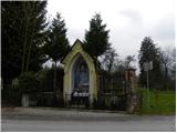 9
9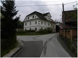 10
10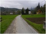 11
11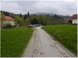 12
12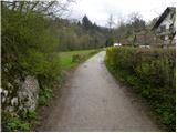 13
13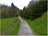 14
14 15
15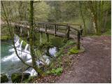 16
16 17
17 18
18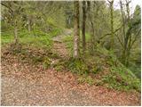 19
19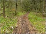 20
20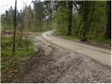 21
21 22
22 23
23 24
24 25
25 26
26 27
27 28
28 29
29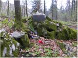 30
30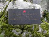 31
31 32
32 33
33 34
34 35
35 36
36 37
37 38
38 39
39 40
40 41
41 42
42 43
43 44
44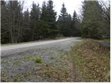 45
45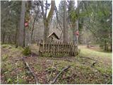 46
46 47
47 48
48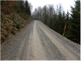 49
49 50
50 51
51 52
52
Discussion about the trail Source of Ljubljanica (Močilnik) - Ljubljanski vrh
|
| navrhu21. 04. 2010 |
Ko boš drugič fotografiral razne partizanske spomenike ipd, naredi vedno še eno fotografijo od blizu, da bomo vsi videli, kaj je pisalo na njej. Isto velja za info planinske table s podatki o času hoje. Pa tudi zanima me, kaj je pisalo na zadnji sliki na tabli (očitno je neko vojaško opozorilo). Nisem bil še nikdar na Ljubljanskem vrhu in ne vem nič o njem, zato bi mi takšni podatki malo pomagali odgnati radovednost in lažje planirati izlet. Ali gostilna na izhodišču v Močilniku dela?
|
|
|
|
| Tadej21. 04. 2010 |
Sem dodal še eno sliko spomenika, kjer se lepo vidi napis. Na tabli, ki se jo vidi na zadnji sliki piše "vojaško območje gibanje omejeno". Gostilna Močilnik je bila v nedeljo 18.4.2010 zaprta.
|
|
|
|
| Mark02. 04. 2022 12:47:38 |
Pozdravljeni! To pot sem prehodil pred dvema tednoma in moram reči, da je prav prijetna in razgibana, primerna je predvsem za tiste, ki se želijo umakniti na samo, kajti pot ni zelo obiskana. Vidi se, da so markacije vse od Močilnika in do zadnjega razpotja na makadamski cesti obnovljene in dobro vidne.
Res je škoda ker pri zadnjem ovinku pred zapornico na vrhu ni nobenega razgleda oz. vsaj neke ploščadi kjer bi se lahko razgledali v dolino. Na nekaterih predelih še ni bilo zaraščeno in se skozi vejevje vidi kako visoko pridemo.
Nazaj grede se lahko naredi krožno turo in sicer nekaj metrov nazaj od zadnjega ovinka (slika 50) nas pozdravi možic in iz ceste stopimo na dobro uhojeno stezo, ki pelje samo naravnost navzdol. Gozd je res čudovit in nedotaknjen. Vmes prečkamo to isto makadamsko cesto, nekaj nižje kmalu prečkamo še en kolovoz in nadaljujemo samo navzdol vse do makadama ki je vzporedno z avtocesto in se usmerimo v desno pod Štampetov most. Pot nas pelje mimo vojašnice na Raskovcu in do naselja. Od Raskovca do Močilnika je 15 - 20 minut hoje po cesti oz. pločniku.
Imam pa vprašanje: Nekaj smernih tabel nižje kažejo na pot Dolgi Tali. Kaj je to? oz. je to nek vrh ali postojanka?
|
|
|
|
| bongo3. 04. 2022 10:32:19 |
To je predel v Colski dolini pod vmesnimi vrhovi, tam je planinska postojanka.
|
|
|