Špitalič pri Slovenskih Konjicah - Babček
Starting point: Špitalič pri Slovenskih Konjicah (376 m)
| Lat/Lon: | 46,3089°N 15,413°E |
| |
Time of walking: 50 min
Difficulty: easy marked way
Altitude difference: 199 m
Altitude difference po putu: 224 m
Map:
Recommended equipment (summer):
Recommended equipment (winter):
Views: 1.827
 | 2 people like this post |
Access to the starting point:
a) From the motorway Maribor - Ljubljana, take the exit Tepanje and follow the road towards Draža vas and Žičy. In Žiča, turn right towards Špitalič and Žička Carthage. Under the viaduct Škedenj, through the village Škedenj, you will soon reach Špitalič, where you will park at the trailhead by the parish church above the church.
b) From Frankolovo via Črešnjice, settlement Sojek, Žička Carthausija to Špitalič
c) From Poljčane via Loč, Žič to Špitalič.
Path description:
The trail starts in the parking lot above the church in the centre of Špitalič. Continue down by the church, the cemetery, which is on the left side of the path, and soon you will reach the construction site of the new mortuary (the path for the description was made on 17. 08. 2014). After the mortuary, turn immediately left and steeply up the grassy path directly next to the woods. Soon the path goes slightly to the left, a short stretch through the forest. As you leave the woods, left up a steep grassy cart track. Through the yard of an abandoned homestead, the path slightly slopes and soon continues through the yard of another inhabited homestead, driveway and reach the crossroads Podgranček.
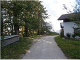
From the crossroads continue left up a few tens of metres along a meadow path, which soon turns into a typical forest mountain path. Follow the trail higher and, if well marked, reach the asphalt road and the Jankar crossroads. Continue sharp left on the asphalt surface. Soon the old construction of a typical farmhouse from decades ago will be on the left side of the path. Follow the asphalt road higher, soon followed by a short descent and the path from St. Ursula (Dramlje) is joined on the right by the crossroads Babček at 553 metres. Continue higher, on the right side of the path, actually the road, there is a small hut. From here you can already see the destination, descend a few metres, to the left of the path is another farmhouse and to the right of the road you reach the summit of Babček at 575 metres. An inconspicuous peak, including a water feature practically at the top and some views, especially to the north and east, reward the route.
The route is about 1700 metres long, 224 positive vertical metres and 27 negative vertical metres.

Pictures:
 1
1 2
2 3
3 4
4 5
5 6
6 7
7 8
8 9
9 10
10 11
11 12
12 13
13 14
14 15
15 16
16 17
17 18
18 19
19 20
20 21
21 22
22 23
23 24
24 25
25 26
26 27
27 28
28
Discussion about the trail Špitalič pri Slovenskih Konjicah - Babček