Starting point: Stahovica (443 m)
| Lat/Lon: | 46,2668°N 14,6036°E |
| |
Time of walking: 2 h
Difficulty: partly demanding marked way
Altitude difference: 816 m
Altitude difference po putu: 816 m
Map: Kamniške in Savinjske Alpe 1:50.000
Recommended equipment (summer):
Recommended equipment (winter): ice axe, crampons
Views: 34.435
 | 3 people like this post |
Access to the starting point:
In Kamnik, continue towards Kamniška Bistrica. After the village Godič you will arrive in Stahovica, where you park. You can also take a bus from Ljubljana or Kamnik.
Path description:
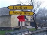
In Stahovica, cross the bridge, which is about 50 metres before the crossroads and the bus station, on the asphalt road in the direction of Županja Njiva. You will reach a signpost where a red mountain sign already directs you to Kamniški vrh and Bistričica. Follow the signs which lead you through the villages, then along cart track and again along the asphalt road. Look out for the ventilation lines on the barns and outbuildings. Soon you will come to a signpost which directs you off the road onto a footpath up a steep incline. When it ends, continue along the grassy valley and cart track leads to the village of Slevo. Through the village, and past the memorial to the fallen partisans in the battle with the national traitors, we continue to the pasture glade. Here the path forks. The left one leads to Kamniški vrh or Krvavec via mountain pasture Osredek and is about half an hour longer. Take the right-hand path, which is initially level, but then begins a steep incline. You reach a saddle between Planjava and Kamniški vrh. Follow the wide ridge on the right to the top. On the way back, instead of going down the slope, you can also return to Stahovica via the mountain pasture Osredek.
At the saddle between Planjava and Kamniški vrh, head straight along the ridge and follow the waymarked path. At Osredke, note that you are following a path that leads downhill - it is marked, but not marked with a sign!

Pictures:
 1
1 2
2 3
3 4
4 5
5 6
6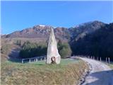 7
7 8
8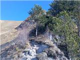 9
9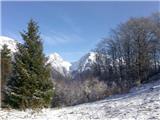 10
10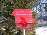 11
11 12
12 13
13 14
14 15
15 16
16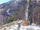 17
17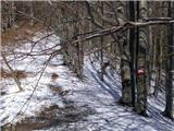 18
18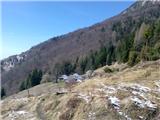 19
19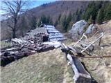 20
20 21
21 22
22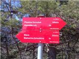 23
23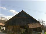 24
24 25
25
Discussion about the trail Stahovica - Kamniški vrh
|
| Kriška5. 04. 2010 |
Naj mi prosim avtor opisa ne zameri, ampak za tole pot bi potrebovala nekaj dodatnih podatkov:
- kje v Stahovici naj bi parkirali in v katero smer s parkirišča naj bi krenili?
- Koliko je tele hoje po asfaltni cesti skozi vasi (katere?)?
- Kraja Stahovica ne poznam, ali je v njem eno samo križišče in most?
- Zakaj naj bi bili pozorni na prezračevalne line na kozolcih?
|
|
|
|
| ziga.subic5. 04. 2010 |
- Iz Kamnika se po glavni cesti peljete proti Kamniški Bistrici. Ko se konča vas Godic se prične vas Stahovica. Neposredno za prometno tablo »Stahovica« na levi strani je parkirišče (pred trgovino in gostilno). Takoj zraven tega parkirišča je odcep za smer Županje Njive (parkirišče je na robu križišča). - Hoje po asfaltni cesti (malo je tudi makadamske) je 25 minut, gre se čez Županje Njive, in Bistričico, vendar ne skozi celo vas, ampak večkrat po delih vasi. - To križišče je prvo. Orientirajte se po gostilni in trgovini, takoj za tablo Stahovica. Verjetno je še kakšen most. - Line na kozolcih niso pomembne za orientacijo, omenil sem jih, ker so se mi zdele zanimive zaradi različnih oblik, v katerih se pojavljajo 
|
|
|
|
| Kriška6. 04. 2010 |
Najlepša hvala, tale izlet bo v kratkem na vrsti  .
|
|
|
|
| ziga.subic6. 04. 2010 |
Ni za kaj. Upam, da boste imeli prijeten izlet 
|
|
|
|
| pohodnik2426. 10. 2010 |
Ali kdo pozna sedanje razmere glede poti na Kamniški Vrh, ker gre pot skozi Županje njive naprej po prisojni strani verjetno še ni snega ?
|
|
|
|
| tol26. 10. 2010 |
Pogled iz Kamnika razkriva:
snega ni.
|
|
|
|
| bostjanp15. 01. 2012 |
Danes bil prelep dan za dober izlet, krožno pot, na Kamniški vrh iz Strahovice. Bilo je kar nekaj pristopnikov z več izhodišč, nekaj hitre debate in tudi dober nasvet za pot za povratek do izhodišča. Da bi bilo letos še več takih dni kot danes.
|
|
|