Studeno - Gora (Sveti Lovrenc)
Starting point: Studeno (600 m)
| Lat/Lon: | 45,8267°N 14,174°E |
| |
Time of walking: 1 h 5 min
Difficulty: easy marked way
Altitude difference: 419 m
Altitude difference po putu: 419 m
Map: Snežnik 1:50.000
Recommended equipment (summer):
Recommended equipment (winter):
Views: 29.604
 | 3 people like this post |
Access to the starting point:
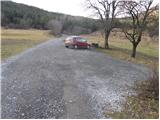
From the motorway Ljubljana - Koper take the Postojna exit. Continue towards Postojna and the road will lead you to a crossroads where you turn right towards Ljubljana (old road). Near the church in Postojna turn left towards the village of Studeno. Follow this road to the village in the middle of which you will see an older sign for Lovrenec. Here turn left onto a narrower road which climbs between houses. Follow this road for a few 100m to the parking lot at the start of the footpath to Lovrenec.
Path description:
A few metres away from the parking lot, we see a mountain sign for Sveti Lovrenec, which directs us across the meadow, initially slightly upwards. Soon, however, the path enters a pine forest, where it gradually climbs steeper and steeper. A little higher up, the forest becomes thinner and thinner and the views from the path become more and more beautiful. To the west we see the slope of Nanos, and behind us we can see the Postojna basin and the Javorniki Mountains. The path, which runs straight up the slope, leads us between pastures so that orientation is not a problem, despite the lack of markings. This beautiful scenic route quickly leads us to the Church of St. Lawrence, where the path turns left into the forest. There follows a five-minute climb through the forest to the top, where the view opens up again.
Pictures:
 1
1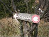 2
2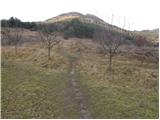 3
3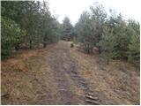 4
4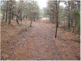 5
5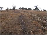 6
6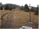 7
7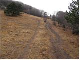 8
8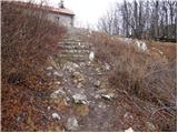 9
9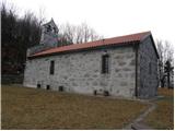 10
10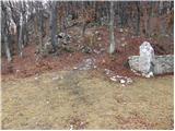 11
11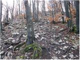 12
12 13
13
Discussion about the trail Studeno - Gora (Sveti Lovrenc)
|
| m30. 12. 2009 |
Pozdravljeni! Sv. Lovrenc je danes zakrivala megla, kljub temu, da je izven borovcev kar malo pihalo. Padal je tudi dez oz. bolj je rosilo, tako, da blato ni prehudo. Je lep vzpon, za si malo pretegnit noge.  Lepsi je sicer v prvi polovici junija, ko cveti kranjska lilija ali zlato jabolko, lepki lan,... in je res ves v pisanem cvetju. Zna bit' pa takrat precej vroce in ker je pot strma in soncna, je temu primerno tudi zejna.  Priporocam. 
|
|
|
|
| naokoli27. 07. 2011 |
Najlepši je v snegu, še posebej s smučmi ali desko.
|
|
|
|
| ulmusglabra21. 12. 2011 |
Kratek, a strm vzpon iz Studenga; sam grem pogostokrat najprej iz Planinske gore na Lipovec in potem kar direktiva na Sv. Lovrenc. LP 
|
|
|
|
| bizgo933. 03. 2021 |
O ti Lovrenc ti.  Sem slišal že veliko o njem in sem se danes odločil povzpeti gor. Zadnje čase hodim v hribe praktično vsak dan pa me je Lovrenc kar pošteno namučil. Začetek poti se zložno vzpenja in po nekaj 100 metrih preide v zelo strm klanec, ki se do vrha drastično ne zravna. Pot do vrha je dolga le dobrega 1,5 km, kar nam da povprečen naklon 28%, na nekaterih delih bi rekel tudi čez 40%. V glavnem kar naporno za noge, je pa iz vrha nad cerkvijo prekrasen razgled na celotno Pivško kotlino, Snežnik, Slivnico, Nanos, Javornike in za gozdom tudi na Julijce z izstopajočim Triglavom ter Kamniške alpe. Tako da se splača vzpeti gor, sploh na tako lep dan kot je današnji.
|
|
|
|
| korab11. 03. 2023 14:37:52 |
 To je hrib, za preverjanje kondicije. Ne vem če je samo 28 procenten naklon. 1,9 km in 1 ura do vrha. Vendar je vse poplačano že med hojo z lepimi razgledi. Bilo je sončno in jasno, tako da so se videli vrhovi zelo daleč. Pridemo preverit jesensko kondicijo 
|
|
|
|
| Acibujl27. 03. 2025 18:33:02 |
27.3.2025
Iz sedla nad Lohačo čez Lipovec in Špilnik na Goro/Sv. Lovrenc. Krasna turca, čeprav je orng pihalo. Spotoma nabrala čemaž, tam ima obsežna rastišča. Razgled proti poplavljenemu Planinskemu polju. Manj obiskani vrhovi so to...
|
|
|