Sveti Trije kralji - Posestvo Šumik
Starting point: Sveti Trije kralji (1181 m)
| Lat/Lon: | 46,43788°N 15,46004°E |
| |
Time of walking: 2 h
Difficulty: easy marked way
Altitude difference: -81 m
Altitude difference po putu: 175 m
Map: Pohorje 1:50.000
Recommended equipment (summer):
Recommended equipment (winter): ice axe, crampons
Views: 368
 | 1 person likes this post |
Access to the starting point:
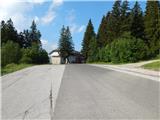
Drive to the centre of Slovenska Bistrica, where you turn off at the traffic lights in the direction of the health centre and continue along Partizanska cesta. Then drive through the town, continuing straight on, on the outskirts of the town, and at the industrial zone turn onto the road towards Tinje, Sveti Trem kralji and Black Lake. The asphalt road is slightly narrower and starts to climb, initially leading past the Hunting Hut of the pizzeria Gams, then higher up through the village of Visole, and a few kilometres higher up we arrive at Zgornje Tinje, from where we follow the signs for the ski resort of Jakec - Trije kralji (Three Kingdoms). Park in the parking lot at the foot of the ski slope, or near the Church of St. Three Kings.
Path description:
From the starting point, walk to the Church of St. Three Kings and continue in the direction of the Black Lake and Urška's path, quickly arriving at the nearby ski slope, which you continue along for a short time and then cross (during the ski slope's operation, the ski slope and the ski lift are crossed higher up - above the ski lift and the ski slope). The way forward takes us past the ARSO weather station, and we continue to follow the markings, and after a few minutes on the connecting ski slope we arrive at another ski slope, which we also cross (up Veliki vrh, next to the ski slope). Then we cross the ski lift and another ski slope, and then the trail comes into the forest, where after a few minutes of further walking we arrive at a cross, next to which stands the Urška Trail teaching board. The path continues slowly descending and leads us to a marked crossroads where we continue straight in the direction of the Šumik waterfall and Ruš (on the left, Črno jezero and Osankarica).
Continue along the gently sloping path through the forest, which leads us across the Sand Flat, and behind the unmarked peak of Trije studenci the path gradually begins to descend. A little lower down, the forest thins out and the path, which gradually stops descending, has several crossroads where you can follow the markings. After a short slight ascent, we start descending again and lower down we reach a macadam road leading from Areh towards Osankarici, but we just cross it and continue descending to the next road, which we follow to the left (right Ruška koča na Arehu), and quickly reach the starting point Bajgot na Šumiku, where one of the paths to Rušy (Holcarska po dol Valley Trail Lobnica) branches off to the right.
From here, continue along the road for a few steps, then turn right onto the marked path towards Pesek and Klopni vrh, which leads over a small bridge over the Lobnice River. A short climb follows and we return to the macadam road, where the road continues on a slightly shorter but unmarked path towards the Šumik estate, while we continue across the road and continue our climb on the marked path. A little further on, we leave the forest and then climb up a slightly overgrown slope to a macadam road where there is a marked crossroads.
Continue to the right in the direction of the Forestry Home at Šumik (left Pohorje Battalion camp, Tiho jezero and Koča na Pesku, straight up Koča na Klopnem vrhu and Koča na Pesku) and follow the dirt road. At a nearby crossroads, go straight ahead (sharp left Koča na Klopnem vrhu), and continue on the road for a short distance, as the signs for the cottage direct us right downhill (straight along the Ruše road). After a short descent, return to the road, and you will see Koča na Šumiku in front of you, which is still a one-minute walk away.
The description refers to the situation in June 2022 and the images are from May 2022 and June 2022.

Pictures:
 1
1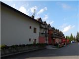 2
2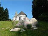 3
3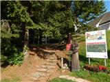 4
4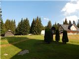 5
5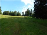 6
6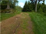 7
7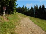 8
8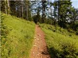 9
9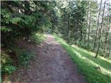 10
10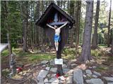 11
11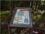 12
12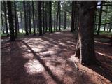 13
13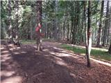 14
14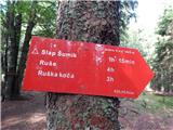 15
15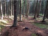 16
16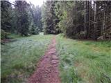 17
17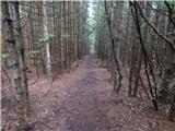 18
18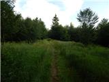 19
19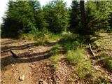 20
20 21
21 22
22 23
23 24
24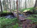 25
25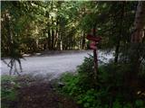 26
26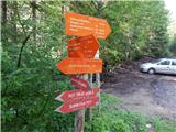 27
27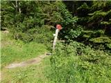 28
28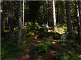 29
29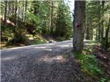 30
30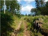 31
31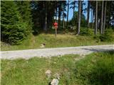 32
32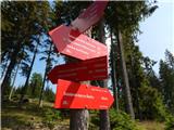 33
33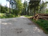 34
34 35
35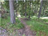 36
36 37
37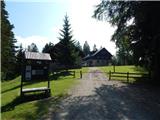 38
38
Discussion about the trail Sveti Trije kralji - Posestvo Šumik