The Krma Valley - Vodnikov dom
Starting point: The Krma Valley (944 m)
| Lat/Lon: | 46,3851°N 13,9071°E |
| |
Time of walking: 3 h 30 min
Difficulty: easy marked way
Altitude difference: 873 m
Altitude difference po putu: 1050 m
Map: Triglav 1:25.000
Recommended equipment (summer): helmet
Recommended equipment (winter): helmet, ice axe, crampons
Views: 29.373
 | 2 people like this post |
Access to the starting point:
Leave the Gorenjska motorway at the Hrušica exit and follow the road towards Kranjska Gora. Just before the village of Dovje, the road branches off to the left and leads to Mojstrana (Vrata, Kot and Krma). Follow the road in the direction of the village of Radovna and the valleys of Krma and Kot. The relatively steep road then takes us past the TNP signboard, after which the road soon lays down and leads us to a crossroads where the macadam road to the valley of Kot branches off to the right. Continue straight ahead on the road, which begins to descend. In the middle of the descent, the road to the Krma valley branches off to the right (straight ahead Radovna). A little further on, you come to the next crossroads, where you continue to the right in the direction of Krma. The macadam road then leads to Kovinarska hut, and we follow it further. Occasionally, a slightly worse road then leads us to the parking area in front of the barrier.
Path description:
From the parking lot, continue along the road past the gate to the extensive gravel deposits. A few minutes of easy walking on the gravel follows to a marked but sometimes harder to see crossroads. The footpath continues straight ahead, but signs point us right across the stream into the woods, where the path begins to climb gently. Only after about 40 minutes of walking does the path become steeper, but not too steep. At 1300m, the moderately steep path leads us out of the forest between dwarf pines. Here we start to get beautiful views of the nearby walls of the peaks above the Krma. The climb does not take long, however, as the path soon drops by a few metres and leads us to the beautiful mountain Vrtača. The walk across the beautiful grassy plain is very pleasant and scenic. On the other side, the path starts climbing again, this time through a rare forest. This climb does not last long either, and is interrupted by the Malo polje plain, where the trail crosses.
Continue left towards Vodnikov dom (Planika and Kredarica on the right) along the path, which quickly begins to climb, first through a larch forest and then up through scree. The scree path becomes steeper and steeper and is dangerous to slip on in the snow that stays here until mid-summer. The narrowness of the last part of the route to Bohinjska vratca also increases the risk of falling rocks.
From Bohinjska vratca it is only about 15 minutes of descent to Vodnik's house.

We can extend the trip to the following destinations: Cesar,
Koča na Doliču (2 h),
Vernar,
Dom Valentina Staniča pod Triglavom,
Vrh Snežne konte,
Šmarjetna glava (2 h 40 min),
Dom Planika pod Triglavom,
Visoka Vrbanova špica,
Begunjski vrh,
Triglavski dom na Kredarici,
Rjavina,
Triglav
Pictures:
 1
1 2
2 3
3 4
4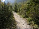 5
5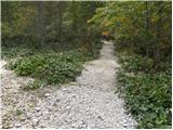 6
6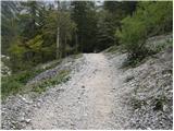 7
7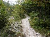 8
8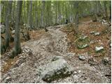 9
9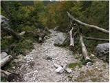 10
10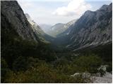 11
11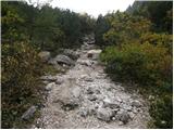 12
12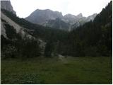 13
13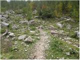 14
14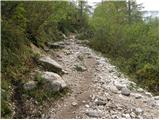 15
15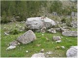 16
16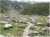 17
17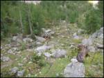 18
18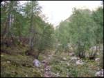 19
19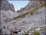 20
20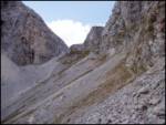 21
21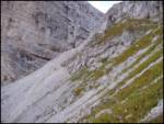 22
22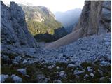 23
23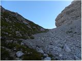 24
24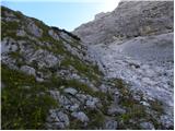 25
25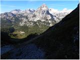 26
26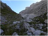 27
27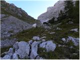 28
28 29
29
Discussion about the trail The Krma Valley - Vodnikov dom
|
| HOPLA6914. 08. 2009 |
Pot Krma-Vodnikov dom prehodil pred dnevi je solidno označena in brez posebnosti.
|
|
|
|
| Aleksander55513. 07. 2023 19:46:15 |
V torek 11.7.23 sva imela namen priti do Vodnikovega doma in to iz doline Krma. Do doma nisva uspela priti, ker ni oznake za odcep proti domu in sva potem preprosto nadaljevala proti Zgornji krmi. Ali kdo pozna razmere ali pa problem s to potjo ? LP
|
|
|
|
| rensul13. 07. 2023 22:00:44 |
Aleksander555-Odcep je na Malem Polju, na višini 1550m. Ob poti proti Zgornji Krmi je na velikem kamnu markacija s puščicama v levo in desno. Če pogledaš kake 30 m direktno čez ta kamen boš opazil skalo s pokončno razpoko, v kateri je železna štanga(drog). Levo mimo te skale boš opazil slabo vidno pot.Pošiljam ti še povezavo in sliko z markacijo. https://www.strava.com/activities/7297861211
|
|
|
|
| turbo14. 07. 2023 18:42:14 |
Konec julija 2021, dve leti tega torej, sem tudi sam komaj našel odcep proti Vodniku. Če ne bi tod že hodil in bil kar domač, bi šel naprej, torej narobe. Po turi sem poslal opozorilo na PZS, komisiji za pota, s podrobnim opisom težave. Nobenega odgovora, lani je bilo stanje enako, vidim, da tudi letos ni dosti drugače 
|
|
|
|
| cofka14. 07. 2023 18:51:55 |
Očitno je PZS postala nekaj drugega kot to, kar kratice pomenijo.
|
|
|
|
| turbo14. 07. 2023 19:33:00 |
|
|
|
|
| di8. 09. 2024 09:54:12 |
Še vedno (žal):
Oznake za razcep (slika 16) ni več najti.
Tudi neka pot (kje naj bi vodila) ni vidna (je nekako tako kot na sliki 18).
|
|
|
|
| turbo8. 09. 2024 10:07:49 |
SRAMOTA od PZS, marš v tri ne bom rekel kaj, štiri leta (2021, 2022, 2023, 2024) in nula koma nula od vas. Se mi je kar zdelo, da bo tako, saj od vas nisem dobil nobenega odgovora na mojo pošto, sedaj pa v zadnjih dveh letih že nekajkrat berem, da razpotje še vedno ni označeno. Gre za zelo obljudeno dolino Krmo in precej obiskano kočo Vodnikov dom, ne bi rekel, če bi šlo za odsek poti nekje nad Bavšico ali kaj podobnega, za tiste konce morebiti sploh ne veste, da obstajajo 
|
|
|
|
| serajko8. 09. 2024 13:08:13 |
Turbo, lahko , da bo pot opuščena zaradi manjših stroškov. Treba bi bilo poiskati vzdrževalca in ga povprašati po "zdravju". Zdi se mi , da pot ni posebno obljudena, saj se v naravi ne vidijo več sledi uporabe. Če ne bo več markirana bo brezpotje!
|
|
|
|
| turbo8. 09. 2024 13:20:39 |
Na strani PZS, v rubriki "Planinske poti" je pot Zgornja Krma-Bohinjska vratca vnešena, označena in ocenjena kot lahka. Primerna za družinski izlet, recimo. No, bi bila primerna, če bi bila razpotja ino poti korektno označene  https://mapzs.pzs.si/path/31602 https://mapzs.pzs.si/path/31602
|
|
|
|
| bbugari18. 09. 2024 13:42:45 |
Žal pa je to resnica tudi za nekatere odseke SPP-ja, kot Tolstovršnik-Savinja, Dobrča-Prevala, Rožca-Hruški vrh-Dovška Rožca, izvir Soče-Na Logu, itd.  
|
|
|