Tolminske Ravne - Tolminski Migovec
Starting point: Tolminske Ravne (924 m)
Time of walking: 2 h 45 min
Difficulty: easy marked way
Altitude difference: 944 m
Altitude difference po putu: 944 m
Map: Julijske Alpe - zahodni del 1:50.000
Recommended equipment (summer):
Recommended equipment (winter): ice axe, crampons
Views: 29.065
 | 1 person likes this post |
Access to the starting point:
From Tolmin, it's a 12-kilometre drive to Tolminske Raven. From the centre of Tolmin, we head towards Žabče. In this village, turn right between the houses and continue above the village towards Tolminske Ravenna. After some time, descend into the valley, where you cross a bridge and continue uphill towards Ravne. When you reach the village, turn right into a small parking area.
The road is fully asphalted, but narrow and with sharp bends in places.
Path description:
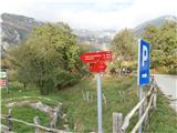
From the parking lot a path leads to a meadow, past a sign for TNP. At the end of the meadow is a pasture gate, beyond which a signpost leads the way left up the hill to Mountain pasture Kal and Migovec. From here the easy, poorly marked path continues, but is well marked at crossroads.
You reach a fork for Mountain pasture Razor and Mountain pasture Kal (also Krn). Turn left again and continue on more or less flat terrain until you reach a signpost leading you along a steeper forest path, this time well marked.
When you reach a clearing, you come to a crossroads where you continue right uphill. This junction should be well remembered, as it is less well marked for backwards shafts. After a few minutes we can see mountain pasture Kal and Migovec above it.
Behind Mountain pasture Kal there is a signpost pointing to Krn, follow it, then a few metres above the huts it splits to the left to Krn and to the right to Migovec.
The path leads us first through dwarf pines, then over a rocky path, sometimes there is also a small scree slope. From the path we have a beautiful view of the Krn mountain range and the Tolminka valley. Following the rocky path through serpentines, you will reach a saddle where you can already see the summit. Here the path leads right up to the summit and left down to the Tolminski Kuk.
Continue right towards the summit, watching out for the scrambles you have to cross. The path from the saddle is fairly flat, as the summit is kopje. Follow the beaten track to the top.
The summit is marked with a small signpost, and there is also a register, a stamp and a seal.
If you are fit enough, you can also visit Grušnica (1570 m), which is reached by an easy, unmarked path, using the Mountain pasture Kal. The altitude difference with Mountain pasture Kal is only 80 m.
From the saddle, a 1,5 km long path leads to the right, along a ridge to the north, to Tolminski Kuk. The path is easy, marked with a large cairns. The difference in altitude from the saddle is approximately 250 m.

Pictures:
 1
1 2
2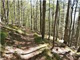 3
3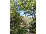 4
4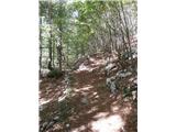 5
5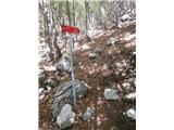 6
6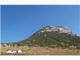 7
7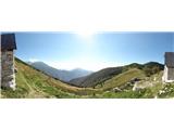 8
8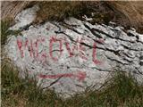 9
9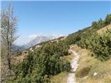 10
10 11
11 12
12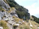 13
13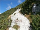 14
14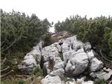 15
15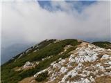 16
16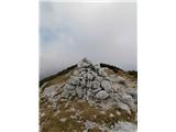 17
17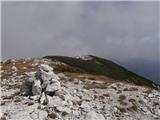 18
18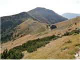 19
19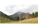 20
20
Discussion about the trail Tolminske Ravne - Tolminski Migovec
|
| d1licen4. 05. 2014 |
Danes sem poskušal z usponom na Tolminski Migovec a ni šlo do vrha .Zakomplicira se nad Planino Kal ,na sredini poti do vrha,Obstajajo kar velika snežišča kjer brez derez in cepina ne gre (ledeno še ob 9 uri)
|
|
|
|
| cut4ever4. 07. 2015 |
Pot je lahka in lepo označena, je lahka označena pot, ne brezpotje.
Sistem ne dopušča popravkov, ko enkrat shraniš vnos. Sem pisal skrbnikom spletne strani, a v dveh letih niso še uspeli spremeniti.
|
|
|
|
| cut4ever4. 07. 2015 |
Pot je lahka in lepo označena, je lahka označena pot, ne brezpotje.
Sistem ne dopušča popravkov, ko enkrat shraniš vnos. Sem pisal skrbnikom spletne strani, a v dveh letih niso še uspeli spremeniti.
|
|
|
|
| piamhrob26. 06. 2019 |
Lahka in lepo označena pot, nekatere oznake so rahlo zbledele, slediti je potrebno tablam in smerokazom.
Pot z oznako 'Kravja pot' ob vznožju (v gozdu), je strmejša in pelje do križišča kjer nadaljujemo desno in ponovno pridemo na glavno pot.
|
|
|
|
| darinka430. 01. 2020 |
Bili včeraj po tem, ko je na novo zasnežilo. Razgledi prekrasni, ker je bilo vse okrašeno. Sploh ruševje , ki ga je vso pot veliko. Glede orientacije nismo imeli težav, kljub temu da pot ni bila vidna. Od odcepa dalje pa je bilo proti vrhu kar nekaj napihanega snega in smo na nekaterih mestih pristali do pasu v snegu. Sedaj je pot zhgažena. Kdor bo šel za nami bo imel veliko lažjo pot.
|
|
|
|
| darinka45. 02. 2020 |
Koliko hoje je iz vasi Čadrg do planine Kal?Je daljša kot iz Tolminskih Raven?
|
|
|
|
| miri5. 02. 2020 |
Zakaj pa ne iz Korit? Krasna po grebenu.
|
|
|
|
| julika5. 02. 2020 |
S Čadrga je dobri 2 uri hoje.
|
|
|