Starting point: Trojane (561 m)
| Lat/Lon: | 46,1879°N 14,8828°E |
| |
Time of walking: 2 h 30 min
Difficulty: easy marked way
Altitude difference: 395 m
Altitude difference po putu: 500 m
Map: Posavsko hribovje - zahodni del 1:50.000
Recommended equipment (summer):
Recommended equipment (winter):
Views: 11.445
 | 3 people like this post |
Access to the starting point:
From the motorway Ljubljana - Maribor, take the exit Trojane, then continue along the parallel old road towards Trojane and Domžale. Our starting point is located in the immediate vicinity of the Trojane Restaurant Company. We park somewhere nearby, as parking in front of the catering company is only allowed for guests.
Path description:
From the parking lot of the Trojane Restaurant, walk to the bus stop and then carefully cross the main road. On the other side of the road, climb the steep steps and continue left above them. After a few steps, you will reach a marked path, and we follow it to the right between the houses to the nearby registration box.
From the registration box, the path, which follows a rough road, begins to descend towards the valley of the Bolska stream. When you reach the valley, take the wider dirt road and follow it to the left. Continue up the valley for some time and then the road will recede slightly to the left. Continue ascending cross-country to the right, crossing a large number of small streams and wells, which tend to dry up on dry days. Higher up, you reach a marked crossroads, where you continue along a wider macadam road on the left, along which there are also signs for the "Lipovc pasture". From the crossroads onwards, the road climbs for a short time, then gradually begins to descend and leads to the next crossroads.
Continue straight on in the direction of the Rokovnjaška cesta (right pasture Lipovec) and continue along the macadam road. At the next crossroads, turn slightly left in the direction of Špilk and Kekec and continue along the road with some short ups and downs for some time. After a good 2 hours of walking on the wider macadam road, the signs for Špilk direct us left onto a slightly narrower and noticeably steeper road, which we follow for only a few more minutes. After a few minutes, before we leave the forest, the signs for Špilk will direct us left onto a relatively steep footpath. The path continues to climb through the forest, but through the forest fringe, so that with just a few steps to the right you can reach a hay meadow. Only a little higher up, the path crosses the less favourable cart track and leads us to the main ridge of Špilka. Here the path turns to the left and after two minutes of further walking leads us to the summit, in the middle of which stands a small bivouac.

Pictures:
 1
1 2
2 3
3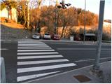 4
4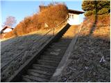 5
5 6
6 7
7 8
8 9
9 10
10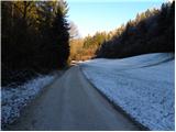 11
11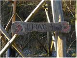 12
12 13
13 14
14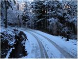 15
15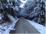 16
16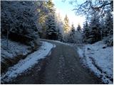 17
17 18
18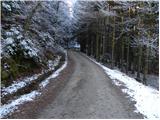 19
19 20
20 21
21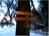 22
22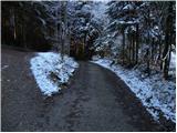 23
23 24
24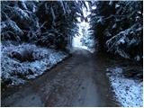 25
25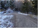 26
26 27
27 28
28 29
29 30
30 31
31 32
32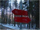 33
33 34
34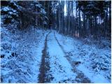 35
35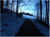 36
36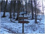 37
37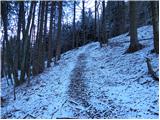 38
38 39
39 40
40 41
41 42
42 43
43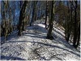 44
44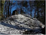 45
45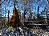 46
46
Discussion about the trail Trojane - Špilk
|
| starakapa23. 12. 2011 |
Včeraj 22.decembra sem šel iz Trojan na Špilk.Pot je v glavnem malo zasnežena vendar ne rabiš derez.Na dveh ali treh mestih,tam kjer voda teče preko ceste,je zaledenelo,vendar se da umakniti.Bil sem tudi na pašniku Lipovec.Zelo zanimivo je še zlasti njihove TROFEJE da o WC-ju sploh ne govorim.Prisrčno ni kaj!!!.Bivak na Špilku je lepo vzdrževan in čist.Torej ,sama pot je lepa in predvsem samotna ter z zelo malo sonca.Poleti jo priporočam mladim družinam in samote željnim planincem.
|
|
|
|
| baro2. 04. 2013 |
Zelo lepa tura. Primerna bi bila tudi za tekače, ki ljubijo tek v naravi, oziroma gozdu, saj je praktično 90 % poti po gozdni cesti, vzpon je pa tudi zelo blag. Lepo markirana in vzdrževana, tudi bivak je lep.
|
|
|
|
| herman83. 04. 2013 |
Zelo lepo ste se imeli, tudi jaz sem to pot že večkrat prehodil. Po opisu poti in fotkah je razvidno, da ste vso pot opravili po cesti. Še bolje bi bilo, da bi takoj za Lipovcem zavili levo mimo rampe. Pot je markirana in ves čas se hodi po gozdu. Probajte naslednjič. LP
|
|
|
|
| bruny4. 04. 2013 |
Pot po gozdu je res markirana vendar so markacije v slabem stanju. Nekoliko nad potjo je tudi 913 metrov visok vrh Reznarca. Takole po videnem bi ocenil, da je trasa po gozdu !? opuščena-(morda ve kdo kaj več) in bila načrtno speljana na gozdno cesto. Tudi Geopedia je ne ,,prepozna,,. Ob poti v gozdu je praktično edina točka - lesen križ za obnovo katerga so sodeč po zapisu poskrbeli lovci. Je pa pot v gozdu lepa, tudi bolj sončna in vzpon na sam vrh Špilk je iz vzhodne strani.Lp
|
|
|
|
| herman810. 04. 2013 |
Trasa seveda ni opuščena je pa res, da je slabo markirana od začetka. Malo pohodnikov ve za to pot. Jaz grem vsako leto vsaj 10x po tej poti na Špilk. Ponavadi se potem oglasim še na Kekca, tam je oskrbnik star partizan Matevž, ki ima zelo rad, da ga kdo obišče.
|
|
|
|
| ejti10. 04. 2013 |
Matevž jih ima že 85, pa še vedno sam vse porihta, tudi pripelje se sam iz Kamnika. Odprto ima čez vikend. Prav rad pove kakšno medvojno zgodbo - nekatere so naravnost filmske, ampak resnične.
Res je faca!
|
|
|
|
| bruny1. 05. 2019 |
Danes iz Trojan po opisani poti...Za ljubitelje gozdnih cest in senčnih terenov  vsekakor ta pravo...
|
|
|
|
| bruny31. 07. 2020 |
Zjutraj danes v petek na zadnji dan julija iz Trojan na Špilk. Po nevihtah v preteklih dneh še kar nekaj svežine v gozdovih Špilka...
|
|
|
|
| bruny21. 07. 2022 15:17:42 |
Po opisani poti danes...Do slike/fotke št. 37 in nazaj.  Super je bilo...
|
|
|
|
| bruny29. 07. 2022 16:20:35 |
Danes po opisani poti...Obrat in nazaj na Trojane ,,nekje,, med fotkama 32/33...
|
|
|