Starting point: Vitovlje (400 m)
| Lat/Lon: | 45,9411°N 13,7613°E |
| |
Time of walking: 3 h
Difficulty: easy marked way
Altitude difference: 837 m
Altitude difference po putu: 900 m
Map: Goriška 1:50.000
Recommended equipment (summer): helmet
Recommended equipment (winter): helmet, ice axe, crampons
Views: 19.581
 | 2 people like this post |
Access to the starting point:
From the expressway Vipava - Nova Gorica take the exit Selo and follow the road towards the villages Črniče and Šempas. When you reach the village Vitovlje, pay attention, because in the middle of the village you will leave the main road and continue driving in the direction of the farm Maloščevo (the exit is marked). Continue through the village on a narrow and steep road, which leads you higher up to a signboard saying "Vitovska Circular Route". Continue left past the last houses on the increasingly steep road, which turns into a macadam road only slightly higher up, and then park alongside it (the most suitable parking place is between the fourth and fifth stations of the Way of the Cross).
Path description:
From the starting point, called Križišče, we continue along the deteriorating macadam road, which after a few minutes of walking leads us to a well-marked crossroads, where a marked trail branches off to the left towards Trpinovišče, the memorial plaque and Vodice. Continue on the right path, which leads past the stations of the cross to the next well-marked crossroads near the top of Vitovski hrib. Continue right again and follow the deteriorating road, which here finally turns into cart track, to the viewpoint on which the church stands.
From the top, descend back to the crossroads, then continue the ascent towards Čavna and Sekulak along the old Napoleon route. Soon we reach the next crossroads, where the path to Skozno branches off to the left, and we continue to the right towards Čavno. Continuing on the Napoleon route, we soon reach the steep rocky cliffs of the High Wall. The wide path leads us over an artificially carved lookout ledge (danger of falling rocks), after which the path returns to the forest and leads us to the place where the path to Kopitnik branches off to the left.
Continue slightly right in the direction of Čavna and Sekulak along a slightly narrower path, which initially leads us through some small clearings to a steeper part. The way ahead climbs steeper and leads us only slightly higher to the next crossroads, where we continue to the right in the direction of the viewpoint (Kopitnik on the left). The ascent continues along the gently sloping path, which leads us in 5 minutes of further walking to the Sekulak lookout point, from which we have a view over most of the Vipava valley.
From Sekulak, continue left along the marked path, which continues along the initially very scenic ridge. The path goes higher into the forest and only a short distance afterwards leads us to a small levelling, where there is a noticeably less well-marked crossroads.
The path to the left continues towards Kopitnik, and we continue to the right, where after a few metres we see the signs for Veliki Rob. We continue our ascent towards Veliki Rob on the initially unrecognisably less visible path. The path higher up becomes more distinct and after a while leads us to a lookout point from which we have a view of the Vipava valley, Trstelj, the Gulf of Trieste and the Dolomites. Continue on the marked path, which begins to climb steeply, and leads to a steeper part below the summit of Čavna (1185m). The path then lays down and continues with a few short descents and ascents to the east. After a few minutes of further walking, we can see the peak of Velika Roba in front of us. The path ahead turns slightly left from the ridge and retreats to steep cliffs. The path climbs through a short lane of a forest and leads to the top slope of the mountain, from where it is only a few 10 steps to the summit.

Pictures:
 1
1 2
2 3
3 4
4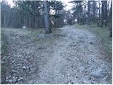 5
5 6
6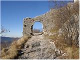 7
7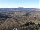 8
8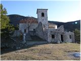 9
9 10
10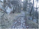 11
11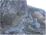 12
12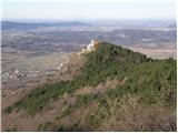 13
13 14
14 15
15 16
16 17
17 18
18 19
19 20
20 21
21 22
22 23
23 24
24 25
25 26
26 27
27 28
28 29
29 30
30 31
31 32
32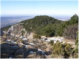 33
33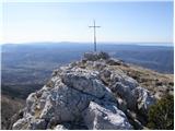 34
34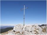 35
35
Discussion about the trail Vitovlje - Veliki Rob
|
| Tadej16. 03. 2009 |
Lep izlet, razgled pa še nekoliko lepši kot s sosednjega Kuclja.
|
|
|
|
| Lj14. 04. 2009 |
Mene pa zanima, ali se pride s Kuclja na Veliki rob - kakšna je steza, koliko časa se hodi? Lp
|
|
|
|
| Lj15. 04. 2009 |
Hvala za informacijo in lepo slikco! 
|
|
|
|
| aina26. 08. 2009 |
Pozna kdo vrh Sončarica ali nekaj podobnega oz. ali je to drugo ime za Veliki Rob? 
|
|
|
|
| Biser gora25. 11. 2010 |
Mene pa zanima, če je ta pot v zimskem času kaj shojena? Hvala že v naprej 
|
|
|
|
| hribar_pomidor11. 08. 2011 |
tukaj itak ne pade veliko snega, tako da se tudi pozimi pot lepo vidi
|
|
|
|
| soraya4. 08. 2012 |
Dva dni nazaj sva se s kolegom odločila, da preveriva kako zgleda Veliki rob od blizu. Prav lepa turca, dve uri in pol normalne hoje iz Vitovelj preko Vitovske cerkve. Priporočam, da za vzpon uporabite smer naravnost ko pridete do Sekulaka, za spust pa gozdno pot naravnost kmalu po vrhom. Po levi smeri je namreč kar lep del steze speljan med kamni in skalami po zgočem soncu. No,sej se preživi, samo poleti je boljša opisana varianta. Skratka, nikjer nobenega človeka, tišina, popoln odklop. 
|
|
|
|
| bagi7. 04. 2015 |
Nekaj vtisov z Vitovske krožne poti ... Popoln mir, na Vipavski strani toplo pomladno vreme, na robu Trnovskega gozda pa leden mraz in nekaj sneženih jezikov v poslavljanju. Pot je vodila od Vitovske cerkve do gaja Sv. Lucije, nato levo v smeri lovske koče in Kopitnika ter se nadaljevala po robu Trnovskega gozda do Visokega roba. Od tu povratek desno čez Čaven in Sekulak in nato po Napoleonovi *cesti* z globokimi kolesnicami v kamnu nazaj proti Vitovljam. Variant je še veliko, vse so lepo označene. Tudi čas je sedaj kar pravi ker ni prevroče. In še vprašanje za Vipavce ...zakaj se koči Antona Bavčerja reče *na Čavnu* če je ta kilometre stran  ???
|
|
|
|
| Zvonček5. 12. 2016 |
Na vrhu Velikega roba je samo skrinjica, žiga ni. Z vrha Kuclja do Velikega roba je uro hoje.
|
|
|
|
| Majdag11. 04. 2017 |
...Lepa pot in krasni razgledi...
..http://jelenkamenmajdag.blogspot.si/2017/04/veliki-rob-kucelj-na-cavnu-po-vitovski.html.
|
|
|
|
| Hribovka894. 01. 2019 |
A je pot zelo prepadna itd.. Ali bi se dalo it brez opreme zdaj januarja (ce ne bo snega seveda).. hvala za info 
|
|
|
|
| margu504. 01. 2019 |
Hribovka, bili v sredo 2.1.2019 krasna pot. Gor smo šli prek Sekulaka. Ker sta tam dve oznake za Veliki Rob, smo se mi odločili za vzpenjajočo, kar je bila pravilna odločitev, po drugi smo se vračali nazaj, Sekulak-Vitovlje, ki se odcepi levo navzdol gledano ob sestopu. Sprva strme suhe trave, zelo previdno se jih je treba lotit, potem pa po skalnih grebenih kar globoko v dolino kakšnih 300 višinskih metrov in potem prečno do Sekulaka, kjer pridemo na pot vzpona. Pot je markirana, lepa čista uživacija. Srečno !
|
|
|