Zgornje Poljčane - Boč (via Baba)
Starting point: Zgornje Poljčane (360 m)
| Lat/Lon: | 46,2971°N 15,5834°E |
| |
Name of path: via Baba
Time of walking: 1 h 45 min
Difficulty: easy marked way
Altitude difference: 618 m
Altitude difference po putu: 618 m
Map: Posavsko hribovje (Boč - Bohor) 1:50.000
Recommended equipment (summer):
Recommended equipment (winter):
Views: 104.002
 | 8 people like this post |
Access to the starting point:
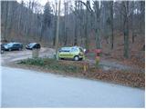
From the motorway Ljubljana - Maribor take the exit Slovenske Konjice and Poljčane. At the first junction from where you left the motorway, turn left towards Poljčane (right Slovenske Konjice). The road then takes you through Draža vas, Žiče and Loče. In the village of Loče you reach a roundabout where you continue "straight on" in the route Poljčane (the exit from the roundabout is not marked). A little further on, the road leads to a larger crossroads, where you continue to the right in the direction of Zgornje Poljčane (left Poljčane). Follow this road to the village, where a road sign for Boč directs you to the left upwards. Continue to the first mountain signposts where there is a parking lot.
Path description:
From the parking lot, continue right along the path in the direction of the house on Boč over Babe. The path through the forest starts climbing quite steeply right away and after about 15 minutes of climbing it crosses the road. The steepness of the path then eases after a few more minutes of climbing. There is a short crossing of the slopes on a wide path, and then the path climbs moderately for a short time. A little higher up, the path leads to the wide cart track, which is followed to the right and then soon abandoned. Further ahead, signs direct us upwards to the left. After the initial few steep metres from where we left cart track, the path climbs almost insignificantly to where it leads to a road. Next it is a 5-minute walk along a road running through the middle of a large meadow to a mountain lodge situated on the other side of a large meadow.
From the house, continue straight along the path towards Boč. The path first crosses the meadow and then goes into the wods, where it soon leads us to cart track, where we have two options for continuing, but they are about the same length. Continue right towards the shady path. After a few steps of easy walking on cart track, a marked footpath branches off up to the left, which starts to climb quite steeply in places (straight ahead, cart track leads you to a road).
The path, which runs through the forest all the way to the top, leads to Boč after a 45-minute walk from the mountain home. The climb does not end here. Ahead of us we see a 20m high lookout tower which we climb up steep stairs. The climb to the top of the tower rewards you with a beautiful view.

Pictures:
 1
1 2
2 3
3 4
4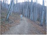 5
5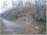 6
6 7
7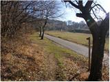 8
8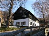 9
9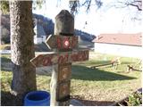 10
10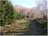 11
11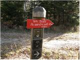 12
12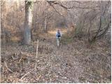 13
13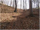 14
14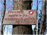 15
15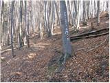 16
16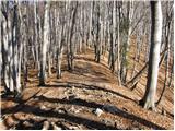 17
17 18
18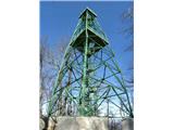 19
19
Discussion about the trail Zgornje Poljčane - Boč (via Baba)
|
| Stolar17. 09. 2009 |
Lep izlet, primeren ravno za dneve, ki so pred nami.
|
|
|
|
| Luciano6728. 09. 2009 |
Smer sva skupaj z tastom prehodila v soboto zjutraj in moram priznati, da sva bila navdušena.Priporočam vsem, ki bi radi obiskali Boč, vzpon bo na koncu poplačan s čudovitim razgledom s stolpa. 
|
|
|
|
| Okmodko19. 04. 2010 |
Sem šel, pa me je tok v križu vsekalo, da nevem če bom še kdaj šel. Uglavnm rož dost in to februarja, nisem pa našel nebene ženske. Tako da ostajam v mejsti.
|
|
|
|
| klm11. 09. 2010 |
danes tekel na vrh. pot je precej premočrtna, že takoj na začetku, pri parkirišču se začne strmo vzpenjati. Od izhodišča do vrha je 640 m vzpona, to višino pa je potrebno premagati le v 2,7 km - to pa je primerljivo z vzponom na Kamniški vrh!
Sicer pa je poljčansko PD uredilo nove smerne table ter markacije. Obe, v forumu opisani poti, se med seboj prepletata, v nadaljevanju pa imata obe tudi svoje variacije. Če je obiskovalec le dovolj zgoden in seveda kar se da tih, bo imel veliko možnosti, da preseneti trop muflonov.
|
|
|
|
| Matjaz_652. 05. 2011 |
nekaj mojih fotk ... z vzponom čez babo in balunjačo ... ter spustom po senčni poti in čez babo  od izhodišča se namreč lahko vzpnemo po detičkovi poti ... ki se priključi nad domom na pot čez balunjačo ... ali čez babo do doma ... in naprej čez balunjačo ali senčno pot 
|
|
|
|
| panda23. 05. 2011 |
Danes po dolgih letih spet na vrhu Boča. Štart v dvoje izpred parkirišča v Spodnjih Poljčanah ob kar "pozni uri" tj. 9-tih po poti "Čez babo". Pri domu malo počitka za sendvič in vodo iz nahrbtnika, saj je dom ob ponedeljkih pač zaprt. Na vrhu je kar precej "vleklo", razgledi pa tako, tako. Na jugu Gorjanci, nato Lisca, Kum, Kamniške delno, Peca in pred njo Uršlja gora, Pohorje........ Sestop po isti poti in nato na znamenito zlato zapečeno postrv v znano indijansko dolino tik pred ploho. Konec dober, vse dobro. 
|
|
|
|
| Helena42. 08. 2017 |
Pohod čez Babo. Na začetku malo strmo, nato pa je lepa pot do koče. Od koče naprej po gozdu, tudi malo strma a lepa pot. Štampiljko dobite v koči. Markacije dobro označene.
|
|
|
|
| jprim3. 08. 2017 |
Super, po dolgem času nekaj novega zapisano. 
|
|
|
|
| Sandi7229. 12. 2024 12:32:07 |
Bil gor danes, strmina ne popušča do vrha. Od oddajnika do stolpa poledenelo in zelo spolzko!
|
|
|
|
| jprim30. 12. 2024 12:52:33 |
Rečem samo lahko, kje so tisti časi, ko si gazil po grebenu več kot pol metra, zima, zima, prava zima.  Druga pot, ki je ni v opisu poti. LP!
|
|
|