Zvodno - Hotel Celjska koča (via Hudičev graben)
Starting point: Zvodno (300 m)
| Lat/Lon: | 46,2079°N 15,2877°E |
| |
Name of path: via Hudičev graben
Time of walking: 1 h 25 min
Difficulty: difficult marked way
Altitude difference: 352 m
Altitude difference po putu: 375 m
Map:
Recommended equipment (summer): helmet
Recommended equipment (winter): helmet, self belay set, ice axe, crampons
Views: 32.280
 | 2 people like this post |
Access to the starting point:
From the motorway Ljubljana - Maribor, take the exit Celje - centre and continue in the direction of Laško and Zidanega Most. The road continues through the centre of Celje and then leads to a roundabout with a water meter. Here, continue "straight ahead" (towards Laško and Zidani Most) and follow the road to the next traffic lights, where you turn left, cross the Savinja River and then turn right at the junction after the bridge. Continue to the underpass under the railway line and a few metres further to the fire station in Zagrad. Continue straight ahead and follow the road through the village, which leads us higher up to a small crossroads, where we see signs for Suhi potok to the right and Hudičev graben to the right. Continue straight ahead and after a short climb you will reach the NOB monument, after which the road gradually becomes a lay-by. Pay attention here, as you will soon reach the start of the marked path leading through Hudičev graben. Park a few 10 m down the road in one of the car parks (there are not many of them).
The starting point can also be reached from Dolenjska and Zasavje. In this case, drive first to Rimske Toplice and then through Laško to the starting point.
Path description:
From the starting point, continue along the road for another 10 m, and then the signs for Hudičev graben direct you to the right on a footpath that first climbs gently along the fence. A little further on, you reach a larger meadow, where the path gets a little lost, but as you continue in the same direction, there are no major problems with orientation. At the end of the meadow, we step onto the wide cart track, which after a few steps leads us to the Hudičevski brok, where there is a marked crossroads.
Continue in the direction of Hudičův grabno (left Srebotnik) and continue the ascent along the path that runs along and along the bed of Hudičovski potok (Hudičovski potok). The gorge soon narrows and we are helped by rungs, clips and ropes. Next, with the help of a number of fixed safety gear, we climb just above the stream bed, where we can see a number of waterfalls.
Higher up, the gorge widens and the path turns slightly to the right, where it starts to climb steeply through the forest. If you take the path in the spring months, you will be able to see numerous stands of hellebores as you climb through the forest. After a few minutes' ascent, the path will lay down and lead to a wide cart track along which you will continue on the path. The way ahead, which follows the increasingly wide cart track on the south side, bypasses the little-known Bavč and leads us just a little further on to a crossroads where the path through the Dry Brok joins us from the right.
Continue in the direction of Hotel Celjska koča and continue the ascent along a wide macadam road, from which the path to Tolsti vrh and Svetina soon branches off to the left. Continue along the road and follow it all the way to Hotel Celjska koča, which is reached after a few minutes of further walking.

Pictures:
 1
1 2
2 3
3 4
4 5
5 6
6 7
7 8
8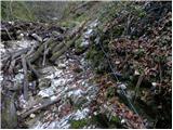 9
9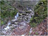 10
10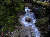 11
11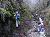 12
12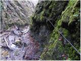 13
13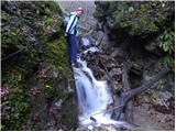 14
14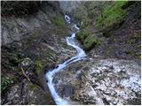 15
15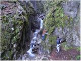 16
16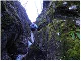 17
17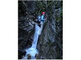 18
18 19
19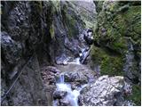 20
20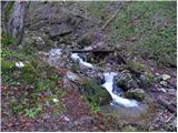 21
21 22
22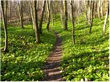 23
23 24
24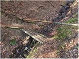 25
25 26
26 27
27 28
28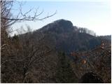 29
29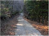 30
30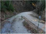 31
31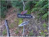 32
32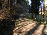 33
33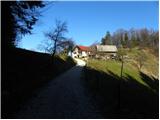 34
34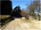 35
35 36
36 37
37 38
38
Discussion about the trail Zvodno - Hotel Celjska koča (via Hudičev graben)
|
| seinfeld4. 08. 2013 |
Smo danes opravili izlet. Kljub neznosni vročini, je v hudičevem grabnu prijetno, vode precej, cela pot pa poteka po senci. Je pa potrebno biti previden, križišče na 28 fotografiji je brez označb, potrebno je zaviti desno in pot gre cca. 200m navzdol, do zapornice. Tam pa so smerokazi. Priporočam, zanimivo za malo večje otroke(10+).
|
|
|
|
| Gdu bo meni reku svinja18. 10. 2014 |
Je pot primerna za srednje velikega psa?
Po nekaterih slikah sodeč najbrž ne ali pa se motim?
|
|
|
|
| sirt118. 10. 2014 |
Jest t' bom reku svinja-če sam pomislš po tej pot s psam!
|
|
|
|
| vespuci18. 10. 2014 |
Ni za nobenega psa,če je pa veliko vode pa tudi dvonožci potrebujejo neopren.
|
|
|
|
| Mira.k9. 05. 2018 |
Zanima me kakšno je stanje poti ali je prehodna glede na stanje vode.
|
|
|
|
| 30610. 05. 2018 |
Pot prehodna, varovala dobra, voda nizka. Kar na pot.
Lp
|
|
|
|
| Mira.k14. 05. 2018 |
Hvala za informacijo 306,ta četrtek če bo vreme.
|
|
|
|
| 30615. 05. 2018 |
Zdravo. Sicer je te dni kar nekaj dezja vendar menim, da bo vseeno OK. Graben je bolj hudourniske narave in bo voda hitro uplaknala. Previdnost vseeno v zep za na pot 
|
|
|
|
| edelweiss9620. 10. 2019 |
Zelo lepa in zanimiva pot, ki rahlo spominja na zahtevnejše poti v visokogorju, hkrati pa nam štajercem ni predaleč. Še pridemo! 
|
|
|
|
| KSG9. 07. 2021 23:00:54 |
Zanimiva pot, ne pretežka, le malo previdnosti ni odveč. Podaljšamo lahko še do Grmade in drugih hribov, pod vrhom Grmade pa se okrepčamo v Pečovniški koči. Utrinki iz julija 2021: https://bit.ly/2SSvEVC
|
|
|