Similar trips - Jablance - Oslica (Bohor) (via Koča na Bohorju)
 | Šentvid pri Planini - Brest (Bohor) (via Škofov travnik)
Brest is a peak on Bohor although it loks more like a saddle. It is an important intersection of the Bohor trails. It lies between Oslica, which ...
2 h 5 min |
 | Okrepčevalnica Zelena dolina - Plešivec (pri Boču)
Peace, silence, rugged terrain... the characteristics of a peak at the "crossroads" of many routes between the Maribor, Celje and Ptuj areas. Ple...
1 h 45 min |
 | Brzika - Plešivec (pri Boču)
Peace, silence, rugged terrain... the characteristics of a peak at the "crossroads" of many routes between the Maribor, Celje and Ptuj areas. Ple...
2 h 15 min |
 | Planina pri Sevnici - Plešivec (Bohor)
Plešivec, also known as Špic hill on some maps, is a 915 m high peak in Bohor, located southeast of the Bohor Cottage....
2 h |
 | Šentvid pri Planini - Plešivec (Bohor)
Plešivec, also known as Špic hill on some maps, is a 915 m high peak in Bohor, located southeast of the Bohor Cottage....
1 h 35 min |
 | Kokarje (ŠRC Laze) - Vrhe (via Tajna)
Vrhe is a forested peak located to the east of the Church of the Holy Mother of God in Čreta. There is no view from the top due to the forest....
1 h 45 min |
 | Kokarje (ŠRC Laze) - Vrhe (via Dom na Farbanci)
Vrhe is a forested peak located to the east of the Church of the Holy Mother of God in Čreta. There is no view from the top due to the forest....
2 h 5 min |
 | Potok (Mostni graben) - Vrhe (via Dom na Farbanci)
Vrhe is a forested peak located to the east of the Church of the Holy Mother of God in Čreta. There is no view from the top due to the forest....
1 h 40 min |
 | Dolenji Novaki (Pod Kovkom) - Škofje (steep path)
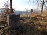
Škofje is a 973 m high peak located above the villages of Čeplez, Planina pri Cerknem and Podpleče. The peak itself, on which stands a small conc...
1 h 40 min |
 | Spodnja Kokra - Kopa (Partizanski vrh)
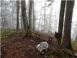
Kopa, also Partizanski vrh, is a 1024-metre high mountain located west of the Davovec saddle, which is west to south-west of Krvavec. There is a ...
1 h 30 min |