Similar trips - Planšarsko jezero - Virnikov Grintovec
 | Mačkin Kot (Enci) - Kranjska reber
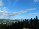
Kranjska reber or Peak Kašna planina (1435 m) is a volcanic mountain. From the top, where the registration box with the stamp is located, we have...
1 h 45 min |
 | Volovljek - Lepenatka (via Bivak na Kalu)
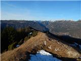
Lepenatka is a grassy peak located south of the 1557 m high Rogatec. From the top, which has a registration box and a stamp, we have a beautiful ...
3 h 10 min |
| Podvolovljek (Petkov graben) - Lepenatka
Lepenatka is a grassy peak located south of the 1557 m high Rogatec. From the top, which has a registration box and a stamp, we have a beautiful ...
2 h 15 min |
| Podvolovljek (Petkov graben) - Lepenatka (via Lepenatka)
Lepenatka is a grassy peak located south of the 1557 m high Rogatec. From the top, which has a registration box and a stamp, we have a beautiful ...
2 h 55 min |
 | St. John the Baptist on Ojstrica - Huhnerkogel/Košenjak (via Sveti Urban)
Huhnerkogel lies north of Dravograd and the River Drava on the border with neighbouring Austria. Huhnerkogel is accessible on foot or by car from...
2 h 50 min |
 | Sveti Križ (Planica) - Žigartov vrh
At 1346m, Žigartov vrh is the highest peak in the eastern part of Pohorje. An "observation" tower used to stand on the summit, but was erected on...
2 h 45 min |