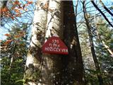
 | Lovrenc na Pohorju (cemetery) - Hožičev vrh
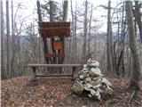
Hožičev vrh is a 595-metre-high, featureless peak located southwest of the centre of Lovrenec na Pohorju. There is a small marker on the summit w...
40 min |
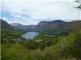 | Jezersko polje - Peč (viewpoint)
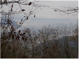
The viewpoint is located 50 metres lower than the 720-metre-high Peči, the peak that separates the Lower Bohinj Valley from the Upper Bohinj Vall...
35 min |
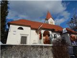
 | Veliko Trebeljevo - Sveta Marjeta (Prežganje)
The Church of St Marjeta is located on top of a hill above Prežganj. Next to the church is the Minorite House of Spiritual Exercises, and a littl...
40 min |
 | Tržič - Sveti Jurij above Tržič
The Church of St George, built in the 15th century, is situated on a small hill above Tržič or Bistrica near Tržič. The first Bishop of Ljubljana...
40 min |
 | Travnarjev gozd (Hotenjsko podolje) - Sveta Barbara (Ravnik pri Hotedršici)
The Church of St Barbara is situated on a hill overloking the village of Ravnik near Hotedršice. From the church or its immediate surroundings, w...
35 min |
 | Praproče - Mali vrh
To the west of Polhov Gradec, between the rivers Mala voda and Velika Božna, is a 708-metre-high hill called Mali vrh. From the grassy summit, wh...
35 min |
 | Možjanca - Apnišče
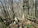
Apnišče is a 740 m high mountain located between Možjanca and Štefanja gora. It is the highest point of the Šenčur municipality. There is a bench...
35 min |
 | Križevska vas - Murovica (circular path)
Murovica is a popular excursion point, accessible from the Posavina side, Domžale or from the Moravška valley. There is a bench and a registratio...
50 min |
 | Križevska vas - Murovica
Murovica is a popular excursion point, accessible from the Posavina side, Domžale or from the Moravška valley. There is a bench and a registratio...
45 min |
 | Veliko Trebeljevo - Kucelj
Kucelj is a 748m high peak located north of Višnja gora. From the top of the peak there is a small geodetic tower with a stamp, which offers a be...
45 min |
 | Zagorje - Šilentabor
Šilentabor is a 751 m high peak located just above the village of the same name. From the top, near which there is also a bench and a registratio...
35 min |
 | Zajasovnik - del (Strmce, chapel) - Jasovnik (Motnik tourist trail)
Jasovnik is a hill better known to all of us as the A1 motorway tunnel. The hill is located near Trojany. It has two peaks: the Little Jasovnik a...
45 min |
 | Topol - Jeterbenk
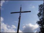
Jeterbenk is a 774 m high peak located between Slavko's home at Gole Brdo and Katarina (Topol village). From the top, where there is a large cros...
45 min |