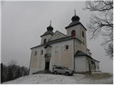
 | Zgornja Besnica (Podrovnik) - Sveti Jošt above Kranj (via Gaber)
Sveti Jošt above Kranj, is a hill located to the west of the slightly lower Šmarjetna Gora. From the top, where the Church of St. Jošto and the J...
2 h 30 min |
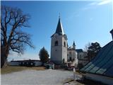 | Vače - Zasavska Sveta gora (on a slope)
Zasavska Sveta gora is a popular excursion point located between Litija and Izlaki. From the top, where the parish church of the Nativity of the ...
2 h 30 min |
 | Vače - Zasavska Sveta gora (on the ridge)
Zasavska Sveta gora is a popular excursion point located between Litija and Izlaki. From the top, where the parish church of the Nativity of the ...
2 h 35 min |
 | Žiri - Vrh Svetih Treh Kraljev
The Church of the Holy Three Kings is situated on a lookout above the village of Vrh Svetih Treh kraljev. From the top, which has an observation ...
2 h 30 min |
 | Velike Lašče - Kamen vrh (čez Gornje Retje in Grmado)
Kamen vrh is a scenic peak located on the northern outskirts of Mala Gora. From the top, surrounded by low bushes, there is a beautiful view of p...
2 h 35 min |
 | Ribnica (Lepovče) - Grmada on Mala gora (via Stene Svete Ane)
Grmada (also Grmada nad Ortnek) is an 887 m high peak located above the village of Vrh pri Poljanah in the Mala Gora mountain range. Just a few m...
3 h 50 min |
 | Ledinsko Razpotje - Medvedje Brdo (east path)
Medvedje Brdo is a small settlement located north of Hotedršice. The highest point of the village is a pleasant lookout point located on Šinkovco...
3 h 10 min |
 | Ledinsko Razpotje - Medvedje Brdo (west path)
Medvedje Brdo is a small settlement located north of Hotedršice. The highest point of the village is a pleasant lookout point located on Šinkovco...
3 h 15 min |
 | Kandrše (Trata) - Golčaj
Golčaj is a 690 m high hill rising south of Blagovica. On the top, which has a registration box and a stamp, stands the NOB monument, and a few 1...
3 h 20 min |
 | Podgorje - Golič (via hunting cottage)
Golič is a grassy ridge stretching from Kojnik to the Slovenian-Croatian border and continuing to Žbevnica on the Croatian side. Due to the relat...
2 h 40 min |
 | Kopačnica - Veliki vrh (Lajše)
Veliki vrh is an almost 900 m high peak rising south of Cerkno. From the top, where there are several television and radio transmitters covering ...
2 h 50 min |
 | Planina pri Sevnici - Debeli vrh (Bohor)
Debeli vrh is a 921-metre-high peak on Bohor between Veliki Koprivnik and Oslice. It is overgrown with dense forest, so there are no views. There...
2 h 30 min |
 | Planina pri Sevnici - Brest (Bohor) (via Škofov travnik)
Brest is a peak on Bohor although it loks more like a saddle. It is an important intersection of the Bohor trails. It lies between Oslica, which ...
2 h 35 min |
 | Lovrenc na Pohorju - Hlebov vrh (Rdeči Breg) (via Povh and Brabar)
The Red Bank stretches between the Radoljna Gorge in the east, the Drava River in the north and the Velka Stream in the east. It is separated fro...
2 h 30 min |
 | Lovrenc na Pohorju - Hlebov vrh (Rdeči Breg) (via Kapus)
The Red Bank stretches between the Radoljna Gorge in the east, the Drava River in the north and the Velka Stream in the east. It is separated fro...
2 h 40 min |
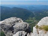 | Bezgovica - Loška stena
Loška stena is located above the Upper Kolpa Valley, specifically above the villages of Grintovec pri Osilnici, Ložec and Ribjek. From the top of...
2 h 40 min |
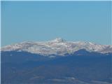 | Radeljski prelaz - Sveti Pankracij (Radelca) (Austrian path)
The Church of St Pancras on Radelca is located on the border ridge between Slovenia and Austria, but since 1966, following an inter-state agreeme...
3 h |
 | Radeljski prelaz - Sveti Pankracij (Radelca) (via Sveti Urban)
The Church of St Pancras on Radelca is located on the border ridge between Slovenia and Austria, but since 1966, following an inter-state agreeme...
3 h 15 min |
 | Sveta Katarina (Zgornja Kapla) - Sveti Pankracij (Radelca) (slovenska pot)
The Church of St Pancras on Radelca is located on the border ridge between Slovenia and Austria, but since 1966, following an inter-state agreeme...
3 h 15 min |